 |
|
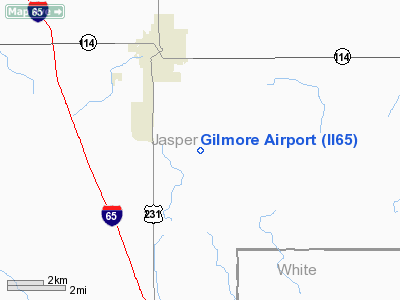
Location
& QuickFacts
|
FAA
Information Effective: |
2007-12-20 |
|
Airport
Identifier: |
II65 |
|
Airport
Status: |
Operational |
|
Longitude/Latitude: |
087-07-25.0760W/40-53-15.1380N
-87.123632/40.887538 (Estimated) |
|
Elevation: |
680 ft / 207.26 m (Estimated) |
|
Land: |
0 acres |
|
From nearest
city: |
5 nautical miles SE of Rensselaer, IN |
|
Location: |
Jasper County, IN |
|
Magnetic
Variation: |
01W (1985) |
Owner
& Manager
|
Ownership: |
Privately
owned |
|
Owner: |
William Gilmore |
|
Address: |
402 S Abigail Street
Rensselaer,
IN 47978 |
|
Phone
number: |
219-866-3474 |
|
Manager: |
William Gilmore |
|
Address: |
402 S Abigail Street
Rensselaer,
IN 47978 |
|
Phone
number: |
219-866-3474 |
Airport Operations
and Facilities
|
Airport
Use: |
Private |
|
Segmented
Circle: |
No |
|
Control
Tower: |
No |
|
Sectional
chart: |
Chicago |
|
Region: |
AGL - Great Lakes |
|
Boundary
ARTCC: |
ZAU - Chicago |
|
Tie-in
FSS: |
HUF - Terre Haute |
|
FSS on
Airport: |
No |
|
FSS Toll
Free: |
1-800-WX-BRIEF |
|
Runway Information
Runway 09/27
|
Dimension: |
2000 x 200 ft
/ 609.6 x 61.0 m |
|
Surface: |
TURF, |
|
|
Runway 09 |
Runway 27 |
|
Traffic
Pattern: |
Left |
Left |
|
Obstruction: |
|
40 ft pline |
|
Radio Navigation
Aids
|
ID |
Type |
Name |
Ch |
Freq |
Var |
Dist |
|
RZL |
NDB |
Rensselaer |
|
362.00 |
02W |
4.5 nm |
|
MCX |
NDB |
White County |
|
377.00 |
03W |
19.6 nm |
|
RWN |
NDB |
Winamac/dcmsnd |
|
335.00 |
00W |
26.6 nm |
|
VP |
NDB |
Sedly |
|
212.00 |
02W |
35.7 nm |
|
GGP |
NDB |
Logansport |
|
263.00 |
01W |
35.8 nm |
|
CPB |
NDB |
Culver |
|
391.00 |
01W |
38.9 nm |
|
IUL |
NDB |
La Porte |
|
356.00 |
03W |
40.0 nm |
|
RCR |
NDB |
Rochester |
|
216.00 |
03W |
43.7 nm |
|
FKR |
NDB |
Frankfort |
|
278.00 |
02W |
45.1 nm |
|
OXI |
VOR/DME |
Knox |
103X |
115.60 |
00E |
33.8 nm |
|
IKK |
VOR/DME |
Kankakee |
053X |
111.60 |
00E |
34.8 nm |
|
BVT |
VORTAC |
Boiler |
098X |
115.10 |
01E |
20.1 nm |
|
EON |
VORTAC |
Peotone |
079X |
113.20 |
02E |
38.0 nm |
|
DNV |
VORTAC |
Danville |
047X |
111.00 |
02E |
40.8 nm |
|
CGT |
VORTAC |
Chicago Heights |
089X |
114.20 |
02E |
42.5 nm |
|
GUS |
VORTAC |
Grissom |
21Y |
108.45 |
02W |
46.6 nm |
Remarks
- OWNER
DESIRES AIRPORT NOT BE CHARTED.
- FILED
FOR RECORD PURPOSES ONLY.
Based Aircraft
|
Aircraft
based on field: |
1 |
|
Single Engine
Airplanes: |
1 |
Gilmore Airport
Address:
Jasper County, IN
Tel:
219-866-3474
Images
and information placed above are from
http://www.airport-data.com/airport/II65/
We
thank them for the data!
| General
Info |
| Country |
United
States |
| State |
INDIANA
|
| FAA ID |
II65 |
| Latitude |
40-53-15.138N
|
| Longitude |
087-07-25.076W
|
| Elevation |
680 feet
|
| Near City |
RENSSELAER
|
We don't guarantee the information is fresh and accurate. The data may
be wrong or outdated.
For more up-to-date information please refer to other sources.
|
|


