 |
|
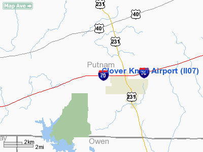
Location
& QuickFacts
|
FAA
Information Effective: |
2007-12-20 |
|
Airport
Identifier: |
II07 |
|
Airport
Status: |
Operational |
|
Longitude/Latitude: |
086-49-56.0320W/39-31-56.1630N
-86.832231/39.532268 (Estimated) |
|
Elevation: |
880 ft / 268.22 m (Estimated) |
|
Land: |
0 acres |
|
From nearest
city: |
2 nautical miles NW of Cloverdale, IN |
|
Location: |
Putnam County, IN |
|
Magnetic
Variation: |
01W (1985) |
Owner
& Manager
|
Ownership: |
Privately
owned |
|
Owner: |
Vernon E. Bothwell |
|
Address: |
Rr2 Box 214a
Cloverdale, IN 46120 |
|
Phone
number: |
317-795-6598 |
|
Manager: |
Vernon E. Bothwell |
|
Address: |
Rr 2 Box 214a
Cloverdale, IN 46120 |
|
Phone
number: |
317-653-4324 |
Airport Operations
and Facilities
|
Airport
Use: |
Private |
|
Wind indicator: |
No |
|
Segmented
Circle: |
No |
|
Control
Tower: |
No |
|
Landing
fee charge: |
No |
|
Sectional
chart: |
St Louis |
|
Region: |
AGL - Great Lakes |
|
Boundary
ARTCC: |
ZID - Indianapolis |
|
Tie-in
FSS: |
HUF - Terre Haute |
|
FSS on
Airport: |
No |
|
FSS Toll
Free: |
1-800-WX-BRIEF |
|
Runway Information
Runway 09/27
|
Dimension: |
2600 x 75 ft
/ 792.5 x 22.9 m |
|
Surface: |
TURF, |
|
|
Runway 09 |
Runway 27 |
|
Traffic
Pattern: |
Left |
Left |
|
Obstruction: |
30 ft sign |
25 ft pline |
|
Radio Navigation
Aids
|
ID |
Type |
Name |
Ch |
Freq |
Var |
Dist |
|
TVX |
NDB |
Greencastle |
|
521.00 |
03W |
11.0 nm |
|
CFJ |
NDB |
Crawfordsville |
|
388.00 |
02W |
27.2 nm |
|
HU |
NDB |
Yinno |
|
245.00 |
02W |
27.6 nm |
|
BM |
NDB |
Claye |
|
382.00 |
02W |
30.6 nm |
|
HFY |
NDB |
Greenwood |
|
398.00 |
02W |
34.9 nm |
|
HZP |
NDB |
Zionsville |
|
248.00 |
03W |
36.4 nm |
|
SIV |
NDB |
Sullivan |
|
326.00 |
02W |
38.1 nm |
|
PRG |
NDB |
Paris |
|
341.00 |
01E |
40.2 nm |
|
UMP |
NDB |
Metropolitan |
|
338.00 |
03W |
43.6 nm |
|
BFR |
NDB |
Bedford |
|
344.00 |
02W |
45.5 nm |
|
FKR |
NDB |
Frankfort |
|
278.00 |
02W |
46.1 nm |
|
BA |
NDB |
Clifs |
|
410.00 |
03W |
48.7 nm |
|
PLX |
NDB |
Palestine |
|
391.00 |
00W |
48.9 nm |
|
RSV |
VOR/DME |
Robinson |
021X |
108.40 |
02E |
49.0 nm |
|
TTH |
VORTAC |
Terre Haute |
100X |
115.30 |
02E |
19.5 nm |
|
OOM |
VORTAC |
Hoosier |
039X |
110.20 |
02W |
25.5 nm |
|
VHP |
VORTAC |
Brickyard |
110X |
116.30 |
01E |
27.4 nm |
|
SHB |
VORTAC |
Shelbyville |
057X |
112.00 |
01E |
47.1 nm |
|
IND |
VOT |
Indianapolis Intl |
|
109.60 |
|
27.9 nm |
Remarks
- FILED
FOR RECORD PURPOSES ONLY.
Based Aircraft
|
Aircraft
based on field: |
6 |
|
Single Engine
Airplanes: |
6 |
Clover Knoll Airport
Address:
Putnam County, IN
Tel:
317-795-6598,
317-653-4324
Images
and information placed above are from
http://www.airport-data.com/airport/II07/
We
thank them for the data!
| General
Info |
| Country |
United
States |
| State |
INDIANA
|
| FAA ID |
II07 |
| Latitude |
39-31-56.163N
|
| Longitude |
086-49-56.032W
|
| Elevation |
880 feet
|
| Near City |
CLOVERDALE
|
We don't guarantee the information is fresh and accurate. The data may
be wrong or outdated.
For more up-to-date information please refer to other sources.
|
|


