 |
|
|
|
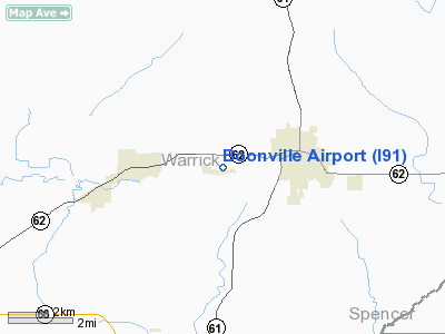
Location
& QuickFacts
|
FAA
Information Effective: |
2007-12-20 |
|
Airport
Identifier: |
I91 |
|
Airport
Status: |
Operational |
|
Longitude/Latitude: |
087-19-04.0260W/38-02-33.1640N
-87.317785/38.042546 (Estimated) |
|
Elevation: |
380 ft / 115.82 m (Estimated) |
|
Land: |
110 acres |
|
From nearest
city: |
2 nautical miles W of Boonville, IN |
|
Location: |
Warrick County, IN |
|
Magnetic
Variation: |
00W (1985) |
Owner & Manager
|
Ownership: |
Publicly
owned |
|
Owner: |
City Of Boonville |
|
Address: |
City Hall
Boonville, IN 47601 |
|
Manager: |
Mike Metzger/mike Loehr |
|
Address: |
655 Center Rd
Boonville,
IN 47601 |
|
Phone
number: |
812-925-7544 |
Airport
Operations and Facilities
|
Airport
Use: |
Open
to public |
|
Wind indicator: |
Yes |
|
Control
Tower: |
No |
|
Landing
fee charge: |
No |
|
Sectional
chart: |
St Louis |
|
Region: |
AGL - Great Lakes |
|
Boundary
ARTCC: |
ZID - Indianapolis |
|
Tie-in
FSS: |
HUF - Terre Haute |
|
FSS on
Airport: |
No |
|
FSS Toll
Free: |
1-800-WX-BRIEF |
|
NOTAMs
Facility: |
HUF (NOTAM-d service avaliable) |
Airport Communications
Airport Services
|
Bottled
Oxygen: |
NONE |
|
Bulk Oxygen: |
NONE |
|
Runway Information
Runway 09/27
|
Dimension: |
2300 x 100 ft
/ 701.0 x 30.5 m |
|
Surface: |
TURF, Fair Condition |
|
|
Runway 09 |
Runway 27 |
|
Longitude: |
087-19-12.0200W |
087-18-47.1600W |
|
Latitude: |
38-02-33.6600N |
38-02-31.5900N |
|
Elevation: |
395.00 ft |
390.00 ft |
|
Traffic
Pattern: |
Left |
Left |
|
Displaced
threshold: |
300.00 ft
09/27 DSPLCD THLDS MKD WITH L SHAPED WHITE CONC. |
300.00 ft |
|
Runway End
Identifier: |
No |
No |
|
Centerline
Lights: |
No |
No |
|
Touchdown
Lights: |
No |
No |
|
Obstruction: |
15 ft road, 20.0 ft from runway, 1:1 slope
to clear
APCH RATIO 21:1 AT DSPLCD THR. |
29 ft trees, 100.0 ft from runway, 100 ft left
of centerline, 3:1 slope to clear
APCH RATIO 13:1 TO DSPLCD THLD. |
|
Radio Navigation
Aids
|
ID |
Type |
Name |
Ch |
Freq |
Var |
Dist |
|
PDW |
NDB |
Evansville |
|
284.00 |
00E |
10.1 nm |
|
FNZ |
NDB |
Ferdinand |
|
239.00 |
00E |
25.9 nm |
|
GVA |
NDB |
Geneva |
|
224.00 |
01W |
25.9 nm |
|
TEL |
NDB |
Tell City |
|
206.00 |
02W |
29.8 nm |
|
CUL |
NDB |
Carmi |
|
332.00 |
01W |
38.1 nm |
|
AJG |
NDB |
Mount Carmel |
|
524.00 |
02W |
39.3 nm |
|
DCY |
NDB |
Washington |
|
212.00 |
03W |
40.2 nm |
|
OEA |
NDB |
Vincennes |
|
251.00 |
00E |
40.6 nm |
|
TWT |
NDB |
Tradewater |
|
276.00 |
00E |
45.7 nm |
|
RRJ |
NDB |
Oranj |
|
368.00 |
02W |
47.3 nm |
|
GMH |
NDB |
Muhlenberg |
|
362.00 |
01E |
49.6 nm |
|
OWB |
VOR/DME |
Owensboro |
023X |
108.60 |
01E |
19.4 nm |
|
HNB |
VOR/DME |
Huntingburg |
029X |
109.20 |
00E |
21.2 nm |
|
SAM |
VOR/DME |
Samsville |
113X |
116.60 |
03E |
45.0 nm |
|
LWV |
VOR/DME |
Lawrenceville |
025X |
108.80 |
01W |
45.7 nm |
|
PXV |
VORTAC |
Pocket City |
080X |
113.30 |
03E |
22.2 nm |
|
CCT |
VORTAC |
Central City |
035X |
109.80 |
01W |
39.8 nm |
Remarks
- DRAINAGE
AREAS ALONG RWY BNDRYS HOLD WATER AFTER RAIN.
- POOR
ACCESS FM TURF RY TO GRVL APRON DUE TO RISING TERRAIN.
- EVIDENCE
OF VEHICULAR TRAFFIC ON WEST END OF RY.
Based Aircraft
|
Aircraft
based on field: |
14 |
|
Single Engine
Airplanes: |
10 |
|
Ultralights: |
4 |
Operational Statistics
Time
Period: 2004-01-02 - 2004-12-31
|
Aircraft
Operations: |
74/Week |
|
General Aviation
Local: |
77.7% |
|
General Aviation
Itinerant: |
22.3% |
Boonville Airport
Address:
Warrick County, IN
Tel:
812-925-7544
Images
and information placed above are from
http://www.airport-data.com/airport/I91/
We
thank them for the data!
| General
Info |
| Country |
United
States |
| State |
INDIANA
|
| FAA ID |
I91 |
| Latitude |
38-02-33.164N
|
| Longitude |
087-19-04.026W
|
| Elevation |
380 feet
|
| Near City |
BOONVILLE
|
We don't guarantee the information is fresh and accurate. The data may
be wrong or outdated.
For more up-to-date information please refer to other sources.
|
|


