|
|
Anderson Municipal - Darlington Field Airport |
Anderson Municipal Airport
Darlington Field |
| IATA: AID â ICAO: KAID â FAA LID: AID |
| Summary |
| Airport type |
Public |
| Owner |
City of Anderson |
| Serves |
Anderson, Indiana |
| Elevation AMSL |
919 ft / 280 m |
| Coordinates |
40°06â²31â³N 085°36â²47â³W / 40.10861°N 85.61306°W / 40.10861; -85.61306 |
| Runways |
| Direction |
Length |
Surface |
| ft |
m |
| 12/30 |
5,400 |
1,646 |
Asphalt |
| 18/36 |
3,400 |
1,036 |
Asphalt |
| Statistics (2006) |
| Aircraft operations |
26,874 |
| Based aircraft |
86 |
| Source: FAA and airport web site |
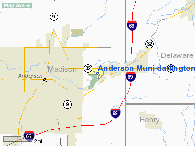
Anderson Municipal Airport (IATA: AID, ICAO: KAID, FAA LID: AID), also known as Darlington Field, is a city-owned, public-use airport located three nautical miles (6 km) east of the central business district of Anderson, a city in Madison County, Indiana, United States.
Facilities and aircraft
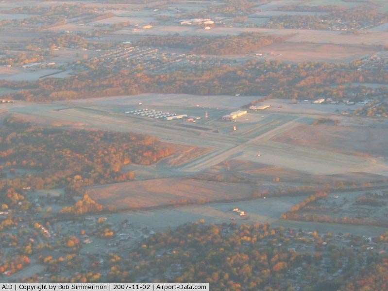
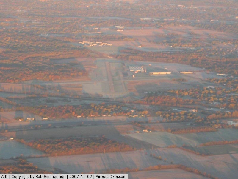
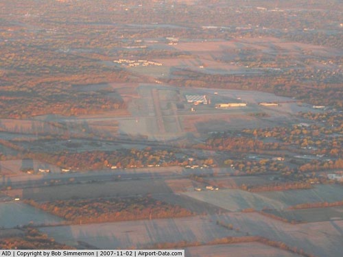
Anderson Municipal Airport covers an area of 619 acres (251 ha) at an elevation of 919 feet (280 m) above mean sea level. It has two asphalt paved runways: 12/30 measuring 5,400 x 100 ft (1,646 x 30 m) and 18/36 measuring 3,400 x 75 ft (1,036 x 23 m).
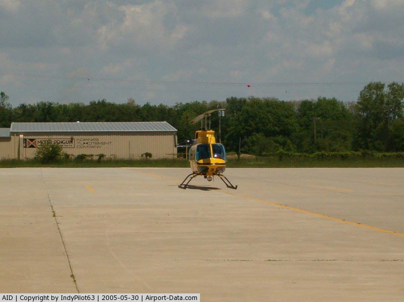
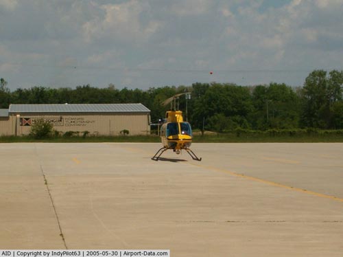
For the 12-month period ending December 31, 2006, the airport had 26,874 aircraft operations, an average of 73 per day: 93% general aviation, 6% air taxi and 1% military. At that time there were 86 aircraft based at this airport: 84% single-engine, 10% multi-engine, 1% jet, 1% helicopter, 1% glider and 2% ultralight.
The above content comes from Wikipedia and is published under free licenses – click here to read more.
|
 |
(Click on the photo to enlarge) |
|
 |
(Click on the photo to enlarge) |
|
 |
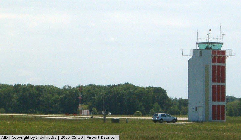
(Click on the photo to enlarge) |
|
 |
(Click on the photo to enlarge) |
Location
& QuickFacts
|
FAA Information Effective: |
2007-12-20 |
|
Airport
Identifier: |
AID |
|
Airport
Status: |
Operational |
|
Longitude/Latitude: |
085-36-46.8000W/40-06-31.0000N
-85.613000/40.108611 (Estimated) |
|
Elevation: |
919 ft / 280.11 m (Surveyed) |
|
Land: |
619 acres |
|
From
nearest city: |
3 nautical miles E of Anderson, IN |
|
Location: |
Madison County, IN |
|
Magnetic
Variation: |
03W (1985) |
Owner & Manager
|
Ownership: |
Publicly
owned |
|
Owner: |
City Of Anderson |
|
Address: |
282 Airport Rd
Anderson,
IN 46017 |
|
Phone
number: |
765-648-6293 |
|
Manager: |
Steve W. Darlington |
|
Address: |
282 Airport Rd.
Anderson,
IN 46017 |
|
Phone
number: |
765-648-6293 |
Airport
Operations and Facilities
|
Airport Use: |
Open to public |
|
Wind
indicator: |
Yes |
|
Segmented
Circle: |
Yes |
|
Control
Tower: |
Yes |
|
Lighting
Schedule: |
DUSK-DAWN
WHEN ATCT CLSD MIRL RYS 18/36 & 12/30 OPERS MED INTST
TO INCR INTST & ACTVT MALSF RY 30 REIL RY 12 VASI RY
12 - 126.0.
VASI RY 30 & PAPI RY 18 ON CONTINUOUSLY. |
|
Beacon
Color: |
Clear-Green (lighted land airport) |
|
Landing
fee charge: |
No |
|
Sectional
chart: |
Chicago |
|
Region: |
AGL - Great Lakes |
|
Boundary
ARTCC: |
ZID - Indianapolis |
|
Tie-in
FSS: |
HUF - Terre Haute |
|
FSS
on Airport: |
No |
|
FSS
Toll Free: |
1-800-WX-BRIEF |
|
NOTAMs
Facility: |
AID (NOTAM-d service avaliable) |
|
Federal
Agreements: |
NGY |
Airport Communications
|
CTAF: |
126.000 |
|
Unicom: |
122.950 |
Airport
Services
|
Fuel available: |
100LLA |
|
Airframe Repair: |
MAJOR |
|
Power Plant Repair: |
MAJOR |
|
Bottled
Oxygen: |
LOW |
|
Bulk
Oxygen: |
NONE |
|
Runway Information
Runway 12/30
|
Dimension: |
5400 x 100 ft / 1645.9 x 30.5 m |
|
Surface: |
ASPH, Fair Condition |
|
Surface
Treatment: |
Saw-cut or plastic Grooved |
|
Weight
Limit: |
Single wheel: 45000 lbs.
Dual wheel: 55000 lbs.
Dual
tandem wheel: 85000 lbs. |
|
Edge
Lights: |
Medium |
|
|
Runway 12 |
Runway 30 |
|
Longitude: |
085-37-22.5849W |
085-36-19.6235W |
|
Latitude: |
40-06-43.0042N |
40-06-20.4243N |
|
Elevation: |
880.00 ft |
919.00 ft |
|
Alignment: |
115 |
127 |
|
ILS
Type: |
|
ILS |
|
Traffic
Pattern: |
Left |
Left |
|
Markings: |
Precision instrument, Fair Condition |
Precision instrument, Fair Condition |
|
Crossing
Height: |
46.00 ft |
47.00 ft |
|
Displaced
threshold: |
0.00 ft |
88.00 ft |
|
VASI: |
4-box on left side |
4-box on left side |
|
Visual
Glide Angle: |
3.00° |
3.00° |
|
Approach
lights: |
|
MALSF |
|
Runway
End Identifier: |
Yes |
No |
|
Centerline
Lights: |
No |
No |
|
Touchdown
Lights: |
No |
No |
|
Obstruction: |
117 ft trees, 1831.0 ft from runway, 519 ft
right of centerline, 13:1 slope to clear |
5 ft road, 201.0 ft from runway, 336 ft right
of centerline
APCH RATIO 0: AT DSPLCD THLD OVER 5 FT ROAD; 0 FT FM DSPLCD
THLD. ALSO 59 FT TREES 859 FT FM RY ENDS 590 FT R OF CNTRLN;
15:1 APCH RATIO. |
|
Runway 18/36
|
Dimension: |
3400 x 75 ft / 1036.3 x 22.9 m |
|
Surface: |
ASPH, Good Condition |
|
Surface
Treatment: |
Saw-cut or plastic Grooved |
|
Weight
Limit: |
Single wheel: 10000 lbs. |
|
Edge
Lights: |
Medium |
|
|
Runway 18 |
Runway 36 |
|
Longitude: |
085-36-39.9610W |
085-36-39.8720W |
|
Latitude: |
40-06-46.7103N |
40-06-13.1157N |
|
Elevation: |
913.00 ft |
908.00 ft |
|
Alignment: |
127 |
127 |
|
Traffic
Pattern: |
Left |
Left |
|
Markings: |
Basic, Good Condition |
Basic, Good Condition |
|
Crossing
Height: |
27.00 ft |
0.00 ft |
|
Displaced
threshold: |
301.00 ft |
298.00 ft |
|
VASI: |
2-light PAPI on left side |
|
|
Visual
Glide Angle: |
3.00° |
0.00° |
|
Runway
End Identifier: |
No |
No |
|
Centerline
Lights: |
No |
No |
|
Touchdown
Lights: |
No |
No |
|
Obstruction: |
84 ft tree, 1463.0 ft from runway, 134 ft right
of centerline, 15:1 slope to clear
RWY 18 APCH RATIO 21:1 TO DSPLCD THR. |
14 ft road, 373.0 ft from runway, 139 ft right
of centerline, 12:1 slope to clear
APCH RATIO 47:1 TO DSPLCD THR. |
|
Radio Navigation
Aids
|
ID |
Type |
Name |
Ch |
Freq |
Var |
Dist |
|
AI |
NDB |
Video |
|
371.00 |
03W |
5.3 nm |
|
UWL |
NDB |
New Castle |
|
385.00 |
02W |
19.3 nm |
|
UMP |
NDB |
Metropolitan |
|
338.00 |
03W |
22.6 nm |
|
HZP |
NDB |
Zionsville |
|
248.00 |
03W |
31.0 nm |
|
PLD |
NDB |
Portland |
|
257.00 |
03W |
35.5 nm |
|
HFY |
NDB |
Greenwood |
|
398.00 |
02W |
36.1 nm |
|
IWH |
NDB |
Wabash |
|
329.00 |
03W |
40.3 nm |
|
FKR |
NDB |
Frankfort |
|
278.00 |
02W |
44.7 nm |
|
HHG |
NDB |
Huntington |
|
417.00 |
03W |
45.4 nm |
|
BA |
NDB |
Clifs |
|
410.00 |
03W |
48.2 nm |
|
HLB |
NDB |
Batesville |
|
254.00 |
02W |
48.5 nm |
|
MIE |
VOR/DME |
Muncie |
091X |
114.40 |
03W |
12.7 nm |
|
MZZ |
VOR/DME |
Marion |
023X |
108.60 |
03W |
23.3 nm |
|
SHB |
VORTAC |
Shelbyville |
057X |
112.00 |
01E |
30.2 nm |
|
OKK |
VORTAC |
Kokomo |
082X |
113.50 |
00E |
32.4 nm |
|
VHP |
VORTAC |
Brickyard |
110X |
116.30 |
01E |
39.0 nm |
|
GUS |
VORTAC |
Grissom |
21Y |
108.45 |
02W |
40.6 nm |
|
RID |
VORTAC |
Richmond |
043X |
110.60 |
03W |
41.5 nm |
|
IND |
VOT |
Indianapolis Intl |
|
109.60 |
|
38.6 nm |
Remarks
- ACFT
DPTG RWY 12, 18 & 36 UNABLE TO SEE EACH OTHER.
- DEER
ON & INVOF ARPT.
- RWY
18/36 NOT AVBL TO AIR CARRIER ACFT OVER 30 SEATS.
Based Aircraft
|
Aircraft
based on field: |
86 |
|
Single
Engine Airplanes: |
72 |
|
Multi
Engine Airplanes: |
9 |
|
Jet Engine
Airplanes: |
1 |
|
Helicopters: |
1 |
|
Gliders: |
1 |
|
Ultralights: |
2 |
Operational Statistics
Time Period: 2006-01-01 - 2006-12-31
|
Aircraft
Operations: |
74/Day |
|
Air Taxi: |
6.3% |
|
General
Aviation Local: |
48.1% |
|
General
Aviation Itinerant: |
45.1% |
|
Military: |
0.5% |
Anderson Municipal-darlington Field Airport
Address:
Madison County, IN
Tel:
765-648-6293
Images
and information placed above are from
http://www.airport-data.com/airport/AID/
We
thank them for the data!
| General
Info |
| Country |
United
States |
| State |
INDIANA
|
| FAA ID |
AID
|
| Latitude |
40-06-31.000N
|
| Longitude |
085-36-46.800W
|
| Elevation |
919 feet
|
| Near City |
ANDERSON
|
We don't guarantee the information is fresh and accurate. The data may
be wrong or outdated.
For more up-to-date information please refer to other sources.
|
|