|
|
|
 |
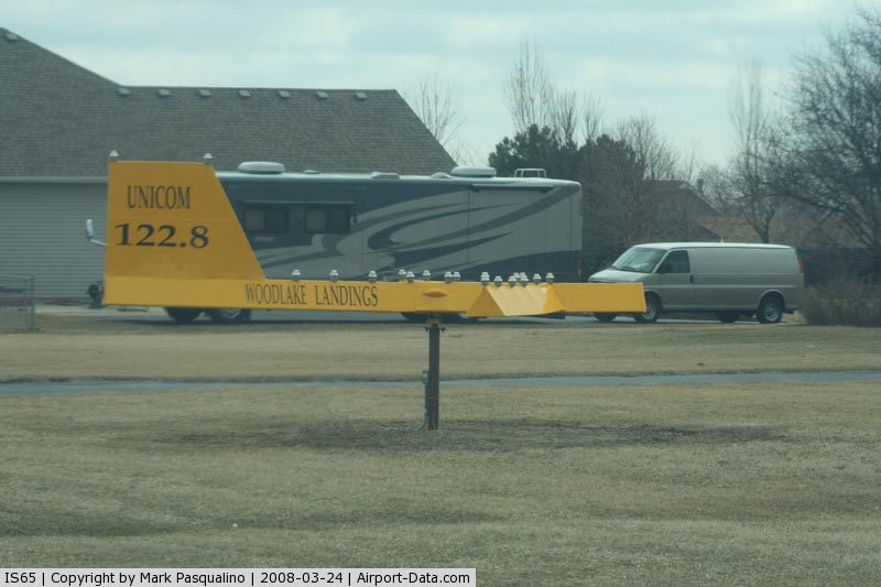
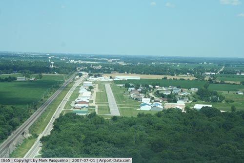
(Click on the photo to enlarge) |
|
 |
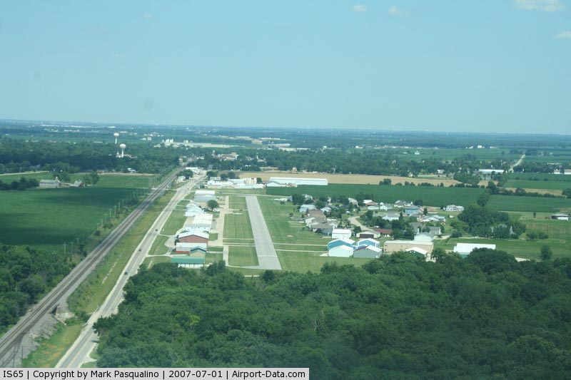
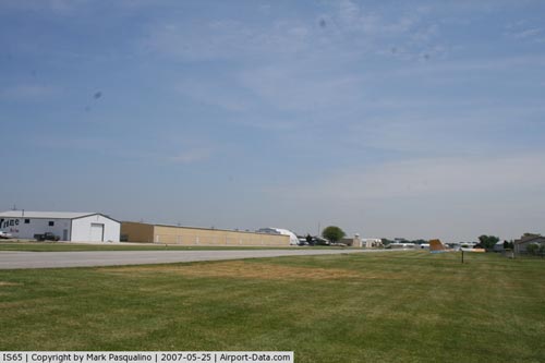
(Click on the photo to enlarge) |
|
 |
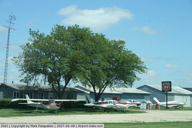
(Click on the photo to enlarge) |
|
 |
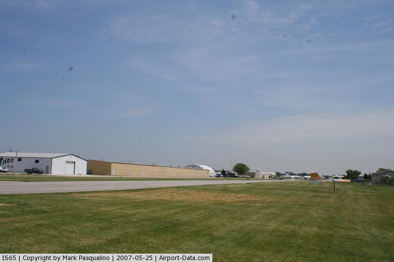
(Click on the photo to enlarge) |
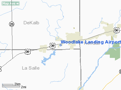
Location
& QuickFacts
|
FAA
Information Effective: |
2007-12-20 |
|
Airport
Identifier: |
IS65 |
|
Airport
Status: |
Operational |
|
Longitude/Latitude: |
088-38-40.2750W/41-38-18.1080N
-88.644521/41.638363 (Estimated) |
|
Elevation: |
677 ft / 206.35 m (Estimated) |
|
Land: |
46 acres |
|
From nearest
city: |
2 nautical miles SW of Sandwich, IL |
|
Location: |
De Kalb County, IL |
|
Magnetic
Variation: |
00W (1985) |
Owner
& Manager
|
Ownership: |
Privately
owned |
|
Owner: |
Lincoln Development Corp |
|
Address: |
1560 W. Church St.
Sandwich,
IL 60548 |
|
Phone
number: |
815-786-7411 |
|
Manager: |
William Johns |
|
Address: |
1560 W. Church St.
Sandwich,
IL 60548 |
|
Phone
number: |
815-786-7411 |
Airport Operations
and Facilities
|
Airport Use: |
Private |
|
Wind
indicator: |
Yes |
|
Segmented
Circle: |
No |
|
Control
Tower: |
No |
|
Lighting
Schedule: |
DUSK-DAWN |
|
Landing
fee charge: |
No |
|
Sectional
chart: |
Chicago |
|
Region: |
AGL - Great Lakes |
|
Boundary
ARTCC: |
ZAU - Chicago |
|
Tie-in
FSS: |
IKK - Kankakee |
|
FSS on
Airport: |
No |
|
FSS Toll
Free: |
1-800-WX-BRIEF |
Airport
Communications
Airport
Services
|
Fuel
available: |
100
80 MOGAS |
|
Bottled
Oxygen: |
NONE |
|
Bulk Oxygen: |
NONE |
|
Runway Information
Runway 08/26
|
Dimension: |
2988 x 50 ft
/ 910.7 x 15.2 m |
|
Surface: |
ASPH, Fair Condition
SFC ROUGH. |
|
Edge Lights: |
Non-standard lighting system
NSTD LIRL DUE TO SPACING; INTENSITY & NON-FRANGIBLE MOUNTINGS. |
|
|
Runway 08 |
Runway 26 |
|
Traffic
Pattern: |
Left |
Left |
|
Markings: |
Basic, Fair Condition |
Basic, Fair Condition |
|
Displaced
threshold: |
500.00 ft |
250.00 ft |
|
Runway End
Identifier: |
No |
No |
|
Centerline
Lights: |
No |
No |
|
Touchdown
Lights: |
No |
No |
|
Obstruction: |
43 ft tree, 403.0 ft from runway, 179 ft right
of centerline, 4:1 slope to clear
APCH SLOPE 21:1 AT DSPLCD THR.
12' ROAD 90'; 0B. |
40 ft ant, 1216.0 ft from runway, 188 ft right
of centerline, 25:1 slope to clear
APCH SLOPE 36:1 AT DSPLCD THR.
15' ROAD 90' 158' LEFT. |
|
Runway 18/36
|
Dimension: |
1750 x 150 ft
/ 533.4 x 45.7 m |
|
Surface: |
TURF, Poor Condition
SFC ROUGH. |
|
|
Runway 18 |
Runway 36 |
|
Traffic
Pattern: |
Left |
Left |
|
Obstruction: |
26 ft bldg, 250.0 ft from runway, 170 ft right
of centerline, 9:1 slope to clear |
30 ft trees, 0.0 ft from runway |
|
Radio Navigation
Aids
|
ID |
Type |
Name |
Ch |
Freq |
Var |
Dist |
|
DKB |
NDB |
Dekalb |
|
209.00 |
02W |
18.0 nm |
|
OIX |
NDB |
Ottawa |
|
266.00 |
01E |
19.1 nm |
|
VYS |
NDB |
Valley |
|
230.00 |
00W |
28.4 nm |
|
ME |
NDB |
Deana |
|
350.00 |
00E |
34.0 nm |
|
HK |
NDB |
Ermin |
|
332.00 |
01W |
36.6 nm |
|
MX |
NDB |
Kedzi |
|
248.00 |
01W |
43.3 nm |
|
DPA |
VOR/DME |
Dupage |
021X |
108.40 |
02E |
20.1 nm |
|
ORD |
VOR/DME |
Chicago O'hare |
086X |
113.90 |
02E |
39.2 nm |
|
RFD |
VOR/DME |
Rockford |
045X |
110.80 |
01E |
43.1 nm |
|
PLL |
VOR/DME |
Polo |
049X |
111.20 |
03E |
44.1 nm |
|
OBK |
VOR/DME |
Northbrook |
077X |
113.00 |
02W |
46.8 nm |
|
PNT |
VOR/DME |
Pontiac |
033X |
109.60 |
03E |
49.3 nm |
|
IKK |
VOR/DME |
Kankakee |
053X |
111.60 |
00E |
49.3 nm |
|
JOT |
VORTAC |
Joliet |
070X |
112.30 |
02E |
15.7 nm |
|
EON |
VORTAC |
Peotone |
079X |
113.20 |
02E |
44.4 nm |
|
CGT |
VORTAC |
Chicago Heights |
089X |
114.20 |
02E |
48.9 nm |
|
ORD |
VOT |
Chicago O'hare Intl |
|
112.00 |
|
39.0 nm |
|
MDW |
VOT |
Chicago Midway |
|
111.00 |
|
41.0 nm |
Remarks
Based Aircraft
|
Aircraft
based on field: |
74 |
|
Single Engine
Airplanes: |
62 |
|
Multi Engine Airplanes: |
4 |
|
Ultralights: |
8 |
Operational Statistics
Time
Period: 1993-10-22 - 1994-10-21
|
Aircraft
Operations: |
76/Day |
|
Air Taxi: |
0.3% |
|
General Aviation
Local: |
54.0% |
|
General Aviation
Itinerant: |
45.7% |
Woodlake Landing Airport
Address:
De Kalb County, IL
Tel:
815-786-7411
Images
and information placed above are from
http://www.airport-data.com/airport/IS65/
We
thank them for the data!
| General
Info |
| Country |
United
States |
| State |
ILLINOIS
|
| FAA ID |
IS65 |
| Latitude |
41-38-18.108N
|
| Longitude |
088-38-40.275W
|
| Elevation |
677 feet
|
| Near City |
SANDWICH
|
We don't guarantee the information is fresh and accurate. The data may
be wrong or outdated.
For more up-to-date information please refer to other sources.
|
|