 |
|
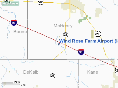
Location
& QuickFacts
|
FAA
Information Effective: |
2007-12-20 |
|
Airport
Identifier: |
IS57 |
|
Airport
Status: |
Operational |
|
Longitude/Latitude: |
088-37-58.0000W/42-10-47.0840N
-88.632778/42.179746 (Estimated) |
|
Elevation: |
815 ft / 248.41 m (Estimated) |
|
Land: |
0 acres |
|
From nearest
city: |
4 nautical miles SW of Marengo, IL |
|
Location: |
Mc Henry County, IL |
|
Magnetic
Variation: |
00W (1985) |
Owner
& Manager
|
Ownership: |
Privately
owned |
|
Owner: |
William F. Krause |
|
Address: |
65 S. Barrington Rd.
Barrington,
IL 60010 |
|
Phone
number: |
847-381-5700 |
|
Manager: |
William R. Rose |
|
Address: |
65 S. Barrington Rd.
Barrington,
IL 60010 |
|
Phone
number: |
847-381-5700 |
Airport Operations
and Facilities
|
Airport
Use: |
Private |
|
Wind indicator: |
Yes |
|
Segmented
Circle: |
No |
|
Control
Tower: |
No |
|
Landing
fee charge: |
No |
|
Sectional
chart: |
Chicago |
|
Region: |
AGL - Great Lakes |
|
Boundary
ARTCC: |
ZAU - Chicago |
|
Tie-in
FSS: |
IKK - Kankakee |
|
FSS on
Airport: |
No |
|
FSS Toll
Free: |
1-800-WX-BRIEF |
|
Runway Information
Runway 09/27
|
Dimension: |
2600 x 70 ft
/ 792.5 x 21.3 m |
|
Surface: |
TURF, |
|
|
Runway 09 |
Runway 27 |
|
Traffic
Pattern: |
Right |
Left |
|
Obstruction: |
|
25 ft pline, 0.0 ft from runway |
|
Radio Navigation
Aids
|
ID |
Type |
Name |
Ch |
Freq |
Var |
Dist |
|
DKB |
NDB |
Dekalb |
|
209.00 |
02W |
15.1 nm |
|
ME |
NDB |
Deana |
|
350.00 |
00E |
29.9 nm |
|
LVV |
NDB |
Lake Lawn |
|
404.00 |
00W |
31.3 nm |
|
JVL |
NDB |
Janesville |
|
375.00 |
03E |
31.8 nm |
|
FEP |
NDB |
Freeport |
|
335.00 |
00E |
42.6 nm |
|
RA |
NDB |
Paser |
|
206.00 |
00E |
44.4 nm |
|
HK |
NDB |
Ermin |
|
332.00 |
01W |
45.1 nm |
|
MX |
NDB |
Kedzi |
|
248.00 |
01W |
49.7 nm |
|
DPA |
VOR/DME |
Dupage |
021X |
108.40 |
02E |
21.5 nm |
|
RFD |
VOR/DME |
Rockford |
045X |
110.80 |
01E |
25.4 nm |
|
OBK |
VOR/DME |
Northbrook |
077X |
113.00 |
02W |
30.4 nm |
|
JVL |
VOR/DME |
Janesville |
090X |
114.30 |
03E |
30.9 nm |
|
BUU |
VOR/DME |
Burbun |
092X |
114.50 |
01W |
34.0 nm |
|
ORD |
VOR/DME |
Chicago O'hare |
086X |
113.90 |
02E |
34.5 nm |
|
ENW |
VOR/DME |
Kenosha |
029X |
109.20 |
02W |
40.1 nm |
|
PLL |
VOR/DME |
Polo |
049X |
111.20 |
03E |
41.8 nm |
|
JOT |
VORTAC |
Joliet |
070X |
112.30 |
02E |
40.6 nm |
|
ORD |
VOT |
Chicago O'hare Intl |
|
112.00 |
|
34.5 nm |
|
MDW |
VOT |
Chicago Midway |
|
111.00 |
|
45.9 nm |
Based Aircraft
|
Aircraft
based on field: |
2 |
|
Single Engine
Airplanes: |
2 |
Wind Rose Farm Airport
Address:
Mc Henry County, IL
Tel:
847-381-5700
Images
and information placed above are from
http://www.airport-data.com/airport/IS57/
We
thank them for the data!
| General
Info |
| Country |
United
States |
| State |
ILLINOIS
|
| FAA ID |
IS57 |
| Latitude |
42-10-47.084N
|
| Longitude |
088-39-58.000W
|
| Elevation |
815 feet
|
| Near City |
MARENGO
|
We don't guarantee the information is fresh and accurate. The data may
be wrong or outdated.
For more up-to-date information please refer to other sources.
|
|


