 |
|
Williamson County Regional Airport |
| Williamson County Regional Airport |
| IATA: MWA â ICAO: KMWA |
| Summary |
| Airport type |
Public |
| Operator |
Williamson County Airport Authority |
| Location |
Marion, Illinois |
| Elevation AMSL |
472 ft / 143.9 m |
| Coordinates |
37°45â²18â³N 89°00â²40â³W / 37.755°N 89.01111°W / 37.755; -89.01111Coordinates: 37°45â²18â³N 89°00â²40â³W / 37.755°N 89.01111°W / 37.755; -89.01111 |
| Runways |
| Direction |
Length |
Surface |
| ft |
m |
| 2/20 |
8,012 |
2,442 |
Asphalt |
| 11/29 |
5,000 |
1,524 |
Asphalt/Concrete |
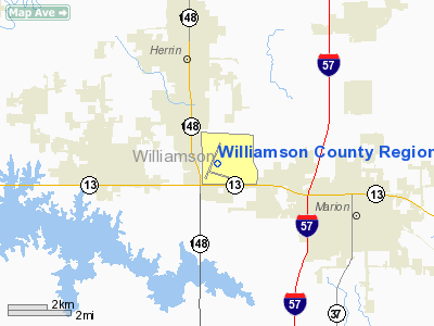
Williamson County Regional Airport (IATA: MWA, ICAO: KMWA) is a public airport located four miles (6 km) west of the central business district (CBD) of Marion, a city in Williamson County, Illinois, USA. The airport covers 1,300 acres (526 ha) and has two runways. It is mostly used for general aviation, although it has scheduled service to Lambert-St. Louis International Airport operated by American Airlines partner Cape Air using Essential Air Service subsidies.
On November 6, 2006, Mesa Airlines announced that new service to Chicago Midway International Airport would begin in February 2007 operated by their wholly-owned subsidiary, Air Midwest, with service to Decatur Airport in Decatur, Illinois, and continuing service on to Chicago Midway International Airport as a direct flight. However, just nine months after starting the service, Mesa announced they would end all service from Marion on November 9, 2007.
On October 23, 2007, Allegiant Air announced new service to McCarran International Airport in Las Vegas, Nevada. Service was to start on February 1, 2008, and be 2x weekly, however Allegiant dropped the route on November 9, 2007 citing high fuel prices.
Essential Air Service service was previously operated by Great Lakes Airlines. Airlines and destinations
| Airlines |
Destinations |
| Cape Air |
St. Louis |
General Aviation
Williamson County Regional Airport has one FBO, Aeroflite, located at the base of the control tower on the general aviation ramp. Aeroflite offers flight training, 100LL and Jet A fuel, charter service, a pilot courtesy car, and rental cars. Currently Aeroflite has three rental aircraft, a Cessna 150 (N50475), a Cessna 172 (N7573G), and a Piper Warrior II (N2875X). Aeroflite charter operations are conducted in a Piper Navajo Chieftain.
The above content comes from Wikipedia and is published under free licenses – click here to read more.
Location
& QuickFacts
|
FAA
Information Effective: |
2007-12-20 |
|
Airport
Identifier: |
MWA |
|
Airport
Status: |
Operational |
|
Longitude/Latitude: |
089-00-39.9370W/37-45-17.8450N
-89.011094/37.754957 (Estimated) |
|
Elevation: |
472 ft / 143.87 m (Surveyed) |
|
Land: |
1300 acres |
|
From nearest
city: |
4 nautical miles W of Marion, IL |
|
Location: |
Williamson County, IL |
|
Magnetic
Variation: |
01E (1985) |
Owner
& Manager
|
Ownership: |
Publicly
owned |
|
Owner: |
Williamson County Arpt Auth |
|
Address: |
10400 Terminal Dr
Marion, IL 62959 |
|
Phone
number: |
618-993-3353 |
|
Manager: |
Douglas S Kimmel |
|
Address: |
10400 Terminal Dr; Suite 200
Marion, IL 62959 |
|
Phone
number: |
618-993-3353 |
Airport Operations
and Facilities
|
Airport
Use: |
Open
to public |
|
Wind indicator: |
Yes |
|
Segmented
Circle: |
Yes |
|
Control
Tower: |
Yes |
|
Lighting
Schedule: |
DUSK-DAWN
HIRL RY 02/20 PRESET ON LOW INTST; TO INCR INTST & ACTVT
MALSR RY 20, MIRL RY 11/29, PAPI RY 11 & 29 & REIL
RYS 11 & 29 - CTAF. |
|
Beacon
Color: |
Clear-Green (lighted land airport) |
|
Landing
fee charge: |
No |
|
Sectional
chart: |
St Louis |
|
Region: |
AGL - Great Lakes |
|
Boundary
ARTCC: |
ZKC - Kansas City |
|
Tie-in
FSS: |
STL - Saint Louis |
|
FSS on
Airport: |
No |
|
FSS Toll
Free: |
1-800-WX-BRIEF |
|
NOTAMs
Facility: |
MWA (NOTAM-d service avaliable) |
|
Certification
type/date: |
II A S 05/197
72 HR PPR FOR ACR OPNS WITH MORE THAN 30 PSGR SEATS CALL
AMGR 618-993-3353. |
|
Federal
Agreements: |
NGY |
Airport Communications
|
CTAF: |
126.900 |
|
Unicom: |
122.950
|
Airport
Services
|
Fuel
available: |
100LLA |
|
Airframe
Repair: |
MAJOR |
|
Power
Plant Repair: |
MAJOR |
|
Bottled
Oxygen: |
NONE |
|
Bulk Oxygen: |
NONE |
|
Runway Information
Runway 02/20
|
Dimension: |
8012 x 150 ft
/ 2442.1 x 45.7 m |
|
Surface: |
ASPH, Fair Condition |
|
Surface Treatment: |
Porous Friction Course |
|
Weight Limit: |
Single wheel: 80000 lbs.
Dual wheel: 95000 lbs.
Dual tandem wheel: 140000 lbs. |
|
Edge Lights: |
High |
|
|
Runway 02 |
Runway 20 |
|
Longitude: |
089-01-04.9023W |
089-00-26.4654W |
|
Latitude: |
37-44-54.1947N |
37-46-07.2901N |
|
Elevation: |
453.00 ft |
466.00 ft |
|
Alignment: |
22 |
127 |
|
ILS Type: |
|
ILS |
|
Traffic
Pattern: |
Left |
Left |
|
Markings: |
Precision instrument, Fair Condition |
Precision instrument, Fair Condition |
|
Crossing
Height: |
34.00 ft |
0.00 ft |
|
VASI: |
4-box on left side |
|
|
Visual Glide
Angle: |
3.50° |
0.00° |
|
Approach
lights: |
|
MALSR |
|
Runway End
Identifier: |
Yes |
|
|
Obstruction: |
56 ft trees, 2130.0 ft from runway, 697 ft
left of centerline, 34:1 slope to clear |
83 ft tree, 2945.0 ft from runway, 847 ft left
of centerline, 33:1 slope to clear |
|
Runway 11/29
|
Dimension: |
5000 x 100 ft
/ 1524.0 x 30.5 m |
|
Surface: |
ASPH-CONC, Fair Condition |
|
Surface Treatment: |
Saw-cut or plastic Grooved |
|
Weight Limit: |
Single wheel: 45000 lbs.
Dual wheel: 55000 lbs.
Dual tandem wheel: 100000 lbs. |
|
Edge Lights: |
Medium |
|
|
Runway 11 |
Runway 29 |
|
Longitude: |
089-01-00.3990W |
089-00-01.0620W |
|
Latitude: |
37-45-04.6600N |
37-44-49.6970N |
|
Elevation: |
454.00 ft |
468.00 ft |
|
Alignment: |
108 |
127 |
|
Traffic
Pattern: |
Left |
Left |
|
Markings: |
Basic, Fair Condition |
Basic, Fair Condition |
|
Crossing
Height: |
25.00 ft |
25.00 ft |
|
VASI: |
4-light PAPI on left side |
4-light PAPI on left side |
|
Visual Glide
Angle: |
3.00° |
3.00° |
|
Runway End
Identifier: |
Yes |
Yes |
|
Obstruction: |
50 ft tree, 778.0 ft from runway, 319 ft left
of centerline, 11:1 slope to clear |
30 ft sign, 1218.0 ft from runway, 249 ft left
of centerline, 33:1 slope to clear |
|
Radio Navigation
Aids
|
ID |
Type |
Name |
Ch |
Freq |
Var |
Dist |
|
PJY |
NDB |
Pinckneyville |
|
215.00 |
00E |
21.3 nm |
|
HSB |
NDB |
Harrisburg-raleigh |
|
230.00 |
00E |
22.4 nm |
|
BDD |
NDB |
Bellgrade |
|
254.00 |
00E |
40.1 nm |
|
SAR |
NDB |
Sparta |
|
239.00 |
01E |
40.3 nm |
|
CIR |
NDB |
Cairo |
|
397.00 |
00E |
42.9 nm |
|
CUL |
NDB |
Carmi |
|
332.00 |
01W |
46.9 nm |
|
FWC |
NDB |
Wayne County |
|
257.00 |
01E |
47.1 nm |
|
VNN |
VOR/DME |
Mount Vernon |
085X |
113.80 |
02E |
37.7 nm |
|
CGI |
VOR/DME |
Cape Girardeau |
076X |
112.90 |
01E |
41.5 nm |
|
ENL |
VORTAC |
Centralia |
097X |
115.00 |
04E |
40.6 nm |
|
CNG |
VORTAC |
Cunningham |
078X |
113.10 |
03E |
45.6 nm |
Remarks
- MIGRATORY
WATERFOWL & DEER ON & INVOF ARPT.
- FIRST
1200 FT OF RY 29 GRVD CONC.
Based Aircraft
|
Aircraft
based on field: |
57 |
|
Single Engine
Airplanes: |
48 |
|
Multi Engine Airplanes: |
6 |
|
Jet Engine Airplanes: |
1 |
|
Helicopters: |
2 |
Operational Statistics
Time
Period: 2006-01-01 - 2006-12-31
|
Aircraft
Operations: |
79/Day |
|
Commerical: |
0.1% |
|
Air Taxi: |
18.9% |
|
General Aviation
Local: |
47.4% |
|
General Aviation
Itinerant: |
33.5% |
|
Military: |
0.2% |
Williamson County Regional Airport
Address:
Williamson County, IL
Tel:
618-993-3353
Images
and information placed above are from
http://www.airport-data.com/airport/MWA/
We
thank them for the data!
| General
Info |
| Country |
United
States |
| State |
ILLINOIS
|
| FAA ID |
MWA |
| Latitude |
37-45-11.287N
|
| Longitude |
089-00-41.749W
|
| Elevation |
472 feet
|
| Near City |
MARION
|
We don't guarantee the information is fresh and accurate. The data may
be wrong or outdated.
For more up-to-date information please refer to other sources.
|
|


