|
|
|
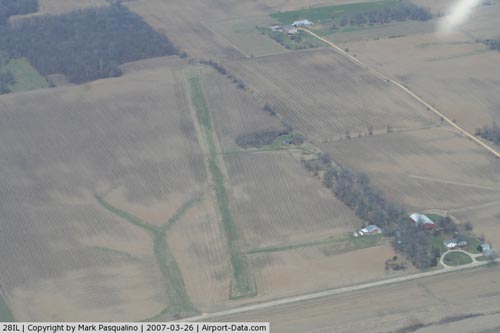 |
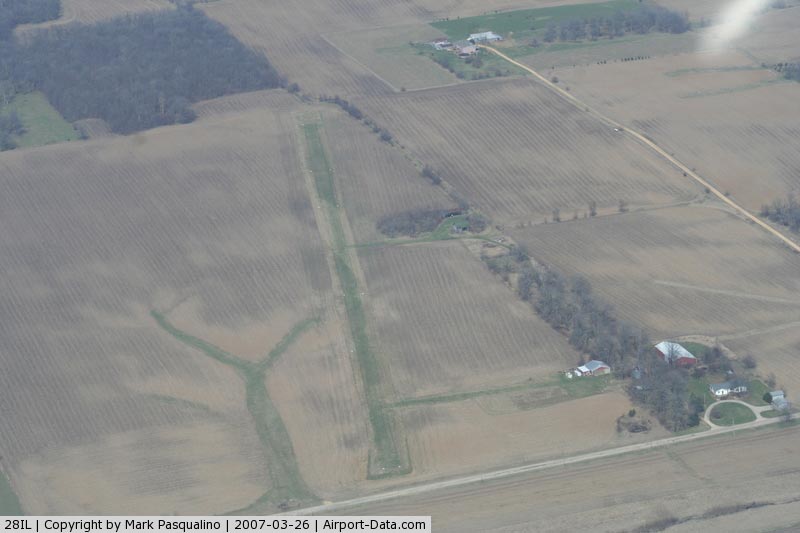
(Click on the photo to enlarge) |
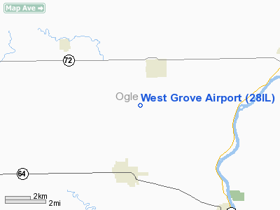
Location
& QuickFacts
|
FAA
Information Effective: |
2007-12-20 |
|
Airport
Identifier: |
28IL |
|
Airport
Status: |
Operational |
|
Longitude/Latitude: |
089-25-09.3940W/42-05-50.0960N
-89.419276/42.097249 (Estimated) |
|
Elevation: |
910 ft / 277.37 m (Estimated) |
|
Land: |
10 acres |
|
From nearest
city: |
3 nautical miles SW of Leaf River, IL |
|
Location: |
Ogle County, IL |
|
Magnetic
Variation: |
00E (1985) |
Owner
& Manager
|
Ownership: |
Privately
owned |
|
Owner: |
Nick Lung |
|
Address: |
4308 Westgrove Rd.
Leaf
River, IL 61047 |
|
Phone
number: |
815-738-2894 |
|
Manager: |
Nick Lung |
|
Address: |
4308 Westgrove Rd.
Leaf
River, IL 61047 |
|
Phone
number: |
815-738-2894 |
Airport Operations
and Facilities
|
Airport Use: |
Private |
|
Wind
indicator: |
Yes |
|
Segmented
Circle: |
No |
|
Control
Tower: |
No |
|
Landing
fee charge: |
No |
|
Sectional
chart: |
Chicago |
|
Region: |
AGL - Great Lakes |
|
Boundary
ARTCC: |
ZAU - Chicago |
|
Tie-in
FSS: |
IKK - Kankakee |
|
FSS on
Airport: |
No |
|
FSS Toll
Free: |
1-800-WX-BRIEF |
Airport Services
|
Airframe
Repair: |
MAJOR |
|
Power
Plant Repair: |
MAJOR |
|
Runway Information
Runway 01/19
|
Dimension: |
2500 x 70 ft
/ 762.0 x 21.3 m |
|
Surface: |
TURF, Fair Condition |
|
|
Runway 01 |
Runway 19 |
|
Traffic
Pattern: |
Left |
Left |
|
Displaced
threshold: |
80.00 ft
01/19 DSPLCD THR MKD WITH TIRES. |
120.00 ft |
|
Obstruction: |
10 ft pline, 135.0 ft from runway, 13:1 slope
to clear
APCH RATIO21:1 TO DSPLCD THR. |
5 ft fence, 100.0 ft from runway, 20:1 slope
to clear
APCH RATIO 20:1 TO DSPLCD THLD. |
|
Radio Navigation
Aids
|
ID |
Type |
Name |
Ch |
Freq |
Var |
Dist |
|
FEP |
NDB |
Freeport |
|
335.00 |
00E |
11.6 nm |
|
BOZ |
NDB |
Whiteside |
|
254.00 |
01E |
28.4 nm |
|
DKB |
NDB |
Dekalb |
|
209.00 |
02W |
33.3 nm |
|
JVL |
NDB |
Janesville |
|
375.00 |
03E |
35.4 nm |
|
CWI |
NDB |
Clinton |
|
377.00 |
01E |
43.7 nm |
|
VYS |
NDB |
Valley |
|
230.00 |
00W |
46.3 nm |
|
PLL |
VOR/DME |
Polo |
049X |
111.20 |
03E |
9.2 nm |
|
RFD |
VOR/DME |
Rockford |
045X |
110.80 |
01E |
12.5 nm |
|
JVL |
VOR/DME |
Janesville |
090X |
114.30 |
03E |
31.0 nm |
|
DPA |
VOR/DME |
Dupage |
021X |
108.40 |
02E |
49.4 nm |
Remarks
- PRVDD
AREA 125 FT EITHER SIDE OF RY CNTRLN +240 FT OFF RY END CLEAR OF OBSTN;
OBSTN ON RY APCH SLP REMOVED/LOWERED OR DSPLCD & MKD TO PRVD MINIMUM
20:1 APCH CLNC OVER OBSTN.
Based Aircraft
|
Aircraft
based on field: |
2 |
|
Single Engine
Airplanes: |
2 |
Operational Statistics
Time
Period: 1994-10-05 - 1995-10-04
|
Aircraft
Operations: |
20/Week |
|
General Aviation
Local: |
35.0% |
|
General Aviation
Itinerant: |
15.0% |
|
Military: |
50.0% |
West Grove Airport
Address:
Ogle County, IL
Tel:
815-738-2894
Images
and information placed above are from
http://www.airport-data.com/airport/28IL/
We
thank them for the data!
| General
Info |
| Country |
United
States |
| State |
ILLINOIS
|
| FAA ID |
28IL |
| Latitude |
42-05-50.096N
|
| Longitude |
089-25-09.394W
|
| Elevation |
910 feet
|
| Near City |
LEAF RIVER
|
We don't guarantee the information is fresh and accurate. The data may
be wrong or outdated.
For more up-to-date information please refer to other sources.
|
|