 |
|
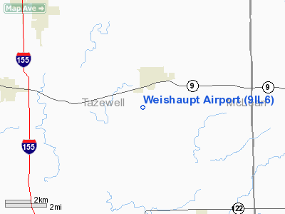
Location
& QuickFacts
|
FAA
Information Effective: |
2007-12-20 |
|
Airport
Identifier: |
9IL6 |
|
Airport
Status: |
Operational |
|
Longitude/Latitude: |
089-22-02.3310W/40-30-47.1390N
-89.367314/40.513094 (Estimated) |
|
Elevation: |
650 ft / 198.12 m (Estimated) |
|
Land: |
0 acres |
|
From nearest
city: |
2 nautical miles SW of Mackinaw, IL |
|
Location: |
Tazewell County, IL |
|
Magnetic
Variation: |
00E (1990) |
Owner
& Manager
|
Ownership: |
Privately
owned |
|
Owner: |
Louis Weishaupt |
|
Address: |
P.o. Box 567
Mackinaw,
IL 61755 |
|
Phone
number: |
309-359-8271 |
|
Manager: |
Louis Weishaupt |
|
Address: |
P.o. Box 567
Mackinaw,
IL 61755 |
|
Phone
number: |
309-359-8271 |
Airport Operations
and Facilities
|
Airport
Use: |
Private |
|
Wind indicator: |
Yes |
|
Segmented
Circle: |
No |
|
Control
Tower: |
No |
|
Sectional
chart: |
Chicago |
|
Region: |
AGL - Great Lakes |
|
Boundary
ARTCC: |
ZAU - Chicago |
|
Tie-in
FSS: |
IKK - Kankakee |
|
FSS Toll
Free: |
1-800-WX-BRIEF |
|
Runway Information
Runway 18/36
|
Dimension: |
2300 x 105 ft
/ 701.0 x 32.0 m |
|
Surface: |
TURF, |
|
|
Runway 18 |
Runway 36 |
|
Traffic
Pattern: |
Left |
Left |
|
Radio Navigation
Aids
|
ID |
Type |
Name |
Ch |
Freq |
Var |
Dist |
|
PI |
NDB |
Tungg |
|
356.00 |
01E |
11.7 nm |
|
AAA |
NDB |
Abraham |
|
329.00 |
00E |
21.3 nm |
|
CTK |
NDB |
Canton |
|
236.00 |
02E |
32.6 nm |
|
LQ |
NDB |
Licol |
|
375.00 |
01W |
37.7 nm |
|
SP |
NDB |
Huskk |
|
382.00 |
01W |
48.0 nm |
|
EZI |
NDB |
Kewanee |
|
245.00 |
01E |
49.3 nm |
|
BMI |
VOR/DME |
Bloomington |
019X |
108.20 |
03E |
20.0 nm |
|
PNT |
VOR/DME |
Pontiac |
033X |
109.60 |
03E |
34.3 nm |
|
PIA |
VORTAC |
Peoria |
099X |
115.20 |
04E |
21.9 nm |
|
CAP |
VORTAC |
Capital |
074X |
112.70 |
04E |
39.2 nm |
|
BDF |
VORTAC |
Bradford |
094X |
114.70 |
00E |
40.1 nm |
|
SPI |
VORTAC |
Spinner |
74X |
112.70 |
01W |
42.9 nm |
Remarks
- PROVIDED
ANY OBST IN RWY APCH SLOPE BE REMOVED/LOWERED OR RWY THR DSPLCD AND
MKD TO PROVIDE MIN 20:1 APCH CLNC OVER OBST; AREA 125' EITHER SIDE OF
RWY CL CLEAR OF OBST.
Based Aircraft
|
Aircraft
based on field: |
1 |
|
Single Engine
Airplanes: |
1 |
Weishaupt Airport
Address:
Tazewell County, IL
Tel:
309-359-8271
Images
and information placed above are from
http://www.airport-data.com/airport/9IL6/
We
thank them for the data!
| General
Info |
| Country |
United
States |
| State |
ILLINOIS
|
| FAA ID |
9IL6 |
| Latitude |
40-30-47.139N
|
| Longitude |
089-22-02.331W
|
| Elevation |
650 feet
|
| Near City |
MACKINAW
|
We don't guarantee the information is fresh and accurate. The data may
be wrong or outdated.
For more up-to-date information please refer to other sources.
|
|


