|
|
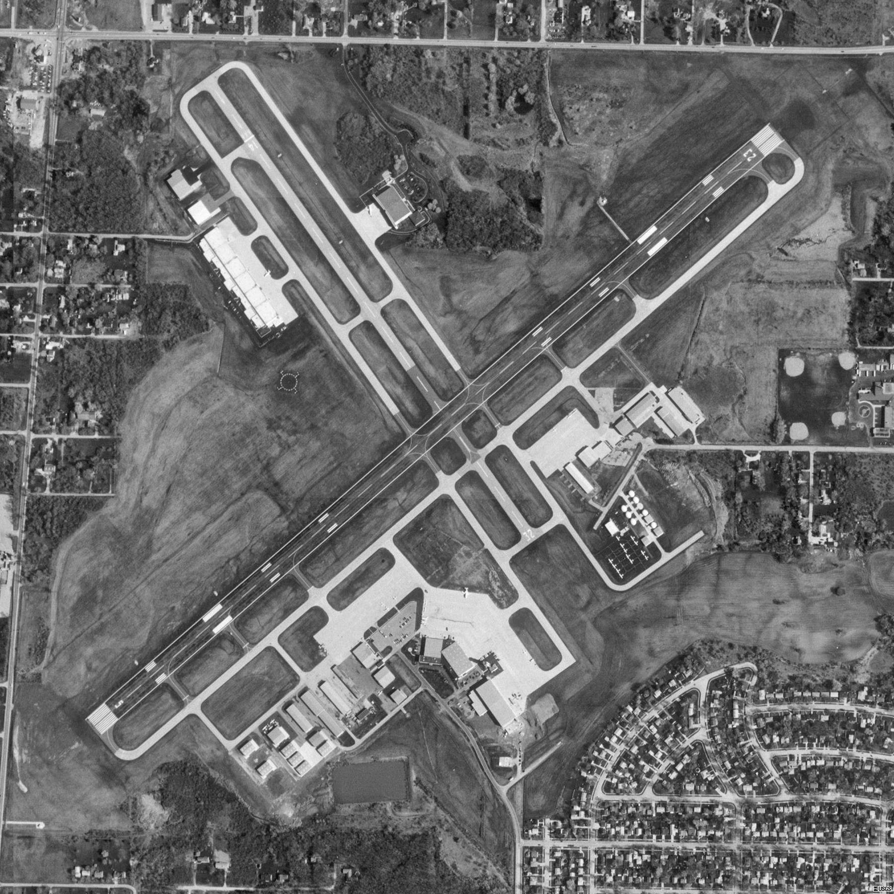
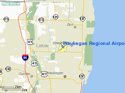
Waukegan Regional Airport |
| Waukegan Regional Airport |
 |
| USGS aerial image - 17 April 1998 |
| IATA: UGN â ICAO: KUGN â FAA LID: UGN |
| Summary |
| Airport type |
Public |
| Owner |
Waukegan Port District |
| Serves |
Chicago, Illinois |
| Location |
Waukegan, Illinois |
| Elevation AMSL |
727 ft / 222 m |
| Coordinates |
42°25â²20â³N 087°52â²04â³W / 42.42222°N 87.86778°W / 42.42222; -87.86778 |
| Website |
www.waukeganport.com/... |
| Runways |
| Direction |
Length |
Surface |
| ft |
m |
| 5/23 |
6,000 |
1,829 |
Asphalt |
| 14/32 |
3,751 |
1,143 |
Asphalt |
| Statistics (2006) |
| Aircraft operations |
69,007 |
| Based aircraft |
194 |
| Source: airport website and FAA |
Waukegan Regional Airport (IATA: UGN, ICAO: KUGN, FAA LID: UGN) is a public use airport located in Waukegan, a city in Lake County, Illinois, United States. The airport is 35 nautical miles (65 km) north of the central business district of Chicago. It was originally named Waukegan Memorial Airport. It has been operated by the Waukegan Port District since 1956 and is the second busiest airport in Illinois for international arrivals.
According to the FAA's National Plan of Integrated Airport Systems for 2009-2013, it is categorized as a reliever airport for the Chicago O'Hare International Airport.
Facilities and aircraft
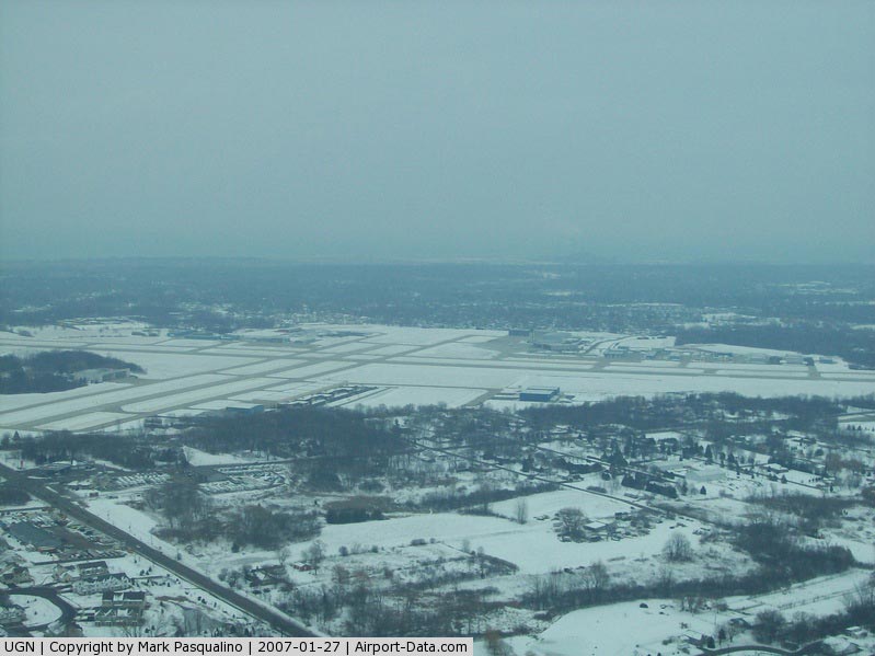
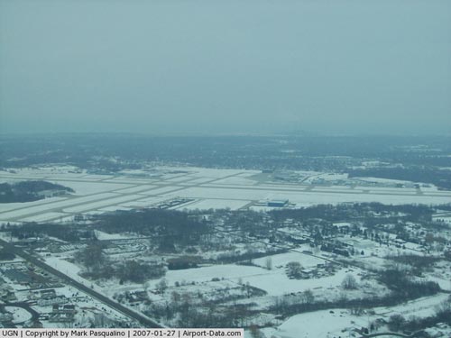
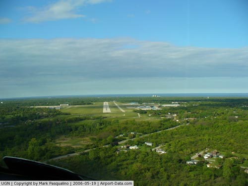
Waukegan Regional Airport covers an area of 600 acres (243 ha) at an elevation of 727 feet (222 m) above mean sea level. It has two runways which are asphalt surfaces overlaying concrete pavements. The NE-SW runway 5/23 is 6,000 feet long and 150 feet wide (1,829 x 46 m), while the NW-SE runway 14/32 is 3,751 feet long and 75 feet wide (1,143 x 23 m).
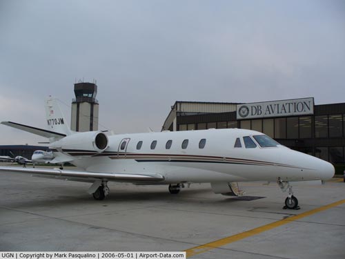
For the 12-month period ending December 31, 2006, the airport had 69,007 aircraft operations, an average of 189 per day: 94% general aviation, 5% air taxi and 1% military. At that time there were 194 aircraft based at this airport: 53% single-engine, 19% multi-engine, 27% jet and 2% helicopter.
The above content comes from Wikipedia and is published under free licenses – click here to read more.
|
 |
(Click on the photo to enlarge) |
|
 |
(Click on the photo to enlarge) |
|
 |
(Click on the photo to enlarge) |
|
 |
(Click on the photo to enlarge) |
Location
& QuickFacts
|
FAA
Information Effective: |
2007-12-20 |
|
Airport
Identifier: |
UGN |
|
Airport
Status: |
Operational |
|
Longitude/Latitude: |
087-52-04.4650W/42-25-19.7760N
-87.867907/42.422160 (Estimated) |
|
Elevation: |
727 ft / 221.59 m (Surveyed) |
|
Land: |
600 acres |
|
From nearest
city: |
35 nautical miles N of Chicago/waukegan,
IL |
|
Location: |
Lake County, IL |
|
Magnetic
Variation: |
01W (1985) |
Owner
& Manager
|
Ownership: |
Publicly
owned |
|
Owner: |
Waukegan Port District |
|
Address: |
Po Box 620
Waukegan, IL 60079 |
|
Phone
number: |
847-244-3133 |
|
Manager: |
Jim Stanczak |
|
Address: |
3500 N. Mc Aree Rd
Waukegan,
IL 60087 |
|
Phone
number: |
847-244-0055 |
Airport Operations
and Facilities
|
Airport
Use: |
Open
to public |
|
Wind indicator: |
Yes |
|
Segmented
Circle: |
Yes |
|
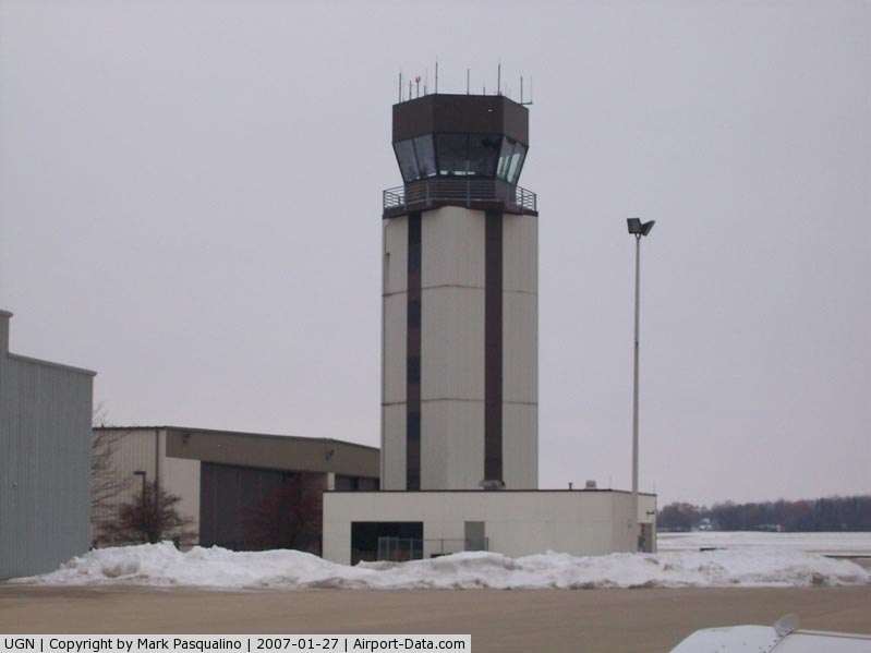
Control
Tower: |
Yes |
|
Lighting
Schedule: |
DUSK-DAWN
WHEN ATCT CLSD MIRL RY 14/32 PRESET LOW INTST; TO INCR INTST
& ACTVT HIRL RY 05/23; MALSR RY 23 & TWY LGTS -
CTAF. |
|
Beacon
Color: |
Clear-Green (lighted land airport) |
|
Sectional
chart: |
Chicago |
|
Region: |
AGL - Great Lakes |
|
Traffic
Pattern Alt: |
800 ft |
|
Boundary
ARTCC: |
ZAU - Chicago |
|
Tie-in
FSS: |
IKK - Kankakee |
|
FSS on
Airport: |
No |
|
FSS Toll
Free: |
1-800-WX-BRIEF |
|
NOTAMs
Facility: |
UGN (NOTAM-d service avaliable) |
|
Federal
Agreements: |
NGY |
Airport Communications
|
CTAF: |
120.050 |
|
Unicom: |
122.950
|
Airport
Services
|
Fuel
available: |
100LLA
FUEL IS PROVIDED BY A DEPARTMENT OF DEFENSE CONTRACT. |
|
Airframe
Repair: |
MAJOR |
|
Power
Plant Repair: |
MAJOR |
|
Bottled
Oxygen: |
HIGH/LOW |
|
Bulk Oxygen: |
HIGH/LOW |
|
Runway Information
Runway 05/23
|
Dimension: |
6000 x 150 ft
/ 1828.8 x 45.7 m |
|
Surface: |
ASPH, Good Condition |
|
Surface Treatment: |
Porous Friction Course |
|
Weight Limit: |
Single wheel: 95000 lbs.
Dual wheel: 120000 lbs.
Dual tandem wheel: 200000 lbs. |
|
Edge Lights: |
High |
|
|
Runway 05 |
Runway 23 |
|
Longitude: |
087-52-32.1910W |
087-51-32.3290W |
|
Latitude: |
42-24-57.0690N |
42-25-36.3740N |
|
Elevation: |
725.00 ft |
723.00 ft |
|
Alignment: |
48 |
127 |
|
ILS Type: |
|
ILS |
|
Traffic
Pattern: |
Left |
Right |
|
Markings: |
Non-precision instrument, Good Condition |
Precision instrument, Good Condition |
|
Crossing
Height: |
37.00 ft |
38.00 ft |
|
VASI: |
4-box on left side |
4-box on left side |
|
Visual Glide
Angle: |
3.00° |
3.00° |
|
Approach
lights: |
|
MALSR |
|
Runway End
Identifier: |
|
No |
|
Centerline
Lights: |
No |
No |
|
Touchdown
Lights: |
No |
No |
|
Obstruction: |
12 ft road, 281.0 ft from runway, 502 ft left
of centerline, 6:1 slope to clear |
20 ft tree, 313.0 ft from runway, 335 ft left
of centerline, 5:1 slope to clear |
|
Runway 14/32
|
Dimension: |
3751 x 75 ft
/ 1143.3 x 22.9 m |
|
Surface: |
ASPH, Good Condition |
|
Weight Limit: |
Single wheel: 16000 lbs.
Dual wheel: 23000 lbs. |
|
Edge Lights: |
Medium |
|
|
Runway 14 |
Runway 32 |
|
Longitude: |
087-52-22.7420W |
087-51-53.4870W |
|
Latitude: |
42-25-39.5870N |
42-25-09.5370N |
|
Elevation: |
727.00 ft |
712.00 ft |
|
Alignment: |
127 |
127 |
|
Traffic
Pattern: |
Left |
Left |
|
Markings: |
Basic, Good Condition |
Basic, Good Condition |
|
Crossing
Height: |
30.00 ft |
0.00 ft |
|
Displaced
threshold: |
500.00 ft |
0.00 ft |
|
VASI: |
4-box on left side |
|
|
Visual Glide
Angle: |
3.50° |
0.00° |
|
Runway End
Identifier: |
No |
No |
|
Centerline
Lights: |
No |
No |
|
Touchdown
Lights: |
No |
No |
|
Obstruction: |
37 ft tree, 404.0 ft from runway, 51 ft left
of centerline, 5:1 slope to clear
APCH RATIO IS 24:1 AT DSPLCD THLD. |
45 ft tree, 1216.0 ft from runway, 56 ft right
of centerline, 22:1 slope to clear |
|
Radio Navigation
Aids
|
ID |
Type |
Name |
Ch |
Freq |
Var |
Dist |
|
RA |
NDB |
Paser |
|
206.00 |
00E |
15.7 nm |
|
ME |
NDB |
Deana |
|
350.00 |
00E |
28.2 nm |
|
GM |
NDB |
Teels |
|
242.00 |
02W |
30.2 nm |
|
LVV |
NDB |
Lake Lawn |
|
404.00 |
00W |
36.2 nm |
|
BL |
NDB |
Yanks |
|
260.00 |
02W |
38.3 nm |
|
UES |
NDB |
Waukesha |
|
359.00 |
01W |
40.8 nm |
|
MX |
NDB |
Kedzi |
|
248.00 |
01W |
41.7 nm |
|
HK |
NDB |
Ermin |
|
332.00 |
01W |
42.3 nm |
|
DKB |
NDB |
Dekalb |
|
209.00 |
02W |
47.5 nm |
|
ENW |
VOR/DME |
Kenosha |
029X |
109.20 |
02W |
11.0 nm |
|
OBK |
VOR/DME |
Northbrook |
077X |
113.00 |
02W |
12.6 nm |
|
HRK |
VOR/DME |
Horlick |
124X |
117.70 |
02W |
20.6 nm |
|
BUU |
VOR/DME |
Burbun |
092X |
114.50 |
01W |
25.0 nm |
|
ORD |
VOR/DME |
Chicago O'hare |
086X |
113.90 |
02E |
26.2 nm |
|
DPA |
VOR/DME |
Dupage |
021X |
108.40 |
02E |
38.5 nm |
|
LJT |
VOR/DME |
Timmerman |
072X |
112.50 |
02W |
42.0 nm |
|
BAE |
VORTAC |
Badger |
111X |
116.40 |
02E |
45.6 nm |
|
ORD |
VOT |
Chicago O'hare Intl |
|
112.00 |
|
26.5 nm |
|
MKE |
VOT |
Milwaukee |
|
109.00 |
|
31.6 nm |
|
MDW |
VOT |
Chicago Midway |
|
111.00 |
|
38.6 nm |
Remarks
- NO
TOUCH & GO LNDGS ON RY 14.
- BIRDS
ON & INVOF ARPT.
- NOISE
ABATEMENT PROCEDURES IN EFFECT CTC AMGR 847-244-0055.
- A110-02
CTC ARPT MGMT OFFICE 847-244-0055. US CUSTOMS USER FEE ARPT. FOR CUSTOMS
CLNC 2 HRS MIN ADVN NOTICE RQRD MON-FRI DURG BUSINESS HRS & BY 4PM
FRI FOR WEEKEND ARRIVALS.
Based Aircraft
|
Aircraft
based on field: |
182 |
|
Single Engine
Airplanes: |
93 |
|
Multi Engine Airplanes: |
36 |
|
Jet Engine Airplanes: |
49 |
|
Helicopters: |
4 |
Operational Statistics
Time
Period: 2006-01-01 - 2006-12-31
|
Aircraft
Operations: |
190/Day |
|
Air Taxi: |
4.8% |
|
General Aviation
Local: |
45.2% |
|
General Aviation
Itinerant: |
48.8% |
|
Military: |
1.3% |
Waukegan Regional Airport
Address:
Lake County, IL
Tel:
847-244-3133,
847-244-0055
Images
and information placed above are from
http://www.airport-data.com/airport/UGN/
We
thank them for the data!
| General
Info |
| Country |
United
States |
| State |
ILLINOIS
|
| FAA ID |
UGN |
| Latitude |
42-25-19.776N
|
| Longitude |
087-52-04.465W
|
| Elevation |
727 feet
|
| Near City |
CHICAGO/WAUKEGAN
|
We don't guarantee the information is fresh and accurate. The data may
be wrong or outdated.
For more up-to-date information please refer to other sources.
|
|