 |
|
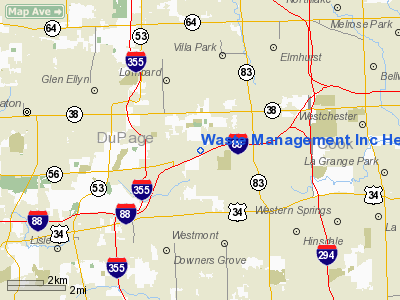
Waste Management Incorporated Heliport |
Location
& QuickFacts
|
FAA
Information Effective: |
2007-12-20 |
|
Airport
Identifier: |
70IS |
|
Airport
Status: |
Operational |
|
Longitude/Latitude: |
087-59-34.2300W/41-50-29.1080N
-87.992842/41.841419 (Estimated) |
|
Elevation: |
800 ft / 243.84 m (Estimated) |
|
Land: |
0
acres |
|
From nearest
city: |
0 nautical miles NE of Oak Brook, IL |
|
Location: |
Du Page County, IL |
|
Magnetic
Variation: |
01W (1985) |
Owner
& Manager
|
Ownership: |
Privately
owned |
|
Owner: |
Waste Management Inc |
|
Address: |
3003 Butterfield Rd
Oak Brook, IL 60521 |
|
Phone number: |
630-443-8400 |
|
Manager: |
Ed Forst
AVIATION DEPT. |
|
Address: |
2735 International Dr
West Chicago, IL 60185 |
|
Phone number: |
630-443-8400 |
Airport
Operations and Facilities
|
Airport
Use: |
Private |
|
Segmented
Circle: |
No |
|
Control
Tower: |
No |
|
Sectional
chart: |
Chicago |
|
Region: |
AGL - Great Lakes |
|
Boundary
ARTCC: |
ZAU - Chicago |
|
Tie-in FSS: |
IKK - Kankakee |
|
FSS Toll
Free: |
1-800-WX-BRIEF |
|
Runway
Information
Helipad
H1
|
Dimension: |
60 x 60 ft / 18.3
x 18.3 m |
|
Surface: |
ASPH,
|
|
|
Runway
H1 |
Runway
|
|
Traffic Pattern: |
Left |
Left |
|
Radio
Navigation Aids
|
ID |
Type |
Name |
Ch |
Freq |
Var |
Dist |
|
ME |
NDB |
Deana |
|
350.00 |
00E |
7.7
nm |
|
HK |
NDB |
Ermin |
|
332.00 |
01W |
10.2
nm |
|
MX |
NDB |
Kedzi |
|
248.00 |
01W |
14.9
nm |
|
DKB |
NDB |
Dekalb |
|
209.00 |
02W |
32.5
nm |
|
OIX |
NDB |
Ottawa |
|
266.00 |
01E |
48.2
nm |
|
ORD |
VOR/DME |
Chicago
O'hare |
086X |
113.90 |
02E |
9.6
nm |
|
DPA |
VOR/DME |
Dupage |
021X |
108.40 |
02E |
16.3
nm |
|
OBK |
VOR/DME |
Northbrook |
077X |
113.00 |
02W |
22.9
nm |
|
ENW |
VOR/DME |
Kenosha |
029X |
109.20 |
02W |
45.6
nm |
|
IKK |
VOR/DME |
Kankakee |
053X |
111.60 |
00E |
46.6
nm |
|
JOT |
VORTAC |
Joliet |
070X |
112.30 |
02E |
23.0
nm |
|
CGT |
VORTAC |
Chicago
Heights |
089X |
114.20 |
02E |
27.5
nm |
|
EON |
VORTAC |
Peotone |
079X |
113.20 |
02E |
35.5
nm |
|
ORD |
VOT |
Chicago
O'hare Intl |
|
112.00 |
|
9.3
nm |
|
MDW |
VOT |
Chicago
Midway |
|
111.00 |
|
11.3
nm |
Remarks
- INGRESS/EGRESS
FROM 270 TO 090 DEG; AREA IS MKD; WIND INDICATOR IS MAINTAINED.
Waste Management Incorporated Heliport
Address: Du
Page County, IL
Tel:
630-443-8400
Images
and information placed above are from
http://www.airport-data.com/airport/70IS/
We
thank them for the data!
| General
Info |
| Country |
United
States |
| State |
ILLINOIS
|
| FAA ID |
70IS |
| Latitude |
41-50-29.108N
|
| Longitude |
087-59-34.230W
|
| Elevation |
800 feet
|
| Near City |
OAK BROOK
|
We don't guarantee the information is fresh and accurate. The data may
be wrong or outdated.
For more up-to-date information please refer to other sources.
|
|


