 |
|
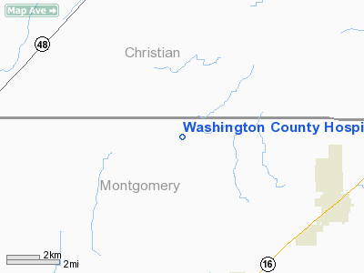
Washington County Hospital Heliport |
Location
& QuickFacts
|
FAA
Information Effective: |
2007-12-20 |
|
Airport
Identifier: |
2LL8 |
|
Airport
Status: |
Operational |
|
Longitude/Latitude: |
089-23-32.0000W/39-20-20.0000N
-89.392222/39.338889 (Estimated) |
|
Elevation: |
700 ft / 213.36 m (Estimated) |
|
Land: |
0 acres |
|
From nearest
city: |
1 nautical miles SW of Nashville, IL |
|
Location: |
Washington County, IL |
|
Magnetic
Variation: |
01W (2000) |
Owner
& Manager
|
Ownership: |
Privately
owned |
|
Owner: |
Washington County Hospital |
|
Address: |
705 S Grand Ave
Nashville,
IL 62263 |
|
Phone
number: |
618-327-8236 |
|
Manager: |
Harold Whitworth |
|
Address: |
705 S Grand Ave
Nashville,
IL 62263 |
|
Phone
number: |
618-327-8236 |
Airport Operations
and Facilities
|
Airport
Use: |
Private |
|
Wind indicator: |
Yes |
|
Segmented
Circle: |
No |
|
Control
Tower: |
No |
|
Lighting
Schedule: |
PHONE REQ
FOR PERIMETER LGTS CALL 618-327-8236. |
|
Sectional
chart: |
St Louis |
|
Region: |
AGL - Great Lakes |
|
Boundary
ARTCC: |
ZKC - Kansas City |
|
Tie-in
FSS: |
COU - Columbia |
|
FSS Toll
Free: |
1-800-WX-BRIEF |
|
Runway Information
Helipad H1
|
Dimension: |
25 x 25 ft /
7.6 x 7.6 m |
|
Surface: |
CONC, |
|
|
Runway H1 |
Runway |
|
Traffic
Pattern: |
Left |
Left |
|
Radio Navigation
Aids
|
ID |
Type |
Name |
Ch |
Freq |
Var |
Dist |
|
TAZ |
NDB |
Taylorville |
|
395.00 |
00E |
12.3 nm |
|
LTD |
NDB |
Litchfield |
|
371.00 |
01E |
16.8 nm |
|
SYZ |
NDB |
Shelbyville |
|
365.00 |
01E |
25.8 nm |
|
SP |
NDB |
Huskk |
|
382.00 |
01W |
31.2 nm |
|
LQ |
NDB |
Licol |
|
375.00 |
01W |
35.8 nm |
|
CVM |
NDB |
Civic Memorial |
|
263.00 |
02E |
41.0 nm |
|
SLO |
NDB |
Salem |
|
400.00 |
01W |
46.2 nm |
|
AAA |
NDB |
Abraham |
|
329.00 |
00E |
49.4 nm |
|
IJX |
VOR/DME |
Jacksonville |
023X |
108.60 |
02E |
47.2 nm |
|
VLA |
VORTAC |
Vandalia |
090X |
114.30 |
04E |
18.2 nm |
|
SPI |
VORTAC |
Spinner |
74X |
112.70 |
01W |
32.9 nm |
|
DEC |
VORTAC |
Decatur |
119X |
117.20 |
03E |
34.5 nm |
|
CAP |
VORTAC |
Capital |
074X |
112.70 |
04E |
35.0 nm |
|
TOY |
VORTAC |
Troy |
107X |
116.00 |
04E |
43.6 nm |
|
BIB |
VORTAC |
Bible Grove |
027X |
109.00 |
03E |
49.3 nm |
Remarks
- PRVDD
APCHS/DEPS FM 085-095 & 355-005, AREA IS MKD, WIND INDICATOR MAINTAINED
& COMPLY WITH FAR PART 91.126(B)(2).
Washington County Hospital Heliport
Address:
Washington County, IL
Tel:
618-327-8236
Images
and information placed above are from
http://www.airport-data.com/airport/2LL8/
We
thank them for the data!
| General
Info |
| Country |
United
States |
| State |
ILLINOIS
|
| FAA ID |
2LL8 |
| Latitude |
39-20-20.000N
|
| Longitude |
089-23-32.000W
|
| Elevation |
700 feet
|
| Near City |
NASHVILLE
|
We don't guarantee the information is fresh and accurate. The data may
be wrong or outdated.
For more up-to-date information please refer to other sources.
|
|


