 |
|
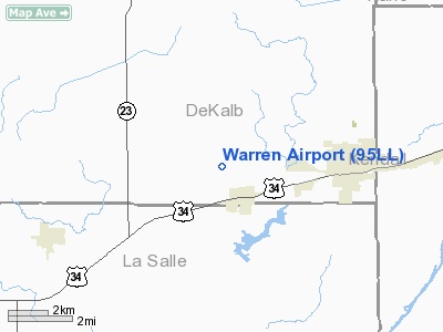
Location
& QuickFacts
|
FAA
Information Effective: |
2007-12-20 |
|
Airport
Identifier: |
95LL |
|
Airport
Status: |
Operational |
|
Longitude/Latitude: |
088-41-40.0000W/41-38-52.0000N
-88.694444/41.647778 (Estimated) |
|
Elevation: |
694 ft / 211.53 m (Estimated) |
|
Land: |
0 acres |
|
From nearest
city: |
1 nautical miles NW of Somonauk, IL |
|
Location: |
De Kalb County, IL |
|
Magnetic
Variation: |
00W (1985) |
Owner
& Manager
|
Ownership: |
Privately
owned |
|
Owner: |
Thomas Warren |
|
Address: |
3805 Victor Line Road
Somonauk,
IL 60552 |
|
Phone
number: |
815-495-2655 |
|
Manager: |
Thomas Warren |
|
Address: |
3805 Victor Line Road
Somonauk,
IL 60552 |
|
Phone
number: |
815-498-2517 |
Airport Operations
and Facilities
|
Airport
Use: |
Private |
|
Wind indicator: |
Yes |
|
Segmented
Circle: |
No |
|
Control
Tower: |
No |
|
Lighting
Schedule: |
PHONE REQ
FOR RWY LGTS CALL 815-498-2655. |
|
Sectional
chart: |
Chicago |
|
Region: |
AGL - Great Lakes |
|
Boundary
ARTCC: |
ZAU - Chicago |
|
Tie-in
FSS: |
IKK - Kankakee |
|
FSS on
Airport: |
No |
|
FSS Toll
Free: |
1-800-WX-BRIEF |
|
Runway Information
Runway 09/27
|
Dimension: |
2300 x 85 ft
/ 701.0 x 25.9 m |
|
Surface: |
TURF, |
|
|
Runway 09 |
Runway 27 |
|
Traffic
Pattern: |
Right |
Left |
|
Radio Navigation
Aids
|
ID |
Type |
Name |
Ch |
Freq |
Var |
Dist |
|
DKB |
NDB |
Dekalb |
|
209.00 |
02W |
17.2 nm |
|
OIX |
NDB |
Ottawa |
|
266.00 |
01E |
18.6 nm |
|
VYS |
NDB |
Valley |
|
230.00 |
00W |
27.0 nm |
|
ME |
NDB |
Deana |
|
350.00 |
00E |
35.6 nm |
|
HK |
NDB |
Ermin |
|
332.00 |
01W |
38.8 nm |
|
MX |
NDB |
Kedzi |
|
248.00 |
01W |
45.4 nm |
|
BOZ |
NDB |
Whiteside |
|
254.00 |
01E |
49.1 nm |
|
DPA |
VOR/DME |
Dupage |
021X |
108.40 |
02E |
21.2 nm |
|
ORD |
VOR/DME |
Chicago O'hare |
086X |
113.90 |
02E |
40.8 nm |
|
RFD |
VOR/DME |
Rockford |
045X |
110.80 |
01E |
41.4 nm |
|
PLL |
VOR/DME |
Polo |
049X |
111.20 |
03E |
41.8 nm |
|
OBK |
VOR/DME |
Northbrook |
077X |
113.00 |
02W |
47.9 nm |
|
PNT |
VOR/DME |
Pontiac |
033X |
109.60 |
03E |
49.7 nm |
|
JOT |
VORTAC |
Joliet |
070X |
112.30 |
02E |
18.0 nm |
|
EON |
VORTAC |
Peotone |
079X |
113.20 |
02E |
46.6 nm |
|
BDF |
VORTAC |
Bradford |
094X |
114.70 |
00E |
49.8 nm |
|
ORD |
VOT |
Chicago O'hare Intl |
|
112.00 |
|
40.6 nm |
|
MDW |
VOT |
Chicago Midway |
|
111.00 |
|
43.1 nm |
Remarks
- E111:ARPT
TRAFFIC PATTERN AIRSPACE AREA ASSOCD WITH THIS ARPT IS INCOMPATIBLE
WITH THE SAME AREA ASSOCD WITH GEORGE ARPT LCTD APRXLY 7500' NORTHEAST.
Based Aircraft
|
Aircraft
based on field: |
4 |
|
Single Engine
Airplanes: |
4 |
Warren Airport
Address:
De Kalb County, IL
Tel:
815-495-2655,
815-498-2517
Images
and information placed above are from
http://www.airport-data.com/airport/95LL/
We
thank them for the data!
| General
Info |
| Country |
United
States |
| State |
ILLINOIS
|
| FAA ID |
95LL |
| Latitude |
41-38-52.000N
|
| Longitude |
088-41-40.000W
|
| Elevation |
694 feet
|
| Near City |
SOMONAUK
|
We don't guarantee the information is fresh and accurate. The data may
be wrong or outdated.
For more up-to-date information please refer to other sources.
|
|


