 |
|
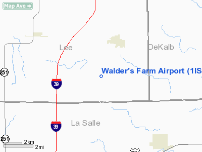
Location
& QuickFacts
|
FAA
Information Effective: |
2007-12-20 |
|
Airport
Identifier: |
1IS5 |
|
Airport
Status: |
Operational |
|
Longitude/Latitude: |
089-00-05.3120W/41-39-11.1090N
-89.001476/41.653086 (Estimated) |
|
Elevation: |
900 ft / 274.32 m (Estimated) |
|
Land: |
0 acres |
|
From nearest
city: |
3 nautical miles SW of Paw Paw, IL |
|
Location: |
Lee County, IL |
|
Magnetic
Variation: |
00E (1985) |
Owner
& Manager
|
Ownership: |
Privately
owned |
|
Owner: |
Verland R. Walder |
|
Address: |
3263 Cyclone Road
Paw
Paw, IL 61353 |
|
Phone
number: |
815-627-3941 |
|
Manager: |
Verland R. Walder |
|
Address: |
3263 Cyclone Road
Paw
Paw, IL 61353 |
|
Phone
number: |
815-627-3941 |
Airport Operations
and Facilities
|
Airport
Use: |
Private |
|
Wind indicator: |
Yes |
|
Segmented
Circle: |
No |
|
Control
Tower: |
No |
|
Sectional
chart: |
Chicago |
|
Region: |
AGL - Great Lakes |
|
Boundary
ARTCC: |
ZAU - Chicago |
|
Tie-in
FSS: |
IKK - Kankakee |
|
FSS Toll
Free: |
1-800-WX-BRIEF |
|
Runway Information
Runway 13/31
|
Dimension: |
1600 x 70 ft
/ 487.7 x 21.3 m |
|
Surface: |
TURF, |
|
|
Runway 13 |
Runway 31 |
|
Traffic
Pattern: |
Right |
Left |
|
Obstruction: |
3 ft fence, 1300.0 ft from runway |
3 ft fence, 60.0 ft from runway |
|
Radio Navigation
Aids
|
ID |
Type |
Name |
Ch |
Freq |
Var |
Dist |
|
OIX |
NDB |
Ottawa |
|
266.00 |
01E |
18.7 nm |
|
VYS |
NDB |
Valley |
|
230.00 |
00W |
19.1 nm |
|
DKB |
NDB |
Dekalb |
|
209.00 |
02W |
21.4 nm |
|
BOZ |
NDB |
Whiteside |
|
254.00 |
01E |
35.4 nm |
|
FEP |
NDB |
Freeport |
|
335.00 |
00E |
44.2 nm |
|
ME |
NDB |
Deana |
|
350.00 |
00E |
47.6 nm |
|
PLL |
VOR/DME |
Polo |
049X |
111.20 |
03E |
30.0 nm |
|
DPA |
VOR/DME |
Dupage |
021X |
108.40 |
02E |
32.5 nm |
|
RFD |
VOR/DME |
Rockford |
045X |
110.80 |
01E |
35.5 nm |
|
JOT |
VORTAC |
Joliet |
070X |
112.30 |
02E |
31.4 nm |
|
BDF |
VORTAC |
Bradford |
094X |
114.70 |
00E |
39.7 nm |
Remarks
- PROVIDED
ALL OPNS ARE CONDUCTED SW OF ARPT.
Based Aircraft
|
Aircraft
based on field: |
2 |
|
Single Engine
Airplanes: |
2 |
Walder's Farm Airport
Address:
Lee County, IL
Tel:
815-627-3941
Images
and information placed above are from
http://www.airport-data.com/airport/1IS5/
We
thank them for the data!
| General
Info |
| Country |
United
States |
| State |
ILLINOIS
|
| FAA ID |
1IS5 |
| Latitude |
41-39-11.109N
|
| Longitude |
089-00-05.312W
|
| Elevation |
900 feet
|
| Near City |
PAW PAW
|
We don't guarantee the information is fresh and accurate. The data may
be wrong or outdated.
For more up-to-date information please refer to other sources.
|
|


