|
|
University Of Illinois-Willard Airport |
University of Illinois
Willard Airport |
 |
| IATA: CMI â ICAO: KCMI â FAA LID: CMI |
| Summary |
| Airport type |
Public |
| Operator |
University of Illinois at Urbana-Champaign |
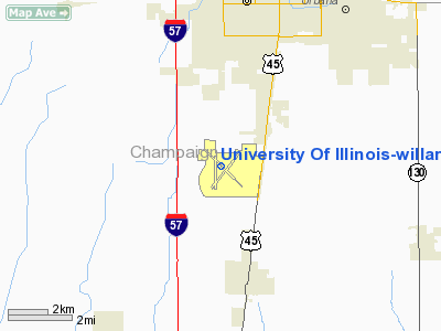
| Location |
Champaign-Urbana, Illinois |
| Elevation AMSL |
754 ft / 229.8 m |
| Coordinates |
40°02â²21â³N 88°16â²41â³W / 40.03917°N 88.27806°W / 40.03917; -88.27806 |
| Runways |
| Direction |
Length |
Surface |
| ft |
m |
| 4/22 |
6,500 |
1,981 |
Concrete |
| 14L/32R |
8,100 |
2,469 |
Concrete |
| 14R/32L |
3,817 |
1,163 |
Asphalt |
| 18/36 |
5,299 |
1,615 |
Concrete |
University of Illinois Willard Airport (IATA: CMI, ICAO: KCMI, FAA LID: CMI) is an airport owned and operated by the University of Illinois at Urbana-Champaign located south of Savoy in Tolono Township, Champaign County, Illinois. It serves the greater Champaign-Urbana Metropolitan Area in East Central Illinois. Willard Airport is named for former University of Illinois president Arthur Cutts Willard, and home to the University of Illinois Institute of Aviation, which is a major research facility at the university.
The airport faces several challenges in terms of competitiveness. No international flights are offered due to the lack of U.S. immigration and customs facilities. The additional price airlines charge to fly to regional airports compared to a major hub like Chicago's O'Hare International Airport often encourages budget-minded travelers to use surface transport to reach Champaign County instead. Finally, some airlines do not fly into Willard Airport at all, having chosen to serve Central Illinois only via the Central Illinois Regional Airport in Bloomington-Normal instead. Ground Transportation
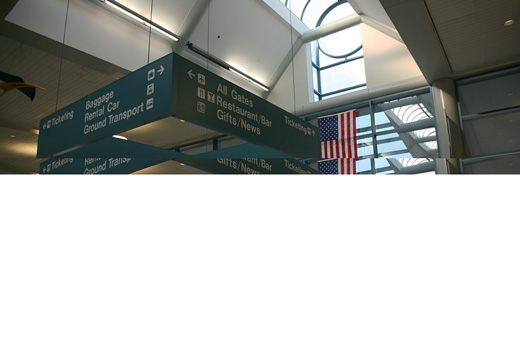
The airport is served by buses from the Champaign-Urbana Mass Transit District, which connect with intercity buses and with Amtrak. Several car rental agencies have offices in the terminal building. The airport is reached from U.S. Route 45, five miles south of downtown Champaign. The nearest expressway exit is Exit 229 (Monticello Road) on Interstate 57, about a four mile drive west-southwest from the terminal building. In addition to the curbside loading zone and the rental car parking lot, parking facilities include a paid parking lot ($5/day).
History
The airport was dedicated on 26 October 1945. The first scheduled commercial flights began in 1954. The terminal building constructed in 1960 was used until the present terminal was completed in 1987. By 1969, Willard had become the second-busiest airport in the state of Illinois. After the Airline Deregulation Act of 1978, however, many airlines found service to a regional airport to be inefficient, the price differential to airfares from major hub airports such as Chicago O'Hare grew, which limited the growth of demand for tickets from Willard, lowered the market share within the state, and caused airlines to discontinue service in the ensuing decades.
Willard Airport received its 15 minutes of fame on January 28, 1998. President Bill Clinton was in Champaign-Urbana for a speaking engagement at Assembly Hall and arrived at Willard Airport on Air Force One. Due to the breaking story, news media descended on Champaign-Urbana. After the engagement, just prior to takeoff, the Boeing 707 acting as Air Force One got stuck in the mud, the taxiway not being designed for aircraft as wide as the Boeing 707. After about an hour of being stuck, a backup Air Force One descended upon Willard Airport. The backup was SAM26000, which was the same 707 that took John Kennedy to Dallas. The trip on SAM26000 marked the last time it carried a sitting president. Several months later it was retired to the Air Force Museum at Wright-Patterson. Many news broadcasts that evening carried live video feed of the Presidential aircraft stuck at Willard Airport.
Facilities
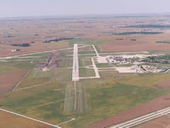
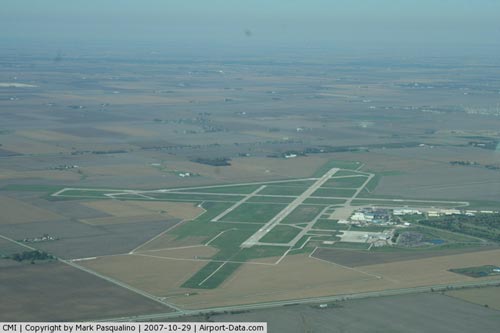
Willard Airport covers 1,799 acres (728 ha) and has four runways:
- Runway 4/22: 6,500 x 150 ft. (1,981 x 46 m), Surface: Concrete
- Runway 14L/32R: 8,100 x 150 ft. (2,469 x 46 m), Surface: Concrete, ILS equipped.
- Runway 14R/32L: 3,817 x 75 ft. (1,163 x 23 m), Surface: Asphalt
- Runway 18/36: 5,299 x 150 ft. (1,615 x 46 m), Surface: Concrete
Airlines and destinations
 | |
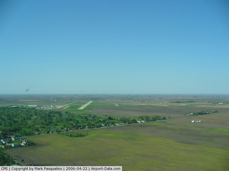
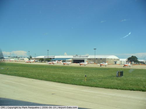
Terminal building at Willard Airport |
Currently, American Eagle operates one daily flight to Dallas/Fort Worth International Airport on 50-seat ERJ - jets, and five daily (four on weekends) flights to Chicago's O'Hare International Airport on 50 ERJs.
Delta Air Lines ceased service to Willard Airport on August 31, 2010.
The terminal is made of five gates: gates 1-5
| Airlines |
Destinations |
| American Eagle |
Chicago-O'Hare, Dallas/Fort Worth |
The above content comes from Wikipedia and is published under free licenses – click here to read more.
|
 |
(Click on the photo to enlarge) |
|
 |
(Click on the photo to enlarge) |
|
 |
(Click on the photo to enlarge) |
|
 |
(Click on the photo to enlarge) |
Location
& QuickFacts
|
FAA
Information Effective: |
2007-12-20 |
|
Airport
Identifier: |
CMI |
|
Airport
Status: |
Operational |
|
Longitude/Latitude: |
088-16-41.0000W/40-02-21.3000N
-88.278056/40.039250 (Estimated) |
|
Elevation: |
754 ft / 229.82 m (Surveyed) |
|
Land: |
1799 acres |
|
From nearest
city: |
5 nautical miles SW of Champaign/urbana,
IL |
|
Location: |
Champaign County, IL |
|
Magnetic
Variation: |
00E (1985) |
Owner & Manager
|
Ownership: |
Publicly
owned |
|
Owner: |
Univ Of Illinois |
|
Address: |
11 Airport Road
Savoy,
IL 61874 |
|
Phone
number: |
217-244-8634 |
|
Manager: |
Steve Wanzek |
|
Address: |
11 Airport Rd
Savoy,
IL 61874 |
|
Phone
number: |
217-244-8634 |
Airport
Operations and Facilities
|
Airport
Use: |
Open
to public |
|
Wind indicator: |
Yes |
|
Segmented
Circle: |
No |
|
Control
Tower: |
Yes |
|
Lighting
Schedule: |
DUSK-DAWN
WHEN ATCT CLSD HIRL RY 14L/32R PRESET LOW INTST; TO INCR
INTST & ACTVT MIRL RYS 04/22 & 14R/32L & MALSR
RY 32R - CTAF. |
|
Beacon
Color: |
Clear-Green (lighted land airport) |
|
Landing
fee charge: |
No |
|
Sectional
chart: |
Chicago |
|
Region: |
AGL - Great Lakes |
|
Traffic
Pattern Alt: |
750 ft |
|
Boundary
ARTCC: |
ZAU - Chicago |
|
Tie-in
FSS: |
STL - Saint Louis |
|
FSS on
Airport: |
No |
|
FSS Toll
Free: |
1-800-WX-BRIEF |
|
NOTAMs
Facility: |
CMI (NOTAM-d service avaliable) |
|
Certification
type/date: |
I B S 05/1973
24 HR PPR FOR UNSKED ACR OPNS WITH MORE THAN 30 PSGR SEATS
BETWEEN 2200-0600 LCL DLY CALL AMGR 217-244-8634/8764. |
|
Federal
Agreements: |
NGY3 |
Airport Communications
|
CTAF: |
120.400 |
|
Unicom: |
122.950
|
Airport
Services
|
Fuel
available: |
100LLA1+ |
|
Airframe
Repair: |
MAJOR |
|
Power
Plant Repair: |
MAJOR |
|
Bottled
Oxygen: |
NONE |
|
Bulk Oxygen: |
HIGH |
|
Runway Information
Runway 04/22
|
Dimension: |
6500 x 150 ft
/ 1981.2 x 45.7 m |
|
Surface: |
CONC, Fair Condition |
|
Surface Treatment: |
Saw-cut or plastic Grooved |
|
Weight Limit: |
Single wheel: 100000 lbs.
Dual wheel: 180000 lbs.
Dual tandem wheel: 260000 lbs. |
|
Edge Lights: |
Medium |
|
|
Runway 04 |
Runway 22 |
|
Longitude: |
088-17-07.4470W |
088-16-12.5370W |
|
Latitude: |
40-01-54.5910N |
40-02-43.0130N |
|
Elevation: |
751.00 ft |
746.00 ft |
|
Alignment: |
41 |
127 |
|
Traffic
Pattern: |
Left |
Left |
|
Markings: |
Non-precision instrument, Fair Condition |
Non-precision instrument, Fair Condition |
|
Crossing
Height: |
45.00 ft |
41.00 ft |
|
VASI: |
4-box on left side |
4-box on left side |
|
Visual Glide
Angle: |
3.00° |
3.00° |
|
Centerline
Lights: |
No |
No |
|
Touchdown
Lights: |
No |
No |
|
Obstruction: |
, 50:1 slope to clear |
53 ft tree, 1687.0 ft from runway, 279 ft left
of centerline, 28:1 slope to clear |
|
Runway 14L/32R
|
Dimension: |
8100 x 150 ft
/ 2468.9 x 45.7 m |
|
Surface: |
CONC, Fair Condition |
|
Surface Treatment: |
Saw-cut or plastic Grooved |
|
Weight Limit: |
Single wheel: 100000 lbs.
Dual wheel: 180000 lbs.
Dual tandem wheel: 260000 lbs. |
|
Edge Lights: |
High |
|
|
Runway 14L |
Runway 32R |
|
Longitude: |
088-17-08.6190W |
088-15-55.7640W |
|
Latitude: |
40-02-50.5120N |
40-01-53.3110N |
|
Elevation: |
754.00 ft |
749.00 ft |
|
Alignment: |
127 |
127 |
|
ILS Type: |
|
ILS |
|
Traffic
Pattern: |
Left |
Left |
|
Markings: |
Precision instrument, Fair Condition |
Precision instrument, Fair Condition |
|
Crossing
Height: |
31.00 ft |
54.00 ft |
|
VASI: |
4-box on left side |
4-box on left side |
|
Visual Glide
Angle: |
3.00° |
3.00° |
|
RVR Equipment: |
|
touchdown |
|
Approach
lights: |
|
MALSR |
|
Runway End
Identifier: |
|
No |
|
Centerline
Lights: |
No |
No |
|
Touchdown
Lights: |
No |
No |
|
Runway 14R/32L
|
Dimension: |
3817 x 75 ft
/ 1163.4 x 22.9 m |
|
Surface: |
ASPH, Good Condition |
|
Weight Limit: |
Single wheel: 12500 lbs.
Dual wheel: 12500 lbs. |
|
Edge Lights: |
Medium |
|
|
Runway 14R |
Runway 32L |
|
Longitude: |
088-16-52.2200W |
088-16-17.9000W |
|
Latitude: |
40-02-25.8100N |
40-01-58.8500N |
|
Elevation: |
743.00 ft |
750.00 ft |
|
Alignment: |
127 |
127 |
|
Traffic
Pattern: |
Left |
Left |
|
Markings: |
Basic, |
Basic, |
|
Crossing
Height: |
35.00 ft |
35.00 ft |
|
VASI: |
4-light PAPI on left side |
4-light PAPI on left side |
|
Visual Glide
Angle: |
3.00° |
3.00° |
|
Runway 18/36
|
Dimension: |
5299 x 150 ft
/ 1615.1 x 45.7 m |
|
Surface: |
CONC, Fair Condition |
|
Weight Limit: |
Single wheel: 40000 lbs.
Dual wheel: 50000 lbs.
Dual tandem wheel: 90000 lbs. |
|
Edge Lights: |
Medium |
|
|
Runway 18 |
Runway 36 |
|
Longitude: |
088-16-56.2600W |
088-16-55.5470W |
|
Latitude: |
40-02-49.4530N |
40-01-57.0900N |
|
Elevation: |
752.00 ft |
750.00 ft |
|
Alignment: |
127 |
127 |
|
Traffic
Pattern: |
Left |
Left |
|
Markings: |
Basic, Fair Condition |
Basic, Fair Condition |
|
Crossing
Height: |
0.00 ft |
40.00 ft |
|
VASI: |
|
4-box on left side |
|
Visual Glide
Angle: |
0.00° |
3.00° |
|
Runway End
Identifier: |
No |
No |
|
Centerline
Lights: |
No |
No |
|
Touchdown
Lights: |
No |
No |
|
Obstruction: |
, 50:1 slope to clear |
78 ft tree, 2780.0 ft from runway, 397 ft left
of centerline, 33:1 slope to clear |
|
Radio Navigation
Aids
|
ID |
Type |
Name |
Ch |
Freq |
Var |
Dist |
|
HMJ |
NDB |
Homer |
|
281.00 |
01E |
15.0 nm |
|
PRG |
NDB |
Paris |
|
341.00 |
01E |
34.6 nm |
|
MT |
NDB |
Zebre |
|
347.00 |
00E |
36.2 nm |
|
CZB |
NDB |
Casey |
|
359.00 |
00E |
45.9 nm |
|
SYZ |
NDB |
Shelbyville |
|
365.00 |
01E |
46.1 nm |
|
AAA |
NDB |
Abraham |
|
329.00 |
00E |
49.3 nm |
|
RBS |
VOR/DME |
Roberts |
115X |
116.80 |
02E |
33.0 nm |
|
MTO |
VOR/DME |
Mattoon |
031X |
109.40 |
03E |
33.7 nm |
|
BMI |
VOR/DME |
Bloomington |
019X |
108.20 |
03E |
40.0 nm |
|
CMI |
VORTAC |
Champaign |
037X |
110.00 |
03E |
0.3 nm |
|
DEC |
VORTAC |
Decatur |
119X |
117.20 |
03E |
32.3 nm |
|
DNV |
VORTAC |
Danville |
047X |
111.00 |
02E |
36.5 nm |
Remarks
- ITINERANT
PARKING ON SE GENERAL AVIATION RAMP ONLY.
- TAXIING
ACFT SHOULD USE CAUTION IN EARLY MORNING AND LATE AFTERNOON HRS; SUN
GLARE MAY MAKE VISUAL RECOGNITION OF SIGNS AND PAVEMENT MARKINGS DIFFICULT.
- RY
14L & RY 18 APCH ENDS ARE CLOSELY ALIGNED. RY 04 & RY 36 APCH
ENDS ARE CLOSELY ALIGNED. VERIFY
CORRECT RY AND COMPASS HEADING PRIOR TO DEP.
- BIRDS
ON & INVOF ARPT.
- TWY
'A5' & 'C1' SW OF RY 14L/23R CLSD TO ACFT OVR 11800 LBS.
- TWY
A6 & A7, ADJ TO RAMP, NOT VSB FM THE CONTROL TWR.
- AER
22 & 32 NOT VSB FM EACH OTHER.
- WHEN
TWR IS CLSD RY 32R IS THE CALM WIND RY.
Based Aircraft
|
Aircraft
based on field: |
80 |
|
Single Engine
Airplanes: |
59 |
|
Multi Engine Airplanes: |
11 |
|
Jet Engine Airplanes: |
10 |
Major Carriers
Serving This Airport
|
American Eagle Airlines Inc. |
91.3% |
|
Atlantic Southeast Airlines |
8.7% |
Most Popular Destinations
|
Chicago O'hare
Intl (ORD) |
78.0% |
|
Dallas/fort
Worth Intl (DFW) |
13.3% |
|
Hartsfield
- Jackson Atlanta Intl (ATL) |
8.7% |
Most Popular Aircraft
|
N683AE |
2.2% |
|
N682AE |
1.9% |
|
N675AE |
1.8% |
|
N908AE |
1.8% |
|
N649PP |
1.8% |
|
N686AE |
1.8% |
|
N659AE |
1.6% |
|
N922AE |
1.6% |
|
N632AE |
1.6% |
|
N670AE |
1.5% |
Operational Statistics
Time
Period: 2006-01-01 - 2006-12-31
|
Aircraft
Operations: |
315/Day |
|
Commerical: |
0.1% |
|
Air Taxi: |
9.2% |
|
General Aviation
Local: |
59.7% |
|
General Aviation
Itinerant: |
30.9% |
|
Military: |
0.2% |
University Of Illinois-willard Airport
Address:
Champaign County, IL
Tel:
217-244-8634
Images
and information placed above are from
http://www.airport-data.com/airport/CMI/
We
thank them for the data!
| General
Info |
| Country |
United
States |
| State |
ILLINOIS
|
| FAA ID |
CMI |
| Latitude |
40-02-21.300N
|
| Longitude |
088-16-41.000W
|
| Elevation |
754 feet
|
| Near City |
CHAMPAIGN/URBANA
|
We don't guarantee the information is fresh and accurate. The data may
be wrong or outdated.
For more up-to-date information please refer to other sources.
|
|