 |
|
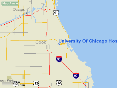
University Of Chicago Hospitals Heliport |
|
|
Location
& QuickFacts
|
FAA
Information Effective: |
2007-12-20 |
|
Airport
Identifier: |
4IS3 |
|
Airport
Status: |
Operational |
|
Longitude/Latitude: |
087-36-15.1760W/41-47-18.1220N
-87.604216/41.788367 (Estimated) |
|
Elevation: |
665 ft / 202.69 m (Estimated) |
|
Land: |
0 acres |
|
From nearest
city: |
0 nautical miles NW of Chicago, IL |
|
Location: |
Cook County, IL |
|
Magnetic
Variation: |
01W (1984) |
Owner
& Manager
|
Ownership: |
Privately
owned |
|
Owner: |
Univ Chicago Hospitals |
|
Address: |
5841 S Maryland, Box 337
Chicago, IL 60637 |
|
Phone
number: |
312-702-3222 |
|
Manager: |
Debbie Gorombei |
|
Address: |
5841 S Maryland, Mc 0952
Chicago, IL 60637 |
|
Phone
number: |
773-702-9895 |
Airport Operations
and Facilities
|
Airport
Use: |
Private
MEDICAL USE. |
|
Wind indicator: |
Yes |
|
Segmented
Circle: |
No |
|
Control
Tower: |
No |
|
Lighting
Schedule: |
24 HRS |
|
Beacon
Color: |
Clear-Green-Yellow (heliport) |
|
Landing
fee charge: |
No |
|
Sectional
chart: |
Chicago |
|
Region: |
AGL - Great Lakes |
|
Boundary
ARTCC: |
ZAU - Chicago |
|
Tie-in
FSS: |
IKK - Kankakee |
|
FSS on
Airport: |
No |
|
FSS Toll
Free: |
1-800-WX-BRIEF |
|
Runway Information
Helipad H1
|
Dimension: |
38 x 30 ft /
11.6 x 9.1 m |
|
Surface: |
PSP,
ROOFTOP. |
|
|
Runway H1 |
Runway |
|
Traffic
Pattern: |
Left |
Left |
|
Radio Navigation
Aids
|
ID |
Type |
Name |
Ch |
Freq |
Var |
Dist |
|
MX |
NDB |
Kedzi |
|
248.00 |
01W |
4.8 nm |
|
HK |
NDB |
Ermin |
|
332.00 |
01W |
11.2 nm |
|
ME |
NDB |
Deana |
|
350.00 |
00E |
21.8 nm |
|
MGC |
NDB |
Michigan City |
|
203.00 |
01W |
35.7 nm |
|
VP |
NDB |
Sedly |
|
212.00 |
02W |
38.4 nm |
|
IUL |
NDB |
La Porte |
|
356.00 |
03W |
41.3 nm |
|
ORD |
VOR/DME |
Chicago O'hare |
086X |
113.90 |
02E |
18.0 nm |
|
OBK |
VOR/DME |
Northbrook |
077X |
113.00 |
02W |
30.3 nm |
|
DPA |
VOR/DME |
Dupage |
021X |
108.40 |
02E |
34.0 nm |
|
IKK |
VOR/DME |
Kankakee |
053X |
111.60 |
00E |
44.3 nm |
|
CGT |
VORTAC |
Chicago Heights |
089X |
114.20 |
02E |
16.8 nm |
|
EON |
VORTAC |
Peotone |
079X |
113.20 |
02E |
32.3 nm |
|
JOT |
VORTAC |
Joliet |
070X |
112.30 |
02E |
35.2 nm |
|
MDW |
VOT |
Chicago Midway |
|
111.00 |
|
6.6 nm |
|
ORD |
VOT |
Chicago O'hare Intl |
|
112.00 |
|
17.9 nm |
Remarks
- PRVDD
ALL OPNS ARE CONDD IN AREA FM 080-100 DEG, 170-190 & 350-030 DEGS.
AREA
IS APROPLY MKD. WIND INDCR IS MAINTD.
Based Aircraft
|
Aircraft
based on field: |
1 |
|
Helicopters: |
1 |
University Of Chicago Hospitals Heliport
Address:
Cook County, IL
Tel:
312-702-3222,
773-702-9895
Images
and information placed above are from
http://www.airport-data.com/airport/4IS3/
We
thank them for the data!
| General
Info |
| Country |
United
States |
| State |
ILLINOIS
|
| FAA ID |
4IS3 |
| Latitude |
41-47-18.122N
|
| Longitude |
087-36-15.176W
|
| Elevation |
665 feet
|
| Near City |
CHICAGO
|
We don't guarantee the information is fresh and accurate. The data may
be wrong or outdated.
For more up-to-date information please refer to other sources.
|
|


