|
|
| Tuscola Area Airport |
| IATA: none – ICAO: KCFS – FAA LID: CFS |
| Summary |
| Airport type |
Public |
| Owner |
Tuscola Area Airport Authority |
| Serves |
Caro, Michigan |
| Elevation AMSL |
701 ft / 214 m |
| Coordinates |
43°27′32″N 083°26′44″W / 43.45889°N 83.44556°W / 43.45889; -83.44556 |
| Runways |
| Direction |
Length |
Surface |
| ft |
m |
| 5/23 |
4,300 |
1,311 |
Asphalt |
| 12/30 |
2,300 |
701 |
Turf |
| Statistics (2008) |
| Aircraft operations |
10,200 |
| Based aircraft |
48 |
| Source: Federal Aviation Administration |
Tuscola Area Airport (ICAO: KCFS, FAA LID: CFS, formerly 78D) is a public use airport located three nautical miles (6 km) southwest of the central business district of Caro, a city in Tuscola County, Michigan, United States. It is owned by the Tuscola Area Airport Authority. According to the FAA's National Plan of Integrated Airport Systems for 2009–2013, it is categorized as a general aviation airport.
Although many U.S. airports use the same three-letter location identifier for the FAA and IATA, this airport is assigned CFS by the FAA and no designation from the IATA (which assigned CFS to Coffs Harbour Airport in Coffs Harbour, New South Wales, Australia). Facilities and aircraft
Tuscola Area Airport covers an area of 260 acres (105 ha) at an elevation of 701 feet (214 m) above mean sea level. It has two runways: 5/23 is 4,300 by 75 feet (1,311 x 23 m) with an asphalt pavement; 12/30 is 2,300 by 110 feet (701 x 34 m) with a turf surface. The airport is not staffed regularly.
For the 12-month period ending December 31, 2008, the airport had 10,200 general aviation aircraft operations, an average of 27 per day. At that time there were 48 aircraft based at this airport: 85.4% single-engine, 4.2% multi-engine, 2.1% jet and 8.3% helicopter.
Transit
The airport is accessible by road from M-81, and is close to M-24.
The above content comes from Wikipedia and is published under free licenses – click here to read more.
|
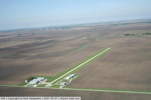 |
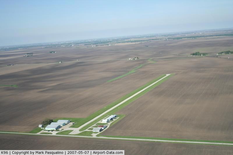
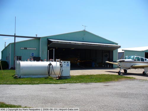
(Click on the photo to enlarge) |
|
 |
(Click on the photo to enlarge) |
|
 |
(Click on the photo to enlarge) |
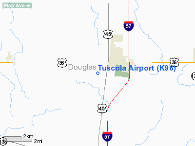
Location
& QuickFacts
|
FAA
Information Effective: |
2007-12-20 |
|
Airport
Identifier: |
K96 |
|
Airport
Status: |
Operational |
|
Longitude/Latitude: |
088-18-22.1760W/39-46-51.1150N
-88.306160/39.780865 (Estimated) |
|
Elevation: |
665 ft / 202.69 m (Estimated) |
|
Land: |
12 acres |
|
From nearest
city: |
2 nautical miles SW of Tuscola, IL |
|
Location: |
Douglas County, IL |
|
Magnetic
Variation: |
00W (1985) |
Owner
& Manager
|
Ownership: |
Privately
owned |
|
Owner: |
Tuscola Arpt Improvement Ltd |
|
Address: |
880 N. County Rd-900e
Tuscola, IL 61593 |
|
Phone
number: |
217-253-9504 |
|
Manager: |
Jud Nogle |
|
Address: |
880 N. County Rd-900e
Tuscola, IL 61953 |
|
Phone
number: |
217-253-9504 |
Airport Operations
and Facilities
|
Airport
Use: |
Open
to public |
|
Wind indicator: |
Yes |
|
Segmented
Circle: |
No |
|
Control
Tower: |
No |
|
Lighting
Schedule: |
DUSK-DAWN |
|
Landing
fee charge: |
No |
|
Sectional
chart: |
St Louis |
|
Region: |
AGL - Great Lakes |
|
Traffic
Pattern Alt: |
800 ft |
|
Boundary
ARTCC: |
ZKC - Kansas City |
|
Responsible
ARTCC: |
ZAU - Chicago |
|
Tie-in
FSS: |
STL - Saint Louis |
|
FSS on
Airport: |
No |
|
FSS Toll
Free: |
1-800-WX-BRIEF |
|
NOTAMs
Facility: |
STL (NOTAM-d service avaliable) |
|
Federal
Agreements: |
N |
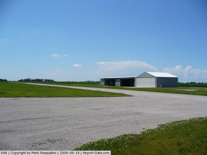
Airport Communications
Airport
Services
|
Fuel
available: |
100LL80 |
|
Airframe
Repair: |
MAJOR |
|
Power
Plant Repair: |
MAJOR |
|
Bottled
Oxygen: |
NONE |
|
Bulk Oxygen: |
NONE |
|
Runway Information
Runway 09/27
|
Dimension: |
2660 x 30 ft
/ 810.8 x 9.1 m |
|
Surface: |
GRVL, Good Condition
SFC IS A CHIP & SEAL. |
|
Edge Lights: |
Low
THERE IS NO LIGHTED, MARKED DISPLACED THRESHOLD FOR NIGHT OPERATION.
RUNWAY
LIGHTING ALIGNMENT DOES NOT DEFINE CENTER OF RUNWAY. |
|
|
Runway 09 |
Runway 27 |
|
Longitude: |
088-18-40.2400W |
088-18-06.1700W |
|
Latitude: |
39-46-52.5100N |
39-46-52.1100N |
|
Elevation: |
665.00 ft |
665.00 ft |
|
Traffic
Pattern: |
Left |
Left |
|
Markings: |
None, |
None, |
|
Displaced
threshold: |
0.00 ft |
660.00 ft |
|
Runway End
Identifier: |
No |
No |
|
Centerline
Lights: |
No |
No |
|
Touchdown
Lights: |
No |
No |
|
Obstruction: |
80 ft tree, 2869.0 ft from runway, 66 ft right
of centerline, 35:1 slope to clear |
15 ft road, 15.0 ft from runway, 1:1 slope
to clear
RWY 27 APCH RATIO IS 16:1 FM OVER 13 FT HIGH BLDG 210 FT WEST
OF RY END & 23 FT R NORTH OF CNTRLN TO MKD DSPLCD THLD.
DSPLCD THLD MKD BY 12" WD WHT STRIPE ACROSS RY &
18" X 8' WHT CONC "ANGLES" ON BTH SDS IN GRASS.
+15
FT BLDS 100 FT BOTH SIDES CNTRLN IN PRIM SFC. |
|
Radio Navigation
Aids
|
ID |
Type |
Name |
Ch |
Freq |
Var |
Dist |
|
MT |
NDB |
Zebre |
|
347.00 |
00E |
21.3 nm |
|
HMJ |
NDB |
Homer |
|
281.00 |
01E |
22.0 nm |
|
PRG |
NDB |
Paris |
|
341.00 |
01E |
29.6 nm |
|
CZB |
NDB |
Casey |
|
359.00 |
00E |
31.9 nm |
|
SYZ |
NDB |
Shelbyville |
|
365.00 |
01E |
33.6 nm |
|
HU |
NDB |
Yinno |
|
245.00 |
02W |
48.3 nm |
|
TAZ |
NDB |
Taylorville |
|
395.00 |
00E |
49.3 nm |
|
MTO |
VOR/DME |
Mattoon |
031X |
109.40 |
03E |
18.2 nm |
|
RBS |
VOR/DME |
Roberts |
115X |
116.80 |
02E |
48.6 nm |
|
CMI |
VORTAC |
Champaign |
037X |
110.00 |
03E |
15.3 nm |
|
DEC |
VORTAC |
Decatur |
119X |
117.20 |
03E |
25.6 nm |
|
DNV |
VORTAC |
Danville |
047X |
111.00 |
02E |
46.2 nm |
Remarks
- SEASONAL
CROPS AT RY 09 APCH END CAN PERIODICALLY BLOCK VIEW OF THLD LGTS.
Based Aircraft
|
Aircraft
based on field: |
8 |
|
Single Engine
Airplanes: |
5 |
|
Ultralights: |
3 |
Operational Statistics
Time
Period: 2005-09-01 - 2006-08-31
|
Aircraft
Operations: |
168/Week |
|
Air Taxi: |
2.3% |
|
General Aviation
Local: |
57.5% |
|
General Aviation
Itinerant: |
40.2% |
Tuscola Airport
Address:
Douglas County, IL
Tel:
217-253-9504
Images
and information placed above are from
http://www.airport-data.com/airport/K96/
We
thank them for the data!
| General
Info |
| Country |
United
States |
| State |
ILLINOIS
|
| FAA ID |
K96 |
| Latitude |
39-46-51.115N
|
| Longitude |
088-18-22.176W
|
| Elevation |
665 feet
|
| Near City |
TUSCOLA
|
We don't guarantee the information is fresh and accurate. The data may
be wrong or outdated.
For more up-to-date information please refer to other sources.
|
|