 |
|
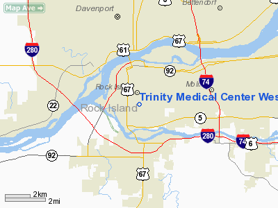
Trinity Medical Center West Heliport |
|
|
Location
& QuickFacts
|
FAA
Information Effective: |
2007-12-20 |
|
Airport
Identifier: |
0IS0 |
|
Airport
Status: |
Operational |
|
Longitude/Latitude: |
090-34-17.0000W/41-28-52.0000N
-90.571389/41.481111 (Estimated) |
|
Elevation: |
664 ft / 202.39 m (Estimated) |
|
Land: |
0 acres |
|
From nearest
city: |
4 nautical miles SE of Rock Island, IL |
|
Location: |
Rock Island County, IL |
|
Magnetic
Variation: |
02E (1985) |
Owner
& Manager
|
Ownership: |
Privately
owned |
|
Owner: |
Trinity Medical Center |
|
Address: |
2701 17th St
Rock Island, IL 61201 |
|
Phone
number: |
309-793-2121 |
|
Manager: |
Lane Trefftz |
|
Address: |
2701 17th St
Rock Island, IL 61201 |
|
Phone
number: |
309-779-2381 |
Airport
Operations and Facilities
|
Airport
Use: |
Private
MEDICAL USE. |
|
Wind indicator: |
Yes |
|
Segmented
Circle: |
Yes |
|
Control
Tower: |
No |
|
Lighting
Schedule: |
DUSK-DAWN |
|
Beacon
Color: |
Clear-Green-Yellow (heliport) |
|
Landing
fee charge: |
No |
|
Sectional
chart: |
Chicago |
|
Region: |
AGL - Great Lakes |
|
Boundary
ARTCC: |
ZAU - Chicago |
|
Tie-in
FSS: |
IKK - Kankakee |
|
FSS Toll
Free: |
1-800-WX-BRIEF |
|
Runway Information
Helipad H1
|
Dimension: |
40 x 40 ft /
12.2 x 12.2 m |
|
Surface: |
ASPH, |
|
|
Runway H1 |
Runway |
|
Traffic
Pattern: |
Left |
Left |
|
Radio Navigation
Aids
|
ID |
Type |
Name |
Ch |
Freq |
Var |
Dist |
|
CWI |
NDB |
Clinton |
|
377.00 |
01E |
23.6 nm |
|
EZI |
NDB |
Kewanee |
|
245.00 |
01E |
32.3 nm |
|
OQW |
NDB |
Maquoketa |
|
386.00 |
02E |
35.1 nm |
|
BOZ |
NDB |
Whiteside |
|
254.00 |
01E |
37.9 nm |
|
DDD |
VOR/DME |
Port City |
112X |
116.50 |
01E |
26.9 nm |
|
GBG |
VOR/DME |
Galesburg |
035X |
109.80 |
03E |
33.3 nm |
|
MZV |
VORTAC |
Moline |
091X |
114.40 |
05E |
10.1 nm |
|
CVA |
VORTAC |
Davenport |
085X |
113.80 |
04E |
14.2 nm |
|
IOW |
VORTAC |
Iowa City |
109X |
116.20 |
05E |
47.0 nm |
|
BRL |
VORTAC |
Burlington |
051X |
111.40 |
05E |
48.3 nm |
|
BDF |
VORTAC |
Bradford |
094X |
114.70 |
00E |
48.4 nm |
|
DVN |
VOT |
Davenport Municipal |
|
111.80 |
|
7.8 nm |
Remarks
- PRVDD
APCH/DEP OPS 190-210 DEGS & 350-010 DEGS; TKOF/LDG AREA APPROPIATELY
MARKED; NON-OBSTN WIND INDICATOR MAINTAINED; 30 FT TREE WITHIN 45 FT
OF CNTR OF LDG SITE REMOVED OR MARKED & LGTD HELIPORT MGR DISCUSS
DEP PROCEDURES WITHIN QUAD CITY ARSA WITH QUAD CITY TWR MGR.
Trinity Medical Center West Heliport
Address:
Rock Island County, IL
Tel:
309-793-2121,
309-779-2381
Images
and information placed above are from
http://www.airport-data.com/airport/0IS0/
We
thank them for the data!
| General
Info |
| Country |
United
States |
| State |
ILLINOIS
|
| FAA ID |
0IS0 |
| Latitude |
41-28-52.000N
|
| Longitude |
090-34-17.000W
|
| Elevation |
664 feet
|
| Near City |
ROCK ISLAND
|
We don't guarantee the information is fresh and accurate. The data may
be wrong or outdated.
For more up-to-date information please refer to other sources.
|
|


