 |
|
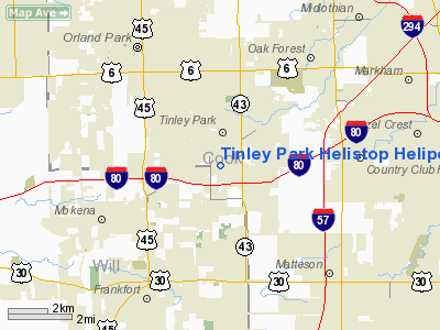
Tinley Park Helistop Heliport |
|
|
Location
& QuickFacts
|
FAA
Information Effective: |
2007-12-20 |
|
Airport
Identifier: |
TF8 |
|
Airport
Status: |
Operational |
|
Longitude/Latitude: |
087-48-21.0000W/41-33-33.0000N
-87.805833/41.559167 (Estimated) |
|
Elevation: |
760 ft / 231.65 m (Estimated) |
|
Land: |
1 acres |
|
From nearest
city: |
20 nautical miles SS of Chicago/tinley Park,
IL |
|
Location: |
Cook County, IL |
|
Magnetic
Variation: |
02W (1995) |
Owner
& Manager
|
Ownership: |
Publicly
owned |
|
Owner: |
Village Of Tinley Park |
|
Address: |
16250 S. Oak Park Avenue
Tinley Park, IL 60477 |
|
Phone
number: |
708-444-5000
24 HR NON-EMERGENCY NUMBER 708-532-9111. |
|
Manager: |
Scott Niehaus |
|
Address: |
16250 S.oak Park Avenue
Tinley Park, IL 60477 |
|
Phone
number: |
708-444-5000 |
Airport
Operations and Facilities
|
Airport
Use: |
Open
to public |
|
Wind indicator: |
Yes |
|
Segmented
Circle: |
No |
|
Control
Tower: |
No |
|
Lighting
Schedule: |
DUSK-DAWN |
|
Sectional
chart: |
Chicago |
|
Region: |
AGL - Great Lakes |
|
Boundary
ARTCC: |
ZAU - Chicago |
|
Tie-in
FSS: |
IKK - Kankakee |
|
FSS on
Airport: |
Yes |
|
FSS Toll
Free: |
1-800-WX-BRIEF |
|
NOTAMs
Facility: |
IKK (NOTAM-d service avaliable) |
Airport
Communications
|
Runway Information
Helipad H1
|
Dimension: |
40 x 40 ft / 12.2 x 12.2 m
60 FT BY 60 FT HELICOPTER PARKING PAD LOCATED 75 FT NORTH OF LNDG
PAD. |
|
Surface: |
ASPH, Fair Condition |
|
|
Runway H1 |
Runway |
|
Traffic
Pattern: |
Left |
Left |
|
Radio Navigation
Aids
|
ID |
Type |
Name |
Ch |
Freq |
Var |
Dist |
|
HK |
NDB |
Ermin |
|
332.00 |
01W |
9.7 nm |
|
MX |
NDB |
Kedzi |
|
248.00 |
01W |
12.1 nm |
|
ME |
NDB |
Deana |
|
350.00 |
00E |
26.5 nm |
|
VP |
NDB |
Sedly |
|
212.00 |
02W |
42.3 nm |
|
MGC |
NDB |
Michigan City |
|
203.00 |
01W |
45.3 nm |
|
DKB |
NDB |
Dekalb |
|
209.00 |
02W |
46.3 nm |
|
RZL |
NDB |
Rensselaer |
|
362.00 |
02W |
46.3 nm |
|
IUL |
NDB |
La Porte |
|
356.00 |
03W |
46.7 nm |
|
OIX |
NDB |
Ottawa |
|
266.00 |
01E |
48.7 nm |
|
ORD |
VOR/DME |
Chicago O'hare |
086X |
113.90 |
02E |
26.1 nm |
|
IKK |
VOR/DME |
Kankakee |
053X |
111.60 |
00E |
29.2 nm |
|
DPA |
VOR/DME |
Dupage |
021X |
108.40 |
02E |
31.5 nm |
|
OBK |
VOR/DME |
Northbrook |
077X |
113.00 |
02W |
40.3 nm |
|
CGT |
VORTAC |
Chicago Heights |
089X |
114.20 |
02E |
11.0 nm |
|
EON |
VORTAC |
Peotone |
079X |
113.20 |
02E |
17.4 nm |
|
JOT |
VORTAC |
Joliet |
070X |
112.30 |
02E |
23.1 nm |
|
MDW |
VOT |
Chicago Midway |
|
111.00 |
|
13.9 nm |
|
ORD |
VOT |
Chicago O'hare Intl |
|
112.00 |
|
25.8 nm |
Remarks
- 32
FT UNMKD & UNLIT PLINES 95 FT SOUTH; 40 FT BLDG 120 FT NW; &
33 FT LGTD POLES 293 FT W; 90 FT LGTD TWR 250 FT NW OF PAD.
- INGRESS/EGRESS
ROUTES ARE 090 DEGS & 270 DEGS.
Operational Statistics
Time
Period: 2005-01-01 - 2005-12-31
|
Aircraft
Operations: |
3/Month |
|
General Aviation
Itinerant: |
100.0% |
Tinley Park Helistop Heliport
Address:
Cook County, IL
Tel:
708-444-5000
Images
and information placed above are from
http://www.airport-data.com/airport/TF8/
We
thank them for the data!
| General
Info |
| Country |
United
States |
| State |
ILLINOIS
|
| FAA ID |
TF8 |
| Latitude |
41-33-33.000N
|
| Longitude |
087-48-21.000W
|
| Elevation |
760 feet
|
| Near City |
CHICAGO/TINLEY
PARK |
We don't guarantee the information is fresh and accurate. The data may
be wrong or outdated.
For more up-to-date information please refer to other sources.
|
|


