 |
|
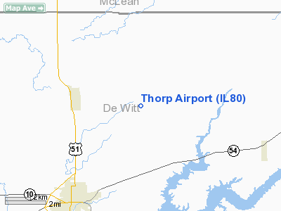
Location
& QuickFacts
|
FAA
Information Effective: |
2007-12-20 |
|
Airport
Identifier: |
IL80 |
|
Airport
Status: |
Operational |
|
Longitude/Latitude: |
088-54-00.2790W/40-13-00.1300N
-88.900077/40.216703 (Estimated) |
|
Elevation: |
763 ft / 232.56 m (Surveyed) |
|
Land: |
0 acres |
|
From nearest
city: |
4 nautical miles NE of Clinton, IL |
|
Location: |
De Witt County, IL |
|
Magnetic
Variation: |
00E (1985) |
Owner
& Manager
|
Ownership: |
Privately
owned |
|
Owner: |
Thorp Seed Co. |
|
Address: |
Rr 3 Box 257
Clinton, IL 61727 |
|
Phone
number: |
217-935-2171 |
|
Manager: |
Nelson Thorp |
|
Address: |
Rr 1 Box 60
Wapella, IL 61777 |
|
Phone
number: |
217-935-9672 |
Airport
Operations and Facilities
|
Airport Use: |
Private |
|
Wind
indicator: |
Yes |
|
Segmented
Circle: |
No |
|
Control
Tower: |
No |
|
Landing
fee charge: |
No |
|
Sectional
chart: |
Chicago |
|
Region: |
AGL - Great Lakes |
|
Boundary
ARTCC: |
ZAU - Chicago |
|
Tie-in
FSS: |
STL - Saint Louis |
|
FSS
on Airport: |
No |
|
FSS
Toll Free: |
1-800-WX-BRIEF |
Airport
Services
|
Airframe
Repair: |
NONE |
|
Power
Plant Repair: |
NONE |
|
Runway Information
Runway E/W
|
Dimension: |
2400 x 100 ft
/ 731.5 x 30.5 m |
|
Surface: |
TURF, |
|
|
Runway E |
Runway W |
|
Traffic
Pattern: |
Left |
Left |
|
Runway N/S
|
Dimension: |
1500 x 70 ft
/ 457.2 x 21.3 m |
|
Surface: |
TURF, |
|
|
Runway N |
Runway S |
|
Traffic
Pattern: |
Left |
Left |
|
Radio Navigation
Aids
|
ID |
Type |
Name |
Ch |
Freq |
Var |
Dist |
|
AAA |
NDB |
Abraham |
|
329.00 |
00E |
20.4 nm |
|
LQ |
NDB |
Licol |
|
375.00 |
01W |
37.2 nm |
|
PI |
NDB |
Tungg |
|
356.00 |
01E |
39.4 nm |
|
HMJ |
NDB |
Homer |
|
281.00 |
01E |
45.0 nm |
|
TAZ |
NDB |
Taylorville |
|
395.00 |
00E |
45.3 nm |
|
SP |
NDB |
Huskk |
|
382.00 |
01W |
47.7 nm |
|
SYZ |
NDB |
Shelbyville |
|
365.00 |
01E |
48.8 nm |
|
BMI |
VOR/DME |
Bloomington |
019X |
108.20 |
03E |
15.9 nm |
|
PNT |
VOR/DME |
Pontiac |
033X |
109.60 |
03E |
37.1 nm |
|
RBS |
VOR/DME |
Roberts |
115X |
116.80 |
02E |
40.2 nm |
|
DEC |
VORTAC |
Decatur |
119X |
117.20 |
03E |
28.9 nm |
|
CMI |
VORTAC |
Champaign |
037X |
110.00 |
03E |
30.7 nm |
|
CAP |
VORTAC |
Capital |
074X |
112.70 |
04E |
38.7 nm |
|
SPI |
VORTAC |
Spinner |
74X |
112.70 |
01W |
42.4 nm |
|
PIA |
VORTAC |
Peoria |
099X |
115.20 |
04E |
49.4 nm |
Remarks
- E/W
RWY SOFT AFTER RAIN; N/S IN GOOD CONDITION AFTER RAIN.
- EXISTED
PRIOR TO 1959.
Based Aircraft
|
Aircraft
based on field: |
2 |
|
Single Engine
Airplanes: |
2 |
Thorp Airport
Address:
De Witt County, IL
Tel:
217-935-2171,
217-935-9672
Images
and information placed above are from
http://www.airport-data.com/airport/IL80/
We
thank them for the data!
| General
Info |
| Country |
United
States |
| State |
ILLINOIS
|
| FAA ID |
IL80 |
| Latitude |
40-13-00.130N
|
| Longitude |
088-54-00.279W
|
| Elevation |
763 feet
|
| Near City |
CLINTON
|
We don't guarantee the information is fresh and accurate. The data may
be wrong or outdated.
For more up-to-date information please refer to other sources.
|
|


