 |
|
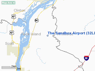
Location
& QuickFacts
|
FAA
Information Effective: |
2007-12-20 |
|
Airport
Identifier: |
32LL |
|
Airport
Status: |
Operational |
|
Longitude/Latitude: |
090-15-35.4590W/41-42-15.1150N
-90.259850/41.704199 (Estimated) |
|
Elevation: |
620 ft / 188.98 m (Estimated) |
|
Land: |
0 acres |
|
From nearest
city: |
3 nautical miles NE of Cordova, IL |
|
Location: |
Rock Island County, IL |
|
Magnetic
Variation: |
01E (1985) |
Owner
& Manager
|
Ownership: |
Privately
owned |
|
Owner: |
James O Battern |
|
Address: |
26221 178th Street, N.
Cordova, IL 61242 |
|
Phone
number: |
309-654-2777 |
|
Manager: |
James O Battern |
|
Address: |
26221 178th Street, N.
Cordova, IL 61242 |
|
Phone
number: |
309-654-2777 |
Airport
Operations and Facilities
|
Airport
Use: |
Private |
|
Wind indicator: |
Yes |
|
Segmented
Circle: |
No |
|
Control
Tower: |
No |
|
Landing
fee charge: |
No |
|
Sectional
chart: |
Chicago |
|
Region: |
AGL - Great Lakes |
|
Boundary
ARTCC: |
ZAU - Chicago |
|
Tie-in
FSS: |
IKK - Kankakee |
|
FSS on
Airport: |
No |
|
FSS Toll
Free: |
1-800-WX-BRIEF |
|
Runway Information
Runway 18/36
|
Dimension: |
2300 x 100 ft
/ 701.0 x 30.5 m |
|
Surface: |
TURF, |
|
|
Runway 18 |
Runway 36 |
|
Traffic
Pattern: |
Right |
Left |
|
Radio Navigation
Aids
|
ID |
Type |
Name |
Ch |
Freq |
Var |
Dist |
|
CWI |
NDB |
Clinton |
|
377.00 |
01E |
8.1 nm |
|
BOZ |
NDB |
Whiteside |
|
254.00 |
01E |
21.3 nm |
|
OQW |
NDB |
Maquoketa |
|
386.00 |
02E |
30.0 nm |
|
EZI |
NDB |
Kewanee |
|
245.00 |
01E |
33.1 nm |
|
FEP |
NDB |
Freeport |
|
335.00 |
00E |
44.3 nm |
|
MXO |
NDB |
Monticello |
|
397.00 |
01E |
49.3 nm |
|
PLL |
VOR/DME |
Polo |
049X |
111.20 |
03E |
36.5 nm |
|
DDD |
VOR/DME |
Port City |
112X |
116.50 |
01E |
44.9 nm |
|
GBG |
VOR/DME |
Galesburg |
035X |
109.80 |
03E |
46.8 nm |
|
CVA |
VORTAC |
Davenport |
085X |
113.80 |
04E |
10.0 nm |
|
MZV |
VORTAC |
Moline |
091X |
114.40 |
05E |
28.6 nm |
|
BDF |
VORTAC |
Bradford |
094X |
114.70 |
00E |
44.6 nm |
|
DBQ |
VORTAC |
Dubuque |
105X |
115.80 |
04E |
46.5 nm |
|
DVN |
VOT |
Davenport Municipal |
|
111.80 |
|
15.7 nm |
Remarks
- PRVDD
ALL TFC PAT OPNS AT ARPT ARE CONDUCTED W OF RWY 18/36; RIGHT-HAND PAT
FOR ALL RWY 18 ARRS/DEPS AND LEFT-HAND PAT FOR ALL RWY 36 ARRS/DEPS.
Based Aircraft
|
Aircraft
based on field: |
2 |
|
Single Engine
Airplanes: |
2 |
The Sandbox Airport
Address:
Rock Island County, IL
Tel:
309-654-2777
Images
and information placed above are from
http://www.airport-data.com/airport/32LL/
We
thank them for the data!
| General
Info |
| Country |
United
States |
| State |
ILLINOIS
|
| FAA ID |
32LL |
| Latitude |
41-42-15.115N
|
| Longitude |
090-15-35.459W
|
| Elevation |
620 feet
|
| Near City |
CORDOVA
|
We don't guarantee the information is fresh and accurate. The data may
be wrong or outdated.
For more up-to-date information please refer to other sources.
|
|


