 |
|
Location
& QuickFacts
|
FAA
Information Effective: |
2007-12-20 |
|
Airport
Identifier: |
71IS |
|
Airport
Status: |
Operational |
|
Longitude/Latitude: |
088-00-02.1340W/40-25-32.1260N
-88.000593/40.425591 (Estimated) |
|
Elevation: |
780 ft / 237.74 m (Estimated) |
|
Land: |
2 acres |
|
From nearest
city: |
5 nautical miles SE of Paxton, IL |
|
Location: |
Ford County, IL |
|
Magnetic
Variation: |
00W (1985) |
Owner
& Manager
|
Ownership: |
Privately
owned |
|
Owner: |
E T Johnson |
|
Address: |
Rr 2 Box 92b
Paxton, IL 60957 |
|
Phone
number: |
217-379-2701 |
|
Manager: |
E T Johnson |
|
Address: |
Rr 2 Box 92b
Paxton, IL 60957 |
|
Phone
number: |
217-379-2701 |
Airport
Operations and Facilities
|
Airport
Use: |
Private |
|
Wind indicator: |
Yes |
|
Segmented
Circle: |
No |
|
Control
Tower: |
No |
|
Sectional
chart: |
Chicago |
|
Region: |
AGL - Great Lakes |
|
Boundary
ARTCC: |
ZAU - Chicago |
|
Tie-in
FSS: |
STL - Saint Louis |
|
FSS Toll
Free: |
1-800-WX-BRIEF |
|
Runway Information
Runway 18/36
|
Dimension: |
2000 x 70 ft
/ 609.6 x 21.3 m |
|
Surface: |
TURF, |
|
|
Runway 18 |
Runway 36 |
|
Traffic
Pattern: |
Left |
Left |
|
Radio Navigation
Aids
|
ID |
Type |
Name |
Ch |
Freq |
Var |
Dist |
|
HMJ |
NDB |
Homer |
|
281.00 |
01E |
24.1 nm |
|
PRG |
NDB |
Paris |
|
341.00 |
01E |
46.2 nm |
|
RZL |
NDB |
Rensselaer |
|
362.00 |
02W |
48.7 nm |
|
RBS |
VOR/DME |
Roberts |
115X |
116.80 |
02E |
12.0 nm |
|
IKK |
VOR/DME |
Kankakee |
053X |
111.60 |
00E |
39.6 nm |
|
PNT |
VOR/DME |
Pontiac |
033X |
109.60 |
03E |
41.0 nm |
|
BMI |
VOR/DME |
Bloomington |
019X |
108.20 |
03E |
42.7 nm |
|
DNV |
VORTAC |
Danville |
047X |
111.00 |
02E |
21.8 nm |
|
CMI |
VORTAC |
Champaign |
037X |
110.00 |
03E |
26.7 nm |
|
BVT |
VORTAC |
Boiler |
098X |
115.10 |
01E |
43.3 nm |
Based Aircraft
|
Aircraft
based on field: |
1 |
|
Single Engine
Airplanes: |
1 |
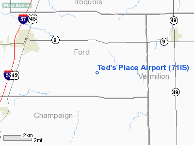
Ted's Place Airport
Address:
Ford County, IL
Tel:
217-379-2701
Images
and information placed above are from
http://www.airport-data.com/airport/71IS/
We
thank them for the data!
| General
Info |
| Country |
United
States |
| State |
ILLINOIS
|
| FAA ID |
71IS |
| Latitude |
40-25-32.126N
|
| Longitude |
088-00-02.134W
|
| Elevation |
780 feet
|
| Near City |
PAXTON
|
We don't guarantee the information is fresh and accurate. The data may
be wrong or outdated.
For more up-to-date information please refer to other sources.
|
|


