 |
|
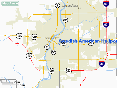
Swedish American Heliport |
Location
& QuickFacts
|
FAA
Information Effective: |
2007-12-20 |
|
Airport
Identifier: |
09IS |
|
Airport
Status: |
Operational |
|
Longitude/Latitude: |
089-04-27.3800W/42-15-54.0720N
-89.074272/42.265020 (Estimated) |
|
Elevation: |
874 ft / 266.40 m (Estimated) |
|
Land: |
0 acres |
|
From nearest
city: |
0 nautical miles SW of Rockford, IL |
|
Location: |
Winnebago County, IL |
|
Magnetic
Variation: |
00E (1985) |
Owner
& Manager
|
Ownership: |
Privately
owned |
|
Owner: |
Swedish American Hospital |
|
Address: |
1400 Charles St
Rockford, IL 61101 |
|
Phone
number: |
815-968-4400 |
|
Manager: |
Jon G Jestvang |
|
Address: |
1400 Charles St
Rockford, IL 61101 |
|
Phone
number: |
815-968-4400 |
Airport
Operations and Facilities
|
Airport
Use: |
Private
MEDICAL USE. |
|
Wind indicator: |
Yes |
|
Segmented
Circle: |
No |
|
Control
Tower: |
No |
|
Lighting
Schedule: |
24 HRS |
|
Beacon
Color: |
Yellow (unlighted seaplane base) |
|
Sectional
chart: |
Chicago |
|
Region: |
AGL - Great Lakes |
|
Boundary
ARTCC: |
ZAU - Chicago |
|
Tie-in
FSS: |
IKK - Kankakee |
|
FSS Toll
Free: |
1-800-WX-BRIEF |
|
Runway Information
Helipad H1
|
Dimension: |
39 x 31 ft /
11.9 x 9.4 m |
|
Surface: |
CONC,
LCTD ON ROOF TOP. |
|
|
Runway H1 |
Runway |
|
Traffic
Pattern: |
Left |
Left |
|
Radio Navigation
Aids
|
ID |
Type |
Name |
Ch |
Freq |
Var |
Dist |
|
JVL |
NDB |
Janesville |
|
375.00 |
03E |
21.1 nm |
|
FEP |
NDB |
Freeport |
|
335.00 |
00E |
22.8 nm |
|
DKB |
NDB |
Dekalb |
|
209.00 |
02W |
25.8 nm |
|
LVV |
NDB |
Lake Lawn |
|
404.00 |
00W |
33.7 nm |
|
BOZ |
NDB |
Whiteside |
|
254.00 |
01E |
46.0 nm |
|
MS |
NDB |
Monah |
|
400.00 |
00E |
49.4 nm |
|
RFD |
VOR/DME |
Rockford |
045X |
110.80 |
01E |
6.0 nm |
|
JVL |
VOR/DME |
Janesville |
090X |
114.30 |
03E |
17.7 nm |
|
PLL |
VOR/DME |
Polo |
049X |
111.20 |
03E |
27.0 nm |
|
DPA |
VOR/DME |
Dupage |
021X |
108.40 |
02E |
39.4 nm |
|
BUU |
VOR/DME |
Burbun |
092X |
114.50 |
01W |
42.7 nm |
Remarks
- PRVDD
APCH/DEPT CONDUCTED FM 110 DEG TO 160 DEG & FM 270 DEG TO 010 DEG;
AREA IS MKD; WIND INDICATOR MNTD.
Swedish American Heliport
Address:
Winnebago County, IL
Tel:
815-968-4400
Images
and information placed above are from
http://www.airport-data.com/airport/09IS/
We
thank them for the data!
| General
Info |
| Country |
United
States |
| State |
ILLINOIS
|
| FAA ID |
09IS |
| Latitude |
42-15-54.072N
|
| Longitude |
089-04-27.380W
|
| Elevation |
874 feet
|
| Near City |
ROCKFORD
|
We don't guarantee the information is fresh and accurate. The data may
be wrong or outdated.
For more up-to-date information please refer to other sources.
|
|


