 |
|
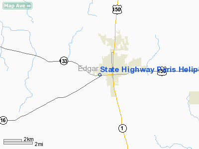
State Highway Paris Heliport |
Location
& QuickFacts
|
FAA Information Effective: |
2007-12-20 |
|
Airport
Identifier: |
8LL6 |
|
Airport
Status: |
Operational |
|
Longitude/Latitude: |
087-42-44.0960W/39-36-12.1250N
-87.712249/39.603368 (Estimated) |
|
Elevation: |
740 ft / 225.55 m (Estimated) |
|
Land: |
0 acres |
|
From
nearest city: |
0 nautical miles SW of Paris, IL |
|
Location: |
Edgar County, IL |
|
Magnetic
Variation: |
01W (1985) |
Owner
& Manager
|
Ownership: |
Publicly
owned |
|
Owner: |
Il Dept Of Transportation |
|
Address: |
13473 Il Hwy 133
Paris, IL 61944 |
|
Phone
number: |
217-465-4181 |
|
Manager: |
Administrative Mgr |
|
Address: |
13473 Il Hwy 133
Paris, IL 61944 |
|
Phone
number: |
217-465-4181 |
Airport
Operations and Facilities
|
Airport Use: |
Private |
|
Wind
indicator: |
No |
|
Segmented
Circle: |
No |
|
Control
Tower: |
No |
|
Landing
fee charge: |
No |
|
Sectional
chart: |
St Louis |
|
Region: |
AGL - Great Lakes |
|
Boundary
ARTCC: |
ZID - Indianapolis |
|
Tie-in
FSS: |
STL - Saint Louis |
|
FSS
on Airport: |
No |
|
FSS
Toll Free: |
1-800-WX-BRIEF |
Airport
Services
|
Airframe Repair: |
NONE |
|
Power Plant Repair: |
NONE |
|
Runway Information
Helipad H1
|
Dimension: |
35 x 35 ft / 10.7 x 10.7 m |
|
Surface: |
CONC, |
|
|
Runway H1 |
Runway |
|
Traffic
Pattern: |
Left |
Left |
|
Radio Navigation
Aids
|
ID |
Type |
Name |
Ch |
Freq |
Var |
Dist |
|
PRG |
NDB |
Paris |
|
341.00 |
01E |
6.0 nm |
|
HU |
NDB |
Yinno |
|
245.00 |
02W |
19.5 nm |
|
CZB |
NDB |
Casey |
|
359.00 |
00E |
22.4 nm |
|
MT |
NDB |
Zebre |
|
347.00 |
00E |
23.5 nm |
|
HMJ |
NDB |
Homer |
|
281.00 |
01E |
27.8 nm |
|
SIV |
NDB |
Sullivan |
|
326.00 |
02W |
31.9 nm |
|
PLX |
NDB |
Palestine |
|
391.00 |
00W |
35.6 nm |
|
TVX |
NDB |
Greencastle |
|
521.00 |
03W |
42.5 nm |
|
CFJ |
NDB |
Crawfordsville |
|
388.00 |
02W |
43.2 nm |
|
MTO |
VOR/DME |
Mattoon |
031X |
109.40 |
03E |
27.6 nm |
|
RSV |
VOR/DME |
Robinson |
021X |
108.40 |
02E |
35.3 nm |
|
TTH |
VORTAC |
Terre Haute |
100X |
115.30 |
02E |
22.5 nm |
|
CMI |
VORTAC |
Champaign |
037X |
110.00 |
03E |
36.7 nm |
|
DNV |
VORTAC |
Danville |
047X |
111.00 |
02E |
42.1 nm |
Remarks
- PROVIDING
INGRESS/EGRESS RTES RESTRICTED TO OPNS FM 315DEG CCW THRU 045DEG &
OPNS TO THE S SHOULD BE AT 500FT.
State Highway Paris Heliport
Address:
Edgar County, IL
Tel:
217-465-4181
Images
and information placed above are from
http://www.airport-data.com/airport/8LL6/
We
thank them for the data!
| General
Info |
| Country |
United
States |
| State |
ILLINOIS
|
| FAA ID |
8LL6
|
| Latitude |
39-36-12.125N
|
| Longitude |
087-42-44.096W
|
| Elevation |
740 feet
|
| Near City |
PARIS
|
We don't guarantee the information is fresh and accurate. The data may
be wrong or outdated.
For more up-to-date information please refer to other sources.
|
|


