 |
|
Location
& QuickFacts
|
FAA Information Effective: |
2007-12-20 |
|
Airport
Identifier: |
IL14 |
|
Airport
Status: |
Operational |
|
Longitude/Latitude: |
089-01-18.0000W/40-28-48.0000N
-89.021667/40.480000 (Estimated) |
|
Elevation: |
750 ft / 228.60 m (Estimated) |
|
Land: |
0 acres |
|
From
nearest city: |
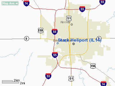
2 nautical miles W of Bloomington, IL |
|
Location: |
Mc Lean County, IL |
|
Magnetic
Variation: |
01W (2000) |
Owner
& Manager
|
Ownership: |
Privately
owned |
|
Owner: |
David Stark |
|
Address: |
1805 W Washington
Bloomington, IL 61701 |
|
Phone
number: |
309-828-5034 |
|
Manager: |
David Stark |
|
Address: |
1805 W Washington
Bloomington, IL 61780 |
|
Phone
number: |
309-828-5034 |
Airport
Operations and Facilities
|
Airport Use: |
Private |
|
Segmented
Circle: |
No |
|
Control
Tower: |
No |
|
Sectional
chart: |
Chicago |
|
Region: |
AGL - Great Lakes |
|
Boundary
ARTCC: |
ZAU - Chicago |
|
Tie-in
FSS: |
IKK - Kankakee |
|
FSS
Toll Free: |
1-800-WX-BRIEF |
|
Runway Information
Helipad H1
|
Dimension: |
30 x 30 ft / 9.1 x 9.1 m |
|
Surface: |
CONC, |
|
|
Runway H1 |
Runway |
|
Traffic
Pattern: |
Left |
Left |
|
Radio Navigation
Aids
|
ID |
Type |
Name |
Ch |
Freq |
Var |
Dist |
|
AAA |
NDB |
Abraham |
|
329.00 |
00E |
24.1 nm |
|
PI |
NDB |
Tungg |
|
356.00 |
01E |
27.2 nm |
|
LQ |
NDB |
Licol |
|
375.00 |
01W |
43.3 nm |
|
CTK |
NDB |
Canton |
|
236.00 |
02E |
48.5 nm |
|
BMI |
VOR/DME |
Bloomington |
019X |
108.20 |
03E |
4.1 nm |
|
PNT |
VOR/DME |
Pontiac |
033X |
109.60 |
03E |
24.4 nm |
|
RBS |
VOR/DME |
Roberts |
115X |
116.80 |
02E |
39.6 nm |
|
PIA |
VORTAC |
Peoria |
099X |
115.20 |
04E |
37.2 nm |
|
CMI |
VORTAC |
Champaign |
037X |
110.00 |
03E |
43.4 nm |
|
CAP |
VORTAC |
Capital |
074X |
112.70 |
04E |
44.9 nm |
|
DEC |
VORTAC |
Decatur |
119X |
117.20 |
03E |
45.3 nm |
|
BDF |
VORTAC |
Bradford |
094X |
114.70 |
00E |
48.3 nm |
|
SPI |
VORTAC |
Spinner |
74X |
112.70 |
01W |
48.9 nm |
Remarks
- PRVDD
ALL APCH/DEP FM 075-085 & FM 275-285, AREA IS MKD, WIND INDICATOR
MAINTAINED, & COMPLY WITH FAR PART 91.126(B)(2).
Based Aircraft
|
Aircraft
based on field: |
1 |
|
Helicopters: |
1 |
Stark Heliport
Address:
Mc Lean County, IL
Tel:
309-828-5034
Images
and information placed above are from
http://www.airport-data.com/airport/IL14/
We
thank them for the data!
| General
Info |
| Country |
United
States |
| State |
ILLINOIS
|
| FAA ID |
IL14 |
| Latitude |
40-28-48.000N
|
| Longitude |
089-01-18.000W
|
| Elevation |
750 feet
|
| Near City |
BLOOMINGTON
|
We don't guarantee the information is fresh and accurate. The data may
be wrong or outdated.
For more up-to-date information please refer to other sources.
|
|


