 |
|
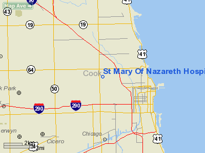
St Mary Of Nazareth Hospital Center Heliport |
|
|
Location
& QuickFacts
|
FAA
Information Effective: |
2007-12-20 |
|
Airport
Identifier: |
6IS7 |
|
Airport
Status: |
Operational |
|
Longitude/Latitude: |
087-40-58.0000W/41-54-10.0000N
-87.682778/41.902778 (Estimated) |
|
Elevation: |
597 ft / 181.97 m (Estimated) |
|
Land: |
0 acres |
|
From nearest
city: |
0 nautical miles NW of Chicago, IL |
|
Location: |
Cook County, IL |
|
Magnetic
Variation: |
01W (1985) |
Owner
& Manager
|
Ownership: |
Privately
owned |
|
Owner: |
St Mary Of Nazareth Hosp Cntr |
|
Address: |
2233 W Division Street
Chicago, IL 60622 |
|
Phone
number: |
312-770-2575 |
|
Manager: |
William Strzoda |
|
Address: |
2233 W Division Street
Chicago, IL 60622 |
|
Phone
number: |
312-770-2575 |
Airport
Operations and Facilities
|
Airport
Use: |
Private
MEDICAL USE. |
|
Wind indicator: |
Yes |
|
Segmented
Circle: |
No |
|
Control
Tower: |
No |
|
Lighting
Schedule: |
PHONE REQ
FOR ARPT BCN CALL 312-770-2457. |
|
Beacon
Color: |
Clear-Green-Yellow (heliport) |
|
Sectional
chart: |
Chicago |
|
Region: |
AGL - Great Lakes |
|
Boundary
ARTCC: |
ZAU - Chicago |
|
Tie-in
FSS: |
IKK - Kankakee |
|
FSS on
Airport: |
No |
|
FSS Toll
Free: |
1-800-WX-BRIEF |
|
Runway Information
Helipad H1
|
Dimension: |
88 x 88 ft /
26.8 x 26.8 m |
|
Surface: |
CONC,
ROOFTOP. |
|
|
Runway H1 |
Runway |
|
Traffic
Pattern: |
Left |
Left |
|
Radio Navigation
Aids
|
ID |
Type |
Name |
Ch |
Freq |
Var |
Dist |
|
MX |
NDB |
Kedzi |
|
248.00 |
01W |
9.7 nm |
|
HK |
NDB |
Ermin |
|
332.00 |
01W |
13.0 nm |
|
ME |
NDB |
Deana |
|
350.00 |
00E |
15.9 nm |
|
MGC |
NDB |
Michigan City |
|
203.00 |
01W |
40.6 nm |
|
VP |
NDB |
Sedly |
|
212.00 |
02W |
45.2 nm |
|
DKB |
NDB |
Dekalb |
|
209.00 |
02W |
45.9 nm |
|
IUL |
NDB |
La Porte |
|
356.00 |
03W |
47.6 nm |
|
RA |
NDB |
Paser |
|
206.00 |
00E |
47.9 nm |
|
ORD |
VOR/DME |
Chicago O'hare |
086X |
113.90 |
02E |
11.2 nm |
|
OBK |
VOR/DME |
Northbrook |
077X |
113.00 |
02W |
22.6 nm |
|
DPA |
VOR/DME |
Dupage |
021X |
108.40 |
02E |
29.9 nm |
|
ENW |
VOR/DME |
Kenosha |
029X |
109.20 |
02W |
43.3 nm |
|
CGT |
VORTAC |
Chicago Heights |
089X |
114.20 |
02E |
24.1 nm |
|
JOT |
VORTAC |
Joliet |
070X |
112.30 |
02E |
35.7 nm |
|
EON |
VORTAC |
Peotone |
079X |
113.20 |
02E |
38.4 nm |
|
MDW |
VOT |
Chicago Midway |
|
111.00 |
|
7.7 nm |
|
ORD |
VOT |
Chicago O'hare Intl |
|
112.00 |
|
11.1 nm |
Remarks
- ALL
OPNS ARE CONDD IN AN AREA TO/FROM 180 DEG & 315-045 DEG, AREA IS
MKD, WIND INDCR IS MAINTD.
St Mary Of Nazareth Hospital Center Heliport
Address:
Cook County, IL
Tel:
312-770-2575
Images
and information placed above are from
http://www.airport-data.com/airport/6IS7/
We
thank them for the data!
| General
Info |
| Country |
United
States |
| State |
ILLINOIS
|
| FAA ID |
6IS7 |
| Latitude |
41-57-30.116N
|
| Longitude |
087-43-00.197W
|
| Elevation |
640 feet
|
| Near City |
CHICAGO
|
We don't guarantee the information is fresh and accurate. The data may
be wrong or outdated.
For more up-to-date information please refer to other sources.
|
|


