 |
|
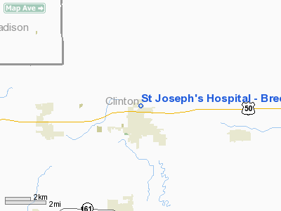
St Joseph's Hospital - Breese Heliport |
|
|
Location
& QuickFacts
|
FAA
Information Effective: |
2007-12-20 |
|
Airport
Identifier: |
8IS0 |
|
Airport
Status: |
Operational |
|
Longitude/Latitude: |
089-31-25.3080W/38-37-35.1740N
-89.523697/38.626437 (Estimated) |
|
Elevation: |
755 ft / 230.12 m (Estimated) |
|
Land: |
0 acres |
|
From nearest
city: |
2 nautical miles N of Breese, IL |
|
Location: |
Clinton County, IL |
|
Magnetic
Variation: |
01E (1985) |
Owner
& Manager
|
Ownership: |
Privately
owned |
|
Owner: |
St Joseph's Hospital |
|
Address: |
9515 Holy Cross Lane
Breese, IL 62230 |
|
Phone
number: |
618-526-4511 |
|
Manager: |
Jacolyn M Schlautman |
|
Address: |
9515 Holy Cross Lane
Breese, IL 62230 |
|
Phone
number: |
618-526-4511 |
Airport
Operations and Facilities
|
Airport
Use: |
Private
MEDICAL USE. |
|
Wind indicator: |
Yes |
|
Segmented
Circle: |
No |
|
Control
Tower: |
No |
|
Lighting
Schedule: |
PHONE REQ
FOR ROTG BCN & HELI LGTS CALL 618-526-4511. |
|
Beacon
Color: |
Clear-Green-Yellow (heliport) |
|
Sectional
chart: |
St Louis |
|
Region: |
AGL - Great Lakes |
|
Boundary
ARTCC: |
ZKC - Kansas City |
|
Tie-in
FSS: |
STL - Saint Louis |
|
FSS on
Airport: |
No |
|
FSS Toll
Free: |
1-800-WX-BRIEF |
|
Runway Information
Helipad H1
|
Dimension: |
30 x 30 ft /
9.1 x 9.1 m |
|
Surface: |
CONC, |
|
|
Runway H1 |
Runway |
|
Traffic
Pattern: |
Left |
Left |
|
Radio Navigation
Aids
|
ID |
Type |
Name |
Ch |
Freq |
Var |
Dist |
|
BL |
NDB |
Belleville |
|
362.00 |
02E |
14.6 nm |
|
SLO |
NDB |
Salem |
|
400.00 |
01W |
26.1 nm |
|
CVM |
NDB |
Civic Memorial |
|
263.00 |
02E |
29.6 nm |
|
SAR |
NDB |
Sparta |
|
239.00 |
01E |
30.1 nm |
|
LTD |
NDB |
Litchfield |
|
371.00 |
01E |
33.2 nm |
|
PJY |
NDB |
Pinckneyville |
|
215.00 |
00E |
39.9 nm |
|
LM |
NDB |
Oblio |
|
338.00 |
00E |
45.8 nm |
|
FES |
NDB |
Festus |
|
269.00 |
01E |
48.2 nm |
|
SKE |
TACAN |
Scott |
059X |
|
02E |
16.2 nm |
|
VNN |
VOR/DME |
Mount Vernon |
085X |
113.80 |
02E |
37.3 nm |
|
CSX |
VOR/DME |
Cardinal |
111Y |
116.45 |
00E |
40.0 nm |
|
TOY |
VORTAC |
Troy |
107X |
116.00 |
04E |
19.7 nm |
|
ENL |
VORTAC |
Centralia |
097X |
115.00 |
04E |
21.2 nm |
|
VLA |
VORTAC |
Vandalia |
090X |
114.30 |
04E |
32.8 nm |
|
STL |
VORTAC |
St Louis |
121X |
117.40 |
01E |
47.1 nm |
|
STL |
VOT |
St Louis Lambert |
|
111.00 |
|
40.0 nm |
Remarks
- PRVDD
APP/DEP OPNS ARE CONDD FM 090-070 DEG, AREA IS MKD, WIND INDCR IS MAINTD.
St Joseph's Hospital - Breese Heliport
Address:
Clinton County, IL
Tel:
618-526-4511
Images
and information placed above are from
http://www.airport-data.com/airport/8IS0/
We
thank them for the data!
| General
Info |
| Country |
United
States |
| State |
ILLINOIS
|
| FAA ID |
8IS0 |
| Latitude |
38-37-35.174N
|
| Longitude |
089-31-25.308W
|
| Elevation |
755 feet
|
| Near City |
BREESE
|
We don't guarantee the information is fresh and accurate. The data may
be wrong or outdated.
For more up-to-date information please refer to other sources.
|
|


