 |
|
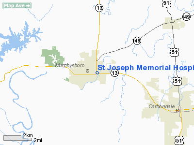
St Joseph Memorial Hospital Heliport |
Location
& QuickFacts
|
FAA
Information Effective: |
2007-12-20 |
|
Airport
Identifier: |
IS38 |
|
Airport
Status: |
Operational |
|
Longitude/Latitude: |
089-19-30.3170W/37-45-57.1820N
-89.325088/37.765884 (Estimated) |
|
Elevation: |
405 ft / 123.44 m (Estimated) |
|
Land: |
0 acres |
|
From nearest
city: |
0 nautical miles N of Murphysboro, IL |
|
Location: |
Jackson County, IL |
|
Magnetic
Variation: |
01E (1985) |
Owner
& Manager
|
Ownership: |
Privately
owned |
|
Owner: |
Southern Il Hospital Ser Inc |
|
Address: |
Po Box 3988
Carbondale, IL 62902 |
|
Phone
number: |
618-684-3156 |
|
Manager: |
Hank Fowler |
|
Address: |
Po Box 588
Murphysboro, IL 62966 |
|
Phone
number: |
618-684-3156 |
Airport
Operations and Facilities
|
Airport
Use: |
Private
MEDICAL USE. |
|
Wind indicator: |
Yes |
|
Segmented
Circle: |
No |
|
Control
Tower: |
No |
|
Sectional
chart: |
St Louis |
|
Region: |
AGL - Great Lakes |
|
Boundary
ARTCC: |
ZKC - Kansas City |
|
Tie-in
FSS: |
COU - Columbia |
|
FSS Toll
Free: |
1-800-WX-BRIEF |
|
Runway Information
Helipad H1
|
Dimension: |
40 x 40 ft /
12.2 x 12.2 m |
|
Surface: |
CONC, |
|
|
Runway H1 |
Runway |
|
Traffic
Pattern: |
Left |
Left |
|
Radio Navigation
Aids
|
ID |
Type |
Name |
Ch |
Freq |
Var |
Dist |
|
PJY |
NDB |
Pinckneyville |
|
215.00 |
00E |
12.7 nm |
|
SAR |
NDB |
Sparta |
|
239.00 |
01E |
29.0 nm |
|
HSB |
NDB |
Harrisburg-raleigh |
|
230.00 |
00E |
37.1 nm |
|
CIR |
NDB |
Cairo |
|
397.00 |
00E |
42.6 nm |
|
BL |
NDB |
Belleville |
|
362.00 |
02E |
46.7 nm |
|
BDD |
NDB |
Bellgrade |
|
254.00 |
00E |
48.6 nm |
|
MWA |
VOR/DME |
Marion |
041X |
110.40 |
04E |
14.9 nm |
|
CGI |
VOR/DME |
Cape Girardeau |
076X |
112.90 |
01E |
34.4 nm |
|
VNN |
VOR/DME |
Mount Vernon |
085X |
113.80 |
02E |
43.4 nm |
|
ENL |
VORTAC |
Centralia |
097X |
115.00 |
04E |
40.1 nm |
|
FAM |
VORTAC |
Farmington |
104X |
115.70 |
01E |
43.6 nm |
Remarks
- PRVDD
APP/DEP FM 200 TO 340; AREA IS MARKED; WIND INDICATOR IS MAINTAINED;
WHILE IN CONTROL ZONE OPER IAW FAA REGS; PILOTS DEPARTING CTC SOUTHERN
ILL ARPT ATCT 618-529-1311.
St Joseph Memorial Hospital Heliport
Address:
Jackson County, IL
Tel:
618-684-3156
Images
and information placed above are from
http://www.airport-data.com/airport/IS38/
We
thank them for the data!
| General
Info |
| Country |
United
States |
| State |
ILLINOIS
|
| FAA ID |
IS38 |
| Latitude |
37-45-57.182N
|
| Longitude |
089-19-30.317W
|
| Elevation |
405 feet
|
| Near City |
MURPHYSBORO
|
We don't guarantee the information is fresh and accurate. The data may
be wrong or outdated.
For more up-to-date information please refer to other sources.
|
|


