 |
|
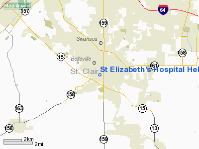
St Elizabeth's Hospital Heliport |
|
|
Location
& QuickFacts
|
FAA
Information Effective: |
2007-12-20 |
|
Airport
Identifier: |
IL73 |
|
Airport
Status: |
Operational |
|
Longitude/Latitude: |
089-59-20.0000W/38-30-36.0000N
-89.988889/38.510000 (Estimated) |
|
Elevation: |
564 ft / 171.91 m (Estimated) |
|
Land: |
0 acres |
|
From nearest
city: |
1 nautical miles S of Belleville, IL |
|
Location: |
St Clair County, IL |
|
Magnetic
Variation: |
00E (2000) |
Owner
& Manager
|
Ownership: |
Privately
owned |
|
Owner: |
St Elizabeth's Hospital |
|
Address: |
211 S. 3rd St.
Belleville, IL 62220-1998 |
|
Phone
number: |
618-234-2120 |
|
Manager: |
Thomas Eisele |
|
Address: |
211 S. 3rd St.
Belleview, IL 62220-1998 |
|
Phone
number: |
618-234-2120
X1561 |
Airport
Operations and Facilities
|
Airport
Use: |
Private |
|
Wind indicator: |
Yes |
|
Segmented
Circle: |
No |
|
Control
Tower: |
No |
|
Lighting
Schedule: |
DUSK-DAWN
FOR PERIMETER AND FLOOD LIGHTS CALL THE SECURITY OFFICE
AT 618-234-2120 EXT 1911. |
|
Beacon
Color: |
Clear-Green-Yellow (heliport) |
|
Sectional
chart: |
St Louis |
|
Region: |
AGL - Great Lakes |
|
Boundary
ARTCC: |
ZKC - Kansas City |
|
Tie-in
FSS: |
STL - Saint Louis |
|
FSS Toll
Free: |
1-800-WX-BRIEF |
|
Runway Information
Helipad H1
|
Dimension: |
40 x 40 ft /
12.2 x 12.2 m |
|
Surface: |
CONC,
HELIPORT SURFACE IS AN ELEVATED DECK ON PARKING GARAGE. |
|
|
Runway H1 |
Runway |
|
Traffic
Pattern: |
Left |
Left |
|
Radio Navigation
Aids
|
ID |
Type |
Name |
Ch |
Freq |
Var |
Dist |
|
BL |
NDB |
Belleville |
|
362.00 |
02E |
11.3 nm |
|
CVM |
NDB |
Civic Memorial |
|
263.00 |
02E |
23.2 nm |
|
SAR |
NDB |
Sparta |
|
239.00 |
01E |
25.8 nm |
|
FES |
NDB |
Festus |
|
269.00 |
01E |
26.6 nm |
|
LM |
NDB |
Oblio |
|
338.00 |
00E |
28.7 nm |
|
LTD |
NDB |
Litchfield |
|
371.00 |
01E |
42.0 nm |
|
PJY |
NDB |
Pinckneyville |
|
215.00 |
00E |
43.7 nm |
|
SLO |
NDB |
Salem |
|
400.00 |
01W |
48.7 nm |
|
PRI |
NDB |
Perrine |
|
367.00 |
02E |
49.4 nm |
|
SKE |
TACAN |
Scott |
059X |
|
02E |
6.8 nm |
|
CSX |
VOR/DME |
Cardinal |
111Y |
116.45 |
00E |
22.8 nm |
|
TOY |
VORTAC |
Troy |
107X |
116.00 |
04E |
14.2 nm |
|
STL |
VORTAC |
St Louis |
121X |
117.40 |
01E |
31.3 nm |
|
ENL |
VORTAC |
Centralia |
097X |
115.00 |
04E |
39.4 nm |
|
FTZ |
VORTAC |
Foristell |
045X |
110.80 |
05E |
47.5 nm |
|
STL |
VOT |
St Louis Lambert |
|
111.00 |
|
22.6 nm |
|
SUS |
VOT |
Spirit Of St Louis |
|
112.20 |
|
32.5 nm |
Remarks
- PRVDD
INGRESS/EGRESS IS FROM 090 TO 320 DEG.
St Elizabeth's Hospital Heliport
Address:
St Clair County, IL
Tel:
618-234-2120
Images
and information placed above are from
http://www.airport-data.com/airport/IL73/
We
thank them for the data!
| General
Info |
| Country |
United
States |
| State |
ILLINOIS
|
| FAA ID |
IL73 |
| Latitude |
38-30-36.000N
|
| Longitude |
089-59-20.000W
|
| Elevation |
564 feet
|
| Near City |
BELLEVILLE
|
We don't guarantee the information is fresh and accurate. The data may
be wrong or outdated.
For more up-to-date information please refer to other sources.
|
|


