 |
|
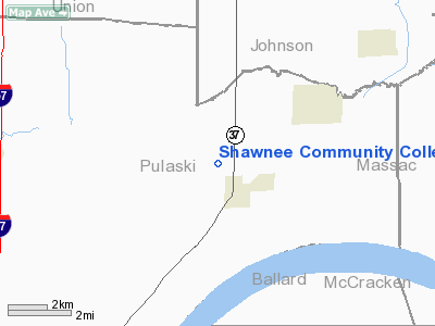
Shawnee Community College Heliport |
Location
& QuickFacts
|
FAA
Information Effective: |
2007-12-20 |
|
Airport
Identifier: |
IL19 |
|
Airport
Status: |
Operational |
|
Longitude/Latitude: |
089-01-55.8000W/37-16-01.8000N
-89.032167/37.267167 (Estimated) |
|
Elevation: |
440 ft / 134.11 m (Estimated) |
|
Land: |
115 acres |
|
From nearest
city: |
9 nautical miles E of Ullin, IL |
|
Location: |
Pulaski County, IL |
|
Magnetic
Variation: |
01E (1990) |
Owner
& Manager
|
Ownership: |
Publicly
owned |
|
Owner: |
Shawnee Community College |
|
Address: |
8364 Shawnee College Rd.
Ullin, IL 62992-9725 |
|
Phone
number: |
618-634-3200 |
|
Manager: |
Dr. Terry Ludwig |
|
Address: |
8364 Shawnee College Rd.
Ullin, IL 62992-9725 |
|
Phone
number: |
618-634-3200 |
Airport
Operations and Facilities
|
Airport
Use: |
Private |
|
Wind indicator: |
Yes
LIGHTED FLAG NORTH OF LANDING AREA. |
|
Segmented
Circle: |
No |
|
Control
Tower: |
No |
|
Sectional
chart: |
St Louis |
|
Region: |
AGL - Great Lakes |
|
Boundary
ARTCC: |
ZME - Memphis |
|
Tie-in
FSS: |
COU - Columbia |
|
FSS on
Airport: |
No |
|
FSS Toll
Free: |
1-800-WX-BRIEF |
|
Runway Information
Helipad H1
|
Dimension: |
40 x 40 ft /
12.2 x 12.2 m |
|
Surface: |
TURF, Good Condition |
|
|
Runway H1 |
Runway |
|
Traffic
Pattern: |
Left |
Left |
|
Radio Navigation
Aids
|
ID |
Type |
Name |
Ch |
Freq |
Var |
Dist |
|
CIR |
NDB |
Cairo |
|
397.00 |
00E |
15.4 nm |
|
BDD |
NDB |
Bellgrade |
|
254.00 |
00E |
18.8 nm |
|
CHQ |
NDB |
Charleston |
|
208.00 |
01E |
29.8 nm |
|
HSB |
NDB |
Harrisburg-raleigh |
|
230.00 |
00E |
40.1 nm |
|
GGK |
NDB |
Mayfield |
|
401.00 |
00E |
40.6 nm |
|
PJY |
NDB |
Pinckneyville |
|
215.00 |
00E |
45.4 nm |
|
CGI |
VOR/DME |
Cape Girardeau |
076X |
112.90 |
01E |
26.0 nm |
|
MWA |
VOR/DME |
Marion |
041X |
110.40 |
04E |
29.3 nm |
|
CNG |
VORTAC |
Cunningham |
078X |
113.10 |
03E |
18.1 nm |
Remarks
- PROVIDED
APCH/DEP OPNS ARE CONDUCTED IN AREA FROM 240 DEGS CLOCKWISE TO 160 DEGS
USING TOUCHDOWN PAD AS CENTER OF COMPASS ROSE; TKOF/LNDG AREA MARKED;
FLAG POLE IS MAINTAINED AND OBSTRUCTION LGTD.
Shawnee Community College Heliport
Address:
Pulaski County, IL
Tel:
618-634-3200
Images
and information placed above are from
http://www.airport-data.com/airport/IL19/
We
thank them for the data!
| General
Info |
| Country |
United
States |
| State |
ILLINOIS
|
| FAA ID |
IL19 |
| Latitude |
37-16-01.800N
|
| Longitude |
089-01-55.800W
|
| Elevation |
440 feet
|
| Near City |
ULLIN
|
We don't guarantee the information is fresh and accurate. The data may
be wrong or outdated.
For more up-to-date information please refer to other sources.
|
|


