 |
|
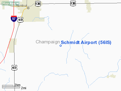
Location
& QuickFacts
|
FAA
Information Effective: |
2007-12-20 |
|
Airport
Identifier: |
56IS |
|
Airport
Status: |
Operational |
|
Longitude/Latitude: |
088-04-58.1470W/40-14-35.1230N
-88.082819/40.243090 (Estimated) |
|
Elevation: |
690 ft / 210.31 m (Estimated) |
|
Land: |
0 acres |
|
From nearest
city: |
5 nautical miles E of Thomasboro, IL |
|
Location: |
Champaign County, IL |
|
Magnetic
Variation: |
00W (1985) |
Owner
& Manager
|
Ownership: |
Privately
owned |
|
Owner: |
Robert D. Schmidt |
|
Address: |
1962 C R 2500 N
Thomasboro, IL 61878 |
|
Phone
number: |
217-694-4153 |
|
Address: |
|
Airport
Operations and Facilities
|
Airport
Use: |
Private
PERSONAL USE. |
|
Segmented
Circle: |
No |
|
Control
Tower: |
No |
|
Landing
fee charge: |
No |
|
Sectional
chart: |
St Louis |
|
Region: |
AGL - Great Lakes |
|
Boundary
ARTCC: |
ZAU - Chicago |
|
Tie-in
FSS: |
STL - Saint Louis |
|
FSS Toll
Free: |
1-800-WX-BRIEF |
|
Runway Information
Runway 09/27
|
Dimension: |
2190 x 70 ft
/ 667.5 x 21.3 m |
|
Surface: |
TURF, |
|
|
Runway 09 |
Runway 27 |
|
Traffic
Pattern: |
Left |
Left |
|
Obstruction: |
|
30 ft pline, 450.0 ft from runway |
|
Radio Navigation
Aids
|
ID |
Type |
Name |
Ch |
Freq |
Var |
Dist |
|
HMJ |
NDB |
Homer |
|
281.00 |
01E |
14.3 nm |
|
PRG |
NDB |
Paris |
|
341.00 |
01E |
37.8 nm |
|
MT |
NDB |
Zebre |
|
347.00 |
00E |
48.3 nm |
|
RBS |
VOR/DME |
Roberts |
115X |
116.80 |
02E |
20.7 nm |
|
BMI |
VOR/DME |
Bloomington |
019X |
108.20 |
03E |
41.4 nm |
|
PNT |
VOR/DME |
Pontiac |
033X |
109.60 |
03E |
45.7 nm |
|
MTO |
VOR/DME |
Mattoon |
031X |
109.40 |
03E |
46.9 nm |
|
CMI |
VORTAC |
Champaign |
037X |
110.00 |
03E |
15.4 nm |
|
DNV |
VORTAC |
Danville |
047X |
111.00 |
02E |
24.3 nm |
|
DEC |
VORTAC |
Decatur |
119X |
117.20 |
03E |
46.8 nm |
Based Aircraft
|
Aircraft
based on field: |
2 |
|
Single Engine
Airplanes: |
2 |
Schmidt Airport
Address:
Champaign County, IL
Tel:
217-694-4153
Images
and information placed above are from
http://www.airport-data.com/airport/56IS/
We
thank them for the data!
| General
Info |
| Country |
United
States |
| State |
ILLINOIS
|
| FAA ID |
56IS |
| Latitude |
40-14-35.123N
|
| Longitude |
088-04-58.147W
|
| Elevation |
690 feet
|
| Near City |
THOMASBORO
|
We don't guarantee the information is fresh and accurate. The data may
be wrong or outdated.
For more up-to-date information please refer to other sources.
|
|


