 |
|
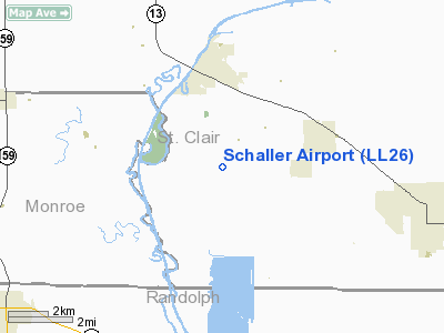
Location
& QuickFacts
|
FAA
Information Effective: |
2007-12-20 |
|
Airport
Identifier: |
LL26 |
|
Airport
Status: |
Operational |
|
Longitude/Latitude: |
089-52-15.3690W/38-16-30.1770N
-89.870936/38.275049 (Estimated) |
|
Elevation: |
434 ft / 132.28 m (Estimated) |
|
Land: |
0 acres |
|
From nearest
city: |
3 nautical miles S of New Athens, IL |
|
Location: |
St Clair County, IL |
|
Magnetic
Variation: |
02E (1985) |
Owner
& Manager
|
Ownership: |
Privately
owned |
|
Owner: |
Neil Schaller |
|
Address: |
1414 Baldwin Road
New Athens, IL 62264 |
|
Phone
number: |
618-475-2222 |
|
Address: |
|
|
Phone
number: |
618-475-2769 |
Airport
Operations and Facilities
|
Airport Use: |
Private |
|
Wind
indicator: |
Yes |
|
Segmented
Circle: |
No |
|
Control
Tower: |
No |
|
Landing
fee charge: |
No |
|
Sectional
chart: |
St Louis |
|
Region: |
AGL - Great Lakes |
|
Boundary
ARTCC: |
ZKC - Kansas City |
|
Tie-in
FSS: |
STL - Saint Louis |
|
FSS
on Airport: |
No |
|
FSS
Toll Free: |
1-800-WX-BRIEF |
Airport
Services
|
Airframe
Repair: |
NONE |
|
Power
Plant Repair: |
NONE |
|
Runway Information
Runway 18/36
|
Dimension: |
2235 x 90 ft
/ 681.2 x 27.4 m |
|
Surface: |
TURF, |
|
|
Runway 18 |
Runway 36 |
|
Traffic
Pattern: |
Left |
Right |
|
Radio Navigation
Aids
|
ID |
Type |
Name |
Ch |
Freq |
Var |
Dist |
|
SAR |
NDB |
Sparta |
|
239.00 |
01E |
11.1 nm |
|
BL |
NDB |
Belleville |
|
362.00 |
02E |
12.6 nm |
|
FES |
NDB |
Festus |
|
269.00 |
01E |
24.9 nm |
|
PJY |
NDB |
Pinckneyville |
|
215.00 |
00E |
30.0 nm |
|
CVM |
NDB |
Civic Memorial |
|
263.00 |
02E |
38.1 nm |
|
PRI |
NDB |
Perrine |
|
367.00 |
02E |
40.5 nm |
|
LM |
NDB |
Oblio |
|
338.00 |
00E |
42.5 nm |
|
SLO |
NDB |
Salem |
|
400.00 |
01W |
48.0 nm |
|
SKE |
TACAN |
Scott |
059X |
|
02E |
16.3 nm |
|
CSX |
VOR/DME |
Cardinal |
111Y |
116.45 |
00E |
36.8 nm |
|
TOY |
VORTAC |
Troy |
107X |
116.00 |
04E |
28.0 nm |
|
ENL |
VORTAC |
Centralia |
097X |
115.00 |
04E |
34.7 nm |
|
FAM |
VORTAC |
Farmington |
104X |
115.70 |
01E |
40.0 nm |
|
STL |
VORTAC |
St Louis |
121X |
117.40 |
01E |
45.4 nm |
|
STL |
VOT |
St Louis Lambert |
|
111.00 |
|
36.6 nm |
|
SUS |
VOT |
Spirit Of St Louis |
|
112.20 |
|
43.5 nm |
Remarks
- AIRPORT
USED FOR AG SPRAYING & AG RELATED BUSINESS.
Based Aircraft
|
Aircraft
based on field: |
4 |
|
Single Engine
Airplanes: |
4 |
Schaller Airport
Address:
St Clair County, IL
Tel:
618-475-2222,
618-475-2769
Images
and information placed above are from
http://www.airport-data.com/airport/LL26/
We
thank them for the data!
| General
Info |
| Country |
United
States |
| State |
ILLINOIS
|
| FAA ID |
LL26 |
| Latitude |
38-16-30.177N
|
| Longitude |
089-52-15.369W
|
| Elevation |
434 feet
|
| Near City |
NEW ATHENS
|
We don't guarantee the information is fresh and accurate. The data may
be wrong or outdated.
For more up-to-date information please refer to other sources.
|
|


