 |
|
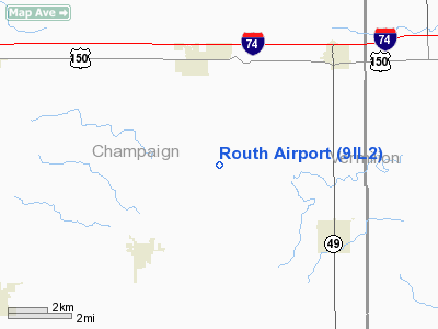
Location
& QuickFacts
|
FAA
Information Effective: |
2007-12-20 |
|
Airport
Identifier: |
9IL2 |
|
Airport
Status: |
Operational |
|
Longitude/Latitude: |
088-01-35.1330W/40-03-54.1220N
-88.026426/40.065034 (Estimated) |
|
Elevation: |
668 ft / 203.61 m (Estimated) |
|
Land: |
10 acres |
|
From nearest
city: |
3 nautical miles S of St Joseph, IL |
|
Location: |
Champaign County, IL |
|
Magnetic
Variation: |
01W (1990) |
Owner
& Manager
|
Ownership: |
Privately
owned |
|
Owner: |
Lowell Routh |
|
Address: |
Box 761
St Joseph, IL 61873 |
|
Phone
number: |
217-469-7480 |
|
Manager: |
Lowell Routh |
|
Address: |
Box 761
St Joseph, IL 61873 |
|
Phone
number: |
217-469-7480 |
Airport
Operations and Facilities
|
Airport
Use: |
Private |
|
Wind indicator: |
Yes |
|
Segmented
Circle: |
No |
|
Control
Tower: |
No |
|
Sectional
chart: |
St Louis |
|
Region: |
AGL - Great Lakes |
|
Boundary
ARTCC: |
ZAU - Chicago |
|
Tie-in
FSS: |
STL - Saint Louis |
|
FSS Toll
Free: |
1-800-WX-BRIEF |
|
Runway Information
Runway 18/36
|
Dimension: |
2664 x 134 ft
/ 812.0 x 40.8 m |
|
Surface: |
TURF, |
|
|
Runway 18 |
Runway 36 |
|
Traffic
Pattern: |
Left |
Left |
|
Obstruction: |
15 ft road |
|
|
Radio Navigation
Aids
|
ID |
Type |
Name |
Ch |
Freq |
Var |
Dist |
|
HMJ |
NDB |
Homer |
|
281.00 |
01E |
4.1 nm |
|
PRG |
NDB |
Paris |
|
341.00 |
01E |
27.4 nm |
|
MT |
NDB |
Zebre |
|
347.00 |
00E |
38.0 nm |
|
CZB |
NDB |
Casey |
|
359.00 |
00E |
45.7 nm |
|
RBS |
VOR/DME |
Roberts |
115X |
116.80 |
02E |
31.7 nm |
|
MTO |
VOR/DME |
Mattoon |
031X |
109.40 |
03E |
37.3 nm |
|
BMI |
VOR/DME |
Bloomington |
019X |
108.20 |
03E |
48.4 nm |
|
CMI |
VORTAC |
Champaign |
037X |
110.00 |
03E |
11.6 nm |
|
DNV |
VORTAC |
Danville |
047X |
111.00 |
02E |
25.6 nm |
|
DEC |
VORTAC |
Decatur |
119X |
117.20 |
03E |
43.0 nm |
|
TTH |
VORTAC |
Terre Haute |
100X |
115.30 |
02E |
49.9 nm |
Remarks
- PRVDD
AREA 125 FT EITHER SIDE OF RY CNTRLN & 200 FT OFF RY ENDS CLEAR
OF OBSTN (NORTH END MUST BE RELOCATED 200 FT SOUTH); OBSTN IN RY APCH
SLOPE REMOVED/LOWERED OR THER DSPLCD & MKD TO PRVD MIN 20:1 APCH
CLNC OVER OBSTN.
Based Aircraft
|
Aircraft
based on field: |
1 |
|
Single Engine
Airplanes: |
1 |
Routh Airport
Address:
Champaign County, IL
Tel:
217-469-7480
Images
and information placed above are from
http://www.airport-data.com/airport/9IL2/
We
thank them for the data!
| General
Info |
| Country |
United
States |
| State |
ILLINOIS
|
| FAA ID |
9IL2 |
| Latitude |
40-03-54.122N
|
| Longitude |
088-01-35.133W
|
| Elevation |
668 feet
|
| Near City |
ST JOSEPH
|
We don't guarantee the information is fresh and accurate. The data may
be wrong or outdated.
For more up-to-date information please refer to other sources.
|
|


