 |
|
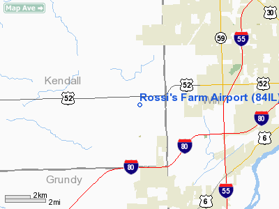
Location
& QuickFacts
|
FAA
Information Effective: |
2007-12-20 |
|
Airport
Identifier: |
84IL |
|
Airport
Status: |
Operational |
|
Longitude/Latitude: |
088-16-40.2330W/41-30-25.1090N
-88.277843/41.506975 (Estimated) |
|
Elevation: |
580 ft / 176.78 m (Estimated) |
|
Land: |
0 acres |
|
From nearest
city: |
3 nautical miles SE of Minooka, IL |
|
Location: |
Kendall County, IL |
|
Magnetic
Variation: |
00W (1985) |
Owner
& Manager
|
Ownership: |
Privately
owned |
|
Owner: |
Josephine Rossi |
|
Address: |
15875 Ridge Road
Minooka, IL 60447 |
|
Phone
number: |
815-467-2912 |
|
Manager: |
Steve Rossi |
|
Address: |
15875 Ridge Road
Minooka, IL 60447 |
|
Phone
number: |
815-467-2912 |
Airport
Operations and Facilities
|
Airport Use: |
Private |
|
Wind
indicator: |
No |
|
Segmented
Circle: |
No |
|
Control
Tower: |
No |
|
Landing
fee charge: |
No |
|
Sectional
chart: |
Chicago |
|
Region: |
AGL - Great Lakes |
|
Boundary
ARTCC: |
ZAU - Chicago |
|
Tie-in
FSS: |
IKK - Kankakee |
|
FSS
on Airport: |
No |
|
FSS
Toll Free: |
1-800-WX-BRIEF |
Airport
Services
|
Airframe
Repair: |
NONE |
|
Power
Plant Repair: |
NONE |
|
Runway Information
Runway 09/27
|
Dimension: |
2400 x 70 ft
/ 731.5 x 21.3 m |
|
Surface: |
TURF, |
|
|
Runway 09 |
Runway 27 |
|
Traffic
Pattern: |
Right |
Left |
|
Displaced
threshold: |
0.00 ft |
450.00 ft |
|
Radio Navigation
Aids
|
ID |
Type |
Name |
Ch |
Freq |
Var |
Dist |
|
HK |
NDB |
Ermin |
|
332.00 |
01W |
23.6 nm |
|
OIX |
NDB |
Ottawa |
|
266.00 |
01E |
27.4 nm |
|
ME |
NDB |
Deana |
|
350.00 |
00E |
29.9 nm |
|
MX |
NDB |
Kedzi |
|
248.00 |
01W |
30.0 nm |
|
DKB |
NDB |
Dekalb |
|
209.00 |
02W |
32.1 nm |
|
VYS |
NDB |
Valley |
|
230.00 |
00W |
40.3 nm |
|
DPA |
VOR/DME |
Dupage |
021X |
108.40 |
02E |
23.3 nm |
|
IKK |
VOR/DME |
Kankakee |
053X |
111.60 |
00E |
32.4 nm |
|
ORD |
VOR/DME |
Chicago O'hare |
086X |
113.90 |
02E |
33.4 nm |
|
OBK |
VOR/DME |
Northbrook |
077X |
113.00 |
02W |
45.4 nm |
|
PNT |
VOR/DME |
Pontiac |
033X |
109.60 |
03E |
46.1 nm |
|
JOT |
VORTAC |
Joliet |
070X |
112.30 |
02E |
3.0 nm |
|
EON |
VORTAC |
Peotone |
079X |
113.20 |
02E |
26.2 nm |
|
CGT |
VORTAC |
Chicago Heights |
089X |
114.20 |
02E |
31.8 nm |
|
MDW |
VOT |
Chicago Midway |
|
111.00 |
|
29.0 nm |
|
ORD |
VOT |
Chicago O'hare Intl |
|
112.00 |
|
33.1 nm |
Remarks
- ALL
OPNS ON SOUTH SIDE OF E/W RWY.
Rossi's Farm Airport
Address:
Kendall County, IL
Tel:
815-467-2912
Images
and information placed above are from
http://www.airport-data.com/airport/84IL/
We
thank them for the data!
| General
Info |
| Country |
United
States |
| State |
ILLINOIS
|
| FAA ID |
84IL |
| Latitude |
41-30-25.109N
|
| Longitude |
088-16-40.233W
|
| Elevation |
580 feet
|
| Near City |
MINOOKA
|
We don't guarantee the information is fresh and accurate. The data may
be wrong or outdated.
For more up-to-date information please refer to other sources.
|
|


