 |
|
Robinson Municipal Airport |
|
|
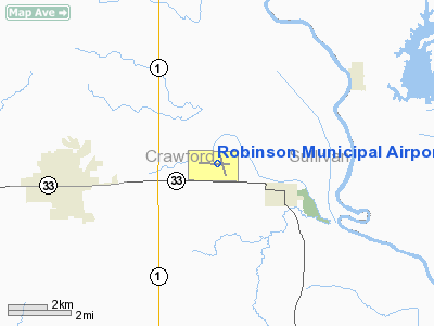
Location
& QuickFacts
|
FAA
Information Effective: |
2007-12-20 |
|
Airport
Identifier: |
RSV |
|
Airport
Status: |
Operational |
|
Longitude/Latitude: |
087-38-59.2000W/39-00-57.7000N
-87.649778/39.016028 (Estimated) |
|
Elevation: |
462 ft / 140.82 m (Surveyed) |
|
Land: |
432 acres |
|
From nearest
city: |
4 nautical miles E of Robinson, IL |
|
Location: |
Crawford County, IL |
|
Magnetic
Variation: |
00E (1985) |
Owner
& Manager
|
Ownership: |
Publicly
owned |
|
Owner: |
Robinson Arpt Authority |
|
Address: |
Po Box 6
Robinson, IL 62454 |
|
Phone
number: |
618-546-5428
PHONE NUMBER SHOWN IS CHAIRMAN OF BOARD, DR. JOHN TRIMBLE. |
|
Address: |
|
Airport Operations
and Facilities
|
Airport
Use: |
Open
to public |
|
Wind indicator: |
Yes |
|
Segmented
Circle: |
No |
|
Control
Tower: |
No |
|
Lighting
Schedule: |
DUSK-DAWN
MIRL RY 09/27 PRESET ON LOW INTST; TO INCR INTST & ACTVT
MIRL RY 17/35 , REIL RYS 09, 27 & 17 PVASI RYS 09 &
27 - CTAF. |
|
Beacon
Color: |
Clear-Green (lighted land airport) |
|
Landing
fee charge: |
No |
|
Sectional
chart: |
St Louis |
|
Region: |
AGL - Great Lakes |
|
Traffic
Pattern Alt: |
800 ft |
|
Boundary
ARTCC: |
ZID - Indianapolis |
|
Tie-in
FSS: |
STL - Saint Louis |
|
FSS on
Airport: |
No |
|
FSS Toll
Free: |
1-800-WX-BRIEF |
|
NOTAMs
Facility: |
RSV (NOTAM-d service avaliable) |
|
Federal
Agreements: |
NGPY |
Airport Communications
|
CTAF: |
123.000 |
|
Unicom: |
123.000
|
Airport
Services
|
Fuel
available: |
100LLA
MOGAS |
|
Airframe
Repair: |
MAJOR |
|
Power
Plant Repair: |
MAJOR |
|
Bottled
Oxygen: |
NONE |
|
Bulk Oxygen: |
NONE |
|
Runway Information
Runway 09/27
|
Dimension: |
5109 x 75 ft
/ 1557.2 x 22.9 m |
|
Surface: |
ASPH, Good Condition |
|
Weight Limit: |
Single wheel: 35000 lbs.
Dual wheel: 50000 lbs.
Dual tandem wheel: 65000 lbs. |
|
Edge Lights: |
Medium
MIRL OTS INDEFLY. |
|
|
Runway 09 |
Runway 27 |
|
Longitude: |
087-39-39.5736W |
087-38-34.8823W |
|
Latitude: |
39-00-59.9051N |
39-00-58.3116N |
|
Elevation: |
462.00 ft |
455.00 ft |
|
Alignment: |
91 |
127 |
|
Traffic
Pattern: |
Left |
Left |
|
Markings: |
Non-precision instrument, Fair Condition |
Non-precision instrument, Fair Condition |
|
Crossing
Height: |
27.00 ft |
25.00 ft |
|
VASI: |
pulsating/steady burning on left side
PVASI OTS INDEFY. |
pulsating/steady burning on left side
PVASI 27 OTS INDEFLY. |
|
Visual Glide
Angle: |
3.00° |
3.00° |
|
Runway End
Identifier: |
Yes
REIL OTS INDEFLY. |
Yes
REIL RWY 27 OTS SVC INDEFLY. |
|
Centerline
Lights: |
No |
No |
|
Touchdown
Lights: |
No |
No |
|
Obstruction: |
48 ft tree, 980.0 ft from runway, 325 ft left
of centerline, 16:1 slope to clear |
58 ft tree, 2283.0 ft from runway, 480 ft left
of centerline, 35:1 slope to clear |
|
Runway 17/35
|
Dimension: |
3399 x 75 ft
/ 1036.0 x 22.9 m |
|
Surface: |
ASPH, Good Condition |
|
Weight Limit: |
Single wheel: 5000 lbs. |
|
Edge Lights: |
Medium
MIRL OTS INDEFLY. |
|
|
Runway 17 |
Runway 35 |
|
Longitude: |
087-38-52.4751W |
087-38-41.9214W |
|
Latitude: |
39-01-11.8973N |
39-00-39.3321N |
|
Elevation: |
455.00 ft |
452.00 ft |
|
Alignment: |
127 |
127 |
|
Traffic
Pattern: |
Left |
Left |
|
Markings: |
Non-precision instrument, Poor Condition
RY 17 MARKINGS NOT PRESENT AT NORTH END DUE TO PARTIAL RY
OVERLAYMENT OBSCURING THE MARKINGS. |
Non-precision instrument, Poor Condition
RY 35 MARKINGS ARE FADED. |
|
Runway End
Identifier: |
Yes |
No |
|
Centerline
Lights: |
No |
No |
|
Touchdown
Lights: |
No |
No |
|
Obstruction: |
85 ft tree, 2615.0 ft from runway, 82 ft left
of centerline, 28:1 slope to clear |
56 ft tree, 1757.0 ft from runway, 366 ft right
of centerline, 27:1 slope to clear |
|
Radio Navigation
Aids
|
ID |
Type |
Name |
Ch |
Freq |
Var |
Dist |
|
PLX |
NDB |
Palestine |
|
391.00 |
00W |
0.4 nm |
|
SIV |
NDB |
Sullivan |
|
326.00 |
02W |
11.1 nm |
|
OEA |
NDB |
Vincennes |
|
251.00 |
00E |
20.0 nm |
|
CZB |
NDB |
Casey |
|
359.00 |
00E |
23.9 nm |
|
AJG |
NDB |
Mount Carmel |
|
524.00 |
02W |
24.5 nm |
|
HU |
NDB |
Yinno |
|
245.00 |
02W |
25.2 nm |
|
OLY |
NDB |
Olney |
|
272.00 |
00W |
30.3 nm |
|
DCY |
NDB |
Washington |
|
212.00 |
03W |
30.9 nm |
|
MT |
NDB |
Zebre |
|
347.00 |
00E |
35.4 nm |
|
PRG |
NDB |
Paris |
|
341.00 |
01E |
41.0 nm |
|
FOA |
NDB |
Elm River |
|
353.00 |
00E |
43.0 nm |
|
BM |
NDB |
Claye |
|
382.00 |
02W |
49.1 nm |
|
RSV |
VOR/DME |
Robinson |
021X |
108.40 |
02E |
0.1 nm |
|
LWV |
VOR/DME |
Lawrenceville |
025X |
108.80 |
01W |
15.0 nm |
|
SAM |
VOR/DME |
Samsville |
113X |
116.60 |
03E |
37.9 nm |
|
MTO |
VOR/DME |
Mattoon |
031X |
109.40 |
03E |
40.6 nm |
|
TTH |
VORTAC |
Terre Haute |
100X |
115.30 |
02E |
34.0 nm |
|
BIB |
VORTAC |
Bible Grove |
027X |
109.00 |
03E |
39.3 nm |
|
OOM |
VORTAC |
Hoosier |
039X |
110.20 |
02W |
49.0 nm |
Based Aircraft
|
Aircraft
based on field: |
9 |
|
Single Engine
Airplanes: |
4 |
|
Multi Engine Airplanes: |
1 |
|
Helicopters: |
1 |
|
Ultralights: |
3 |
Operational Statistics
Time
Period: 2006-03-01 - 2007-02-28
|
Aircraft
Operations: |
174/Week |
|
Air Taxi: |
8.9% |
|
General Aviation
Local: |
62.8% |
|
General Aviation
Itinerant: |
27.8% |
|
Military: |
0.6% |
Robinson Municipal Airport
Address:
Crawford County, IL
Tel:
618-546-5428
Images
and information placed above are from
http://www.airport-data.com/airport/RSV/
We
thank them for the data!
| General
Info |
| Country |
United
States |
| State |
ILLINOIS
|
| FAA ID |
RSV |
| Latitude |
39-00-57.752N
|
| Longitude |
087-38-59.190W
|
| Elevation |
462 feet
|
| Near City |
ROBINSON
|
We don't guarantee the information is fresh and accurate. The data may
be wrong or outdated.
For more up-to-date information please refer to other sources.
|
|


