 |
|
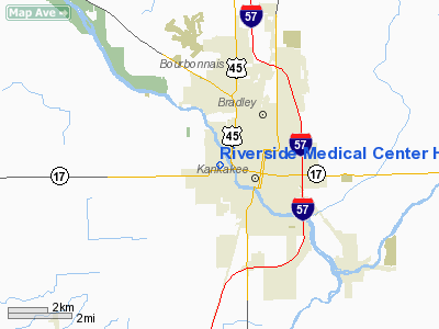
Riverside Medical Center Heliport |
|
|
Location
& QuickFacts
|
FAA
Information Effective: |
2007-12-20 |
|
Airport
Identifier: |
10IL |
|
Airport
Status: |
Operational |
|
Longitude/Latitude: |
087-53-07.1540W/41-07-25.1160N
-87.885321/41.123643 (Estimated) |
|
Elevation: |
620 ft / 188.98 m (Estimated) |
|
Land: |
0 acres |
|
From nearest
city: |
0 nautical miles N of Kankakee, IL |
|
Location: |
Kankakee County, IL |
|
Magnetic
Variation: |
01W (1985) |
Owner
& Manager
|
Ownership: |
Privately
owned |
|
Owner: |
Rivrside Medical Center |
|
Address: |
350 North Wall St
Kankakee,
IL 60901 |
|
Phone
number: |
815-933-1671 |
|
Manager: |
Robert G. Miller |
|
Address: |
350 North Wall St
Kankakee,
IL 60901 |
|
Phone
number: |
815-933-1671 |
Airport Operations
and Facilities
|
Airport
Use: |
Private
MEDICAL USE. |
|
Wind indicator: |
Yes |
|
Segmented
Circle: |
No |
|
Control
Tower: |
No |
|
Lighting
Schedule: |
PHONE REQ
FOR PERIMETER LGTS & ARPT BCN CALL 815-933-1671. |
|
Beacon
Color: |
Clear-Green-Yellow (heliport) |
|
Landing
fee charge: |
No |
|
Sectional
chart: |
Chicago |
|
Region: |
AGL - Great Lakes |
|
Boundary
ARTCC: |
ZAU - Chicago |
|
Tie-in
FSS: |
IKK - Kankakee |
|
FSS on
Airport: |
No |
|
FSS Toll
Free: |
1-800-WX-BRIEF |
Airport Services
|
Airframe
Repair: |
NONE |
|
Power
Plant Repair: |
NONE |
|
Runway Information
Helipad H1
|
Dimension: |
300 x 200 ft
/ 91.4 x 61.0 m |
|
Surface: |
CONC, |
|
|
Runway H1 |
Runway |
|
Traffic
Pattern: |
Left |
Left |
|
Obstruction: |
160 ft twr, 200.0 ft from runway |
|
|
Radio Navigation
Aids
|
ID |
Type |
Name |
Ch |
Freq |
Var |
Dist |
|
RZL |
NDB |
Rensselaer |
|
362.00 |
02W |
33.5 nm |
|
HK |
NDB |
Ermin |
|
332.00 |
01W |
35.9 nm |
|
MX |
NDB |
Kedzi |
|
248.00 |
01W |
38.2 nm |
|
OIX |
NDB |
Ottawa |
|
266.00 |
01E |
46.1 nm |
|
VP |
NDB |
Sedly |
|
212.00 |
02W |
49.6 nm |
|
IKK |
VOR/DME |
Kankakee |
053X |
111.60 |
00E |
3.4 nm |
|
RBS |
VOR/DME |
Roberts |
115X |
116.80 |
02E |
35.0 nm |
|
PNT |
VOR/DME |
Pontiac |
033X |
109.60 |
03E |
42.6 nm |
|
EON |
VORTAC |
Peotone |
079X |
113.20 |
02E |
9.8 nm |
|
CGT |
VORTAC |
Chicago Heights |
089X |
114.20 |
02E |
27.2 nm |
|
JOT |
VORTAC |
Joliet |
070X |
112.30 |
02E |
32.1 nm |
|
MDW |
VOT |
Chicago Midway |
|
111.00 |
|
40.3 nm |
Remarks
- INGRESS/EGRESS
FM SE CLKWS THRU NORTH.
Riverside Medical Center Heliport
Address:
Kankakee County, IL
Tel:
815-933-1671
Images
and information placed above are from
http://www.airport-data.com/airport/10IL/
We
thank them for the data!
| General
Info |
| Country |
United
States |
| State |
ILLINOIS
|
| FAA ID |
10IL |
| Latitude |
41-07-25.116N
|
| Longitude |
087-53-07.154W
|
| Elevation |
620 feet
|
| Near City |
KANKAKEE
|
We don't guarantee the information is fresh and accurate. The data may
be wrong or outdated.
For more up-to-date information please refer to other sources.
|
|


