 |
|
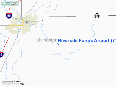
Location
& QuickFacts
|
FAA
Information Effective: |
2007-12-20 |
|
Airport
Identifier: |
71LL |
|
Airport
Status: |
Operational |
|
Longitude/Latitude: |
088-33-35.2110W/40-50-33.1200N
-88.559781/40.842533 (Estimated) |
|
Elevation: |
651 ft / 198.42 m (Surveyed) |
|
Land: |
0 acres |
|
From nearest
city: |
3 nautical miles SE of Pontiac, IL |
|
Location: |
Livingston County, IL |
|
Magnetic
Variation: |
00W (1985) |
Owner & Manager
|
Ownership: |
Privately
owned |
|
Owner: |
David Bruer |
|
Address: |
Route 4
Pontiac, IL 61764 |
|
Phone
number: |
815-842-2933 |
|
Manager: |
David Bruer |
|
Address: |
Route 4
Pontiac, IL 61764 |
|
Phone
number: |
815-842-2933 |
Airport
Operations and Facilities
|
Airport
Use: |
Private |
|
Wind indicator: |
Yes |
|
Segmented
Circle: |
No |
|
Control
Tower: |
No |
|
Landing
fee charge: |
No |
|
Sectional
chart: |
Chicago |
|
Region: |
AGL - Great Lakes |
|
Boundary
ARTCC: |
ZAU - Chicago |
|
Tie-in
FSS: |
IKK - Kankakee |
|
FSS on
Airport: |
No |
|
FSS Toll
Free: |
1-800-WX-BRIEF |
|
Runway Information
Runway 09/27
|
Dimension: |
2600 x 70 ft
/ 792.5 x 21.3 m |
|
Surface: |
TURF, |
|
|
Runway 09 |
Runway 27 |
|
Traffic
Pattern: |
Left |
Left |
|
Radio Navigation
Aids
|
ID |
Type |
Name |
Ch |
Freq |
Var |
Dist |
|
OIX |
NDB |
Ottawa |
|
266.00 |
01E |
34.0 nm |
|
VYS |
NDB |
Valley |
|
230.00 |
00W |
40.7 nm |
|
PI |
NDB |
Tungg |
|
356.00 |
01E |
49.2 nm |
|
PNT |
VOR/DME |
Pontiac |
033X |
109.60 |
03E |
8.0 nm |
|
RBS |
VOR/DME |
Roberts |
115X |
116.80 |
02E |
23.9 nm |
|
BMI |
VOR/DME |
Bloomington |
019X |
108.20 |
03E |
27.6 nm |
|
IKK |
VOR/DME |
Kankakee |
053X |
111.60 |
00E |
35.1 nm |
|
EON |
VORTAC |
Peotone |
079X |
113.20 |
02E |
43.3 nm |
|
JOT |
VORTAC |
Joliet |
070X |
112.30 |
02E |
43.7 nm |
Remarks
- TWR
1027' MSL 1-1/2 MILE NORTHEAST.
Based Aircraft
|
Aircraft
based on field: |
2 |
|
Single Engine
Airplanes: |
1 |
|
Multi Engine Airplanes: |
1 |
Riverode Farms Airport
Address:
Livingston County, IL
Tel:
815-842-2933
Images
and information placed above are from
http://www.airport-data.com/airport/71LL/
We
thank them for the data!
| General
Info |
| Country |
United
States |
| State |
ILLINOIS
|
| FAA ID |
71LL |
| Latitude |
40-50-33.120N
|
| Longitude |
088-33-35.211W
|
| Elevation |
651 feet
|
| Near City |
PONTIAC
|
We don't guarantee the information is fresh and accurate. The data may
be wrong or outdated.
For more up-to-date information please refer to other sources.
|
|


