 |
|
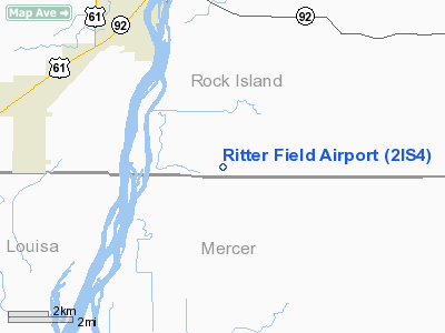
Location
& QuickFacts
|
FAA
Information Effective: |
2007-12-20 |
|
Airport
Identifier: |
2IS4 |
|
Airport
Status: |
Operational |
|
Longitude/Latitude: |
091-00-47.5290W/41-20-13.1080N
-91.013202/41.336974 (Estimated) |
|
Elevation: |
552 ft / 168.25 m (Surveyed) |
|
Land: |
5 acres |
|
From nearest
city: |
7 nautical miles SW of Illinois City, IL |
|
Location: |
Rock Island County, IL |
|
Magnetic
Variation: |
02E (1985) |
Owner
& Manager
|
Ownership: |
Privately
owned |
|
Owner: |
June Suoboda |
|
Address: |
18801 322 St W
Illinois City, IL 61259 |
|
Phone
number: |
309-537-3295 |
|
Manager: |
Carl Ritter |
|
Address: |
18425 322 St W
Illinois City, IL 61259 |
|
Phone
number: |
309-537-3178 |
Airport Operations
and Facilities
|
Airport
Use: |
Private |
|
Wind indicator: |
Yes |
|
Segmented
Circle: |
No |
|
Control
Tower: |
No |
|
Sectional
chart: |
Chicago |
|
Region: |
AGL - Great Lakes |
|
Boundary
ARTCC: |
ZAU - Chicago |
|
Tie-in
FSS: |
IKK - Kankakee |
|
FSS on
Airport: |
No |
|
FSS Toll
Free: |
1-800-WX-BRIEF |
|
Runway Information
Runway E/W
|
Dimension: |
1900 x 100 ft
/ 579.1 x 30.5 m |
|
Surface: |
TURF, |
|
|
Runway E |
Runway W |
|
Traffic
Pattern: |
Left |
Left |
|
Obstruction: |
|
20 ft pline, 500.0 ft from runway |
|
Radio Navigation
Aids
|
ID |
Type |
Name |
Ch |
Freq |
Var |
Dist |
|
AWG |
NDB |
Washington |
|
219.00 |
02E |
30.0 nm |
|
MPZ |
NDB |
Mount Pleasant |
|
212.00 |
02E |
32.6 nm |
|
CWI |
NDB |
Clinton |
|
377.00 |
01E |
42.7 nm |
|
OQW |
NDB |
Maquoketa |
|
386.00 |
02E |
44.6 nm |
|
FFL |
NDB |
Fairfield |
|
332.00 |
03E |
48.3 nm |
|
EZI |
NDB |
Kewanee |
|
245.00 |
01E |
48.3 nm |
|
DDD |
VOR/DME |
Port City |
112X |
116.50 |
01E |
6.4 nm |
|
GBG |
VOR/DME |
Galesburg |
035X |
109.80 |
03E |
35.5 nm |
|
CID |
VOR/DME |
Cedar Rapids |
088X |
114.10 |
05E |
48.0 nm |
|
MZV |
VORTAC |
Moline |
091X |
114.40 |
05E |
17.0 nm |
|
IOW |
VORTAC |
Iowa City |
109X |
116.20 |
05E |
29.2 nm |
|
CVA |
VORTAC |
Davenport |
085X |
113.80 |
04E |
32.7 nm |
|
BRL |
VORTAC |
Burlington |
051X |
111.40 |
05E |
37.1 nm |
|
DVN |
VOT |
Davenport Municipal |
|
111.80 |
|
25.3 nm |
Based Aircraft
|
Aircraft
based on field: |
2 |
|
Single Engine
Airplanes: |
2 |
Ritter Field Airport
Address:
Rock Island County, IL
Tel:
309-537-3295,
309-537-3178
Images
and information placed above are from
http://www.airport-data.com/airport/2IS4/
We
thank them for the data!
| General
Info |
| Country |
United
States |
| State |
ILLINOIS
|
| FAA ID |
2IS4 |
| Latitude |
41-20-13.108N
|
| Longitude |
091-00-47.529W
|
| Elevation |
552 feet
|
| Near City |
ILLINOIS
CITY |
We don't guarantee the information is fresh and accurate. The data may
be wrong or outdated.
For more up-to-date information please refer to other sources.
|
|


