 |
|
|
|
Location
& QuickFacts
|
FAA
Information Effective: |
2007-12-20 |
|
Airport
Identifier: |
3IS8 |
|
Airport
Status: |
Operational |
|
Longitude/Latitude: |
089-36-56.3460W/41-13-51.1340N
-89.615652/41.230871 (Estimated) |
|
Elevation: |
808 ft / 246.28 m (Surveyed) |
|
Land: |
25 acres |
|
From nearest
city: |
3 nautical miles NE of Bradford, IL |
|
Location: |
Bureau County, IL |
|
Magnetic
Variation: |
01E (1985) |
Owner & Manager
|
Ownership: |
Privately
owned |
|
Owner: |
Glen Rinkenberger |
|
Address: |
Rte 2
Bradford, IL 61421 |
|
Phone
number: |
309-897-4742 |
|
Address: |
|
Airport
Operations and Facilities
|
Airport
Use: |
Private |
|
Wind indicator: |
Yes |
|
Segmented
Circle: |
No |
|
Control
Tower: |
No |
|
Lighting
Schedule: |
PHONE REQ
FOR ROTG BCN PHONE 309-897-4742. |
|
Landing
fee charge: |
No |
|
Sectional
chart: |
Chicago |
|
Region: |
AGL - Great Lakes |
|
Traffic
Pattern Alt: |
800 ft |
|
Boundary
ARTCC: |
ZAU - Chicago |
|
Tie-in
FSS: |
IKK - Kankakee |
|
FSS on
Airport: |
No |
|
FSS Toll
Free: |
1-800-WX-BRIEF |
Airport Services
|
Airframe
Repair: |
NONE |
|
Power
Plant Repair: |
NONE |
|
Bottled
Oxygen: |
NONE |
|
Bulk Oxygen: |
NONE |
|
Runway Information
Runway 08/26
|
Dimension: |
2614 x 190 ft
/ 796.7 x 57.9 m |
|
Surface: |
TURF, |
|
|
Runway 08 |
Runway 26 |
|
Traffic
Pattern: |
Left |
Left |
|
Runway End
Identifier: |
No |
No |
|
Centerline
Lights: |
No |
No |
|
Touchdown
Lights: |
No |
No |
|
Runway 18/36
|
Dimension: |
1932 x 190 ft
/ 588.9 x 57.9 m |
|
Surface: |
TURF, |
|
|
Runway 18 |
Runway 36 |
|
Traffic
Pattern: |
Left |
Left |
|
Runway End
Identifier: |
No |
No |
|
Centerline
Lights: |
No |
No |
|
Touchdown
Lights: |
No |
No |
|
Radio Navigation
Aids
|
ID |
Type |
Name |
Ch |
Freq |
Var |
Dist |
|
EZI |
NDB |
Kewanee |
|
245.00 |
01E |
15.6 nm |
|
VYS |
NDB |
Valley |
|
230.00 |
00W |
22.4 nm |
|
BOZ |
NDB |
Whiteside |
|
254.00 |
01E |
29.9 nm |
|
OIX |
NDB |
Ottawa |
|
266.00 |
01E |
35.3 nm |
|
PI |
NDB |
Tungg |
|
356.00 |
01E |
37.6 nm |
|
CTK |
NDB |
Canton |
|
236.00 |
02E |
45.1 nm |
|
CWI |
NDB |
Clinton |
|
377.00 |
01E |
48.1 nm |
|
GBG |
VOR/DME |
Galesburg |
035X |
109.80 |
03E |
41.1 nm |
|
PLL |
VOR/DME |
Polo |
049X |
111.20 |
03E |
44.4 nm |
|
PNT |
VOR/DME |
Pontiac |
033X |
109.60 |
03E |
47.0 nm |
|
BDF |
VORTAC |
Bradford |
094X |
114.70 |
00E |
4.5 nm |
|
PIA |
VORTAC |
Peoria |
099X |
115.20 |
04E |
34.1 nm |
|
MZV |
VORTAC |
Moline |
091X |
114.40 |
05E |
46.5 nm |
|
CVA |
VORTAC |
Davenport |
085X |
113.80 |
04E |
48.5 nm |
|
DVN |
VOT |
Davenport Municipal |
|
111.80 |
|
49.3 nm |
Remarks
- THREE
112' LGTD & MKD TOWERS (RCAG SITE ANTENNAS) LCTD INBOARD OF THR
RWY 08 AND LEFT OF CNTRLN.
- EXISTED
PRIOR TO 1959.
Based Aircraft
|
Aircraft
based on field: |
16 |
|
Single Engine
Airplanes: |
16 |
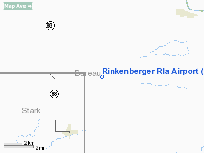
Rinkenberger Rla Airport
Address:
Bureau County, IL
Tel:
309-897-4742
Images
and information placed above are from
http://www.airport-data.com/airport/3IS8/
We
thank them for the data!
| General
Info |
| Country |
United
States |
| State |
ILLINOIS
|
| FAA ID |
3IS8 |
| Latitude |
41-13-51.134N
|
| Longitude |
089-36-56.346W
|
| Elevation |
808 feet
|
| Near City |
BRADFORD
|
We don't guarantee the information is fresh and accurate. The data may
be wrong or outdated.
For more up-to-date information please refer to other sources.
|
|


