 |
|
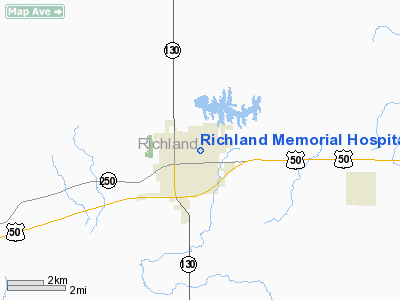
Richland Memorial Hospital Heliport |
|
|
Location
& QuickFacts
|
FAA
Information Effective: |
2007-12-20 |
|
Airport
Identifier: |
8LL4 |
|
Airport
Status: |
Operational |
|
Longitude/Latitude: |
088-04-38.1340W/38-44-15.1710N
-88.077259/38.737547 (Estimated) |
|
Elevation: |
485 ft / 147.83 m (Surveyed) |
|
Land: |
0 acres |
|
From nearest
city: |
1 nautical miles N of Olney, IL |
|
Location: |
Richland County, IL |
|
Magnetic
Variation: |
00E (1985) |
Owner
& Manager
|
Ownership: |
Privately
owned |
|
Owner: |
Richland Meml Hospital Inc |
|
Address: |
800 East Locust St
Olney,
IL 62450-2598 |
|
Phone
number: |
618-395-7340 |
|
Manager: |
Harvey H. Pettry |
|
Address: |
800 E.locust
Olney, IL 62450 |
|
Phone
number: |
618-395-2131 |
Airport
Operations and Facilities
|
Airport
Use: |
Private
MEDICAL USE. |
|
Wind indicator: |
Yes |
|
Segmented
Circle: |
No |
|
Control
Tower: |
No |
|
Lighting
Schedule: |
PHONE REQ
FOR ROTG BCN CALL 618-395-2131. |
|
Beacon
Color: |
Clear-Green-Yellow (heliport) |
|
Landing
fee charge: |
No |
|
Sectional
chart: |
St Louis |
|
Region: |
AGL - Great Lakes |
|
Boundary
ARTCC: |
ZID - Indianapolis |
|
Tie-in
FSS: |
COU - Columbia |
|
FSS on
Airport: |
No |
|
FSS Toll
Free: |
1-800-WX-BRIEF |
|
Runway Information
Helipad H1
|
Dimension: |
40 x 40 ft /
12.2 x 12.2 m |
|
Surface: |
CONC, |
|
|
Runway H1 |
Runway |
|
Traffic
Pattern: |
Left |
Left |
|
Radio Navigation
Aids
|
ID |
Type |
Name |
Ch |
Freq |
Var |
Dist |
|
OLY |
NDB |
Olney |
|
272.00 |
00W |
4.6 nm |
|
FOA |
NDB |
Elm River |
|
353.00 |
00E |
18.1 nm |
|
AJG |
NDB |
Mount Carmel |
|
524.00 |
02W |
18.1 nm |
|
OEA |
NDB |
Vincennes |
|
251.00 |
00E |
24.6 nm |
|
PLX |
NDB |
Palestine |
|
391.00 |
00W |
26.3 nm |
|
FWC |
NDB |
Wayne County |
|
257.00 |
01E |
26.6 nm |
|
CZB |
NDB |
Casey |
|
359.00 |
00E |
34.3 nm |
|
SIV |
NDB |
Sullivan |
|
326.00 |
02W |
37.1 nm |
|
CUL |
NDB |
Carmi |
|
332.00 |
01W |
38.8 nm |
|
SLO |
NDB |
Salem |
|
400.00 |
01W |
42.1 nm |
|
MT |
NDB |
Zebre |
|
347.00 |
00E |
42.6 nm |
|
DCY |
NDB |
Washington |
|
212.00 |
03W |
44.4 nm |
|
PDW |
NDB |
Evansville |
|
284.00 |
00E |
49.2 nm |
|
SAM |
VOR/DME |
Samsville |
113X |
116.60 |
03E |
15.2 nm |
|
LWV |
VOR/DME |
Lawrenceville |
025X |
108.80 |
01W |
22.3 nm |
|
RSV |
VOR/DME |
Robinson |
021X |
108.40 |
02E |
26.2 nm |
|
VNN |
VOR/DME |
Mount Vernon |
085X |
113.80 |
02E |
41.1 nm |
|
MTO |
VOR/DME |
Mattoon |
031X |
109.40 |
03E |
45.6 nm |
|
BIB |
VORTAC |
Bible Grove |
027X |
109.00 |
03E |
21.9 nm |
Remarks
- FIRE
EXTINGUISHERS AVBL FOR LANDINGS.
- ALL
INGRESS/EGRESS ROUTES ARE TO BE TO THE NORTH AND/OR WEST.
Richland Memorial Hospital Heliport
Address:
Richland County, IL
Tel:
618-395-7340,
618-395-2131
Images
and information placed above are from
http://www.airport-data.com/airport/8LL4/
We
thank them for the data!
| General
Info |
| Country |
United
States |
| State |
ILLINOIS
|
| FAA ID |
8LL4 |
| Latitude |
38-44-15.171N
|
| Longitude |
088-04-38.134W
|
| Elevation |
485 feet
|
| Near City |
OLNEY
|
We don't guarantee the information is fresh and accurate. The data may
be wrong or outdated.
For more up-to-date information please refer to other sources.
|
|


