 |
|
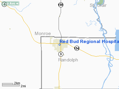
Red Bud Regional Hospital Heliport |
Location
& QuickFacts
|
FAA
Information Effective: |
2007-12-20 |
|
Airport
Identifier: |
78IS |
|
Airport
Status: |
Operational |
|
Longitude/Latitude: |
089-59-48.0000W/38-12-35.0000N
-89.996667/38.209722 (Estimated) |
|
Elevation: |
420 ft / 128.02 m (Estimated) |
|
Land: |
0 acres |
|
From nearest
city: |
0 nautical miles N of Red Bud, IL |
|
Location: |
Randolph County, IL |
|
Magnetic
Variation: |
00E (2000) |
Owner
& Manager
|
Ownership: |
Privately
owned |
|
Owner: |
Unity - St Clements Health Services |
|
Address: |
1 St Clement Blvd
Red Bud, IL 62278 |
|
Phone
number: |
618-282-3831 |
|
Manager: |
Mike Mcmanus |
|
Address: |
1 St Clement Blvd
Red Bud, IL 62278 |
|
Phone
number: |
618-282-3831 |
Airport Operations
and Facilities
|
Airport
Use: |
Private |
|
Segmented
Circle: |
No |
|
Control
Tower: |
No |
|
Lighting
Schedule: |
PHONE REQ
FOR PERIMETER & FLOOD LGTS CALL 618-282-3831. |
|
Sectional
chart: |
St Louis |
|
Region: |
AGL - Great Lakes |
|
Boundary
ARTCC: |
ZKC - Kansas City |
|
Tie-in
FSS: |
COU - Columbia |
|
FSS Toll
Free: |
1-800-WX-BRIEF |
|
Runway Information
Helipad HI
|
Dimension: |
40 x 40 ft /
12.2 x 12.2 m |
|
Surface: |
CONC, |
|
|
Runway HI |
Runway |
|
Traffic
Pattern: |
Left |
Left |
|
Radio Navigation
Aids
|
ID |
Type |
Name |
Ch |
Freq |
Var |
Dist |
|
SAR |
NDB |
Sparta |
|
239.00 |
01E |
14.4 nm |
|
FES |
NDB |
Festus |
|
269.00 |
01E |
18.5 nm |
|
BL |
NDB |
Belleville |
|
362.00 |
02E |
19.1 nm |
|
PJY |
NDB |
Pinckneyville |
|
215.00 |
00E |
33.1 nm |
|
PRI |
NDB |
Perrine |
|
367.00 |
02E |
33.7 nm |
|
CVM |
NDB |
Civic Memorial |
|
263.00 |
02E |
41.1 nm |
|
LM |
NDB |
Oblio |
|
338.00 |
00E |
42.0 nm |
|
SKE |
TACAN |
Scott |
059X |
|
02E |
21.3 nm |
|
CSX |
VOR/DME |
Cardinal |
111Y |
116.45 |
00E |
36.9 nm |
|
TOY |
VORTAC |
Troy |
107X |
116.00 |
04E |
32.0 nm |
|
FAM |
VORTAC |
Farmington |
104X |
115.70 |
01E |
34.1 nm |
|
ENL |
VORTAC |
Centralia |
097X |
115.00 |
04E |
41.5 nm |
|
STL |
VORTAC |
St Louis |
121X |
117.40 |
01E |
45.3 nm |
|
STL |
VOT |
St Louis Lambert |
|
111.00 |
|
36.7 nm |
|
SUS |
VOT |
Spirit Of St Louis |
|
112.20 |
|
41.1 nm |
Remarks
- SEE
AIRSPACE CASE 82-AGL-152-NRA.
Red Bud Regional Hospital Heliport
Address:
Randolph County, IL
Tel:
618-282-3831
Images
and information placed above are from
http://www.airport-data.com/airport/78IS/
We
thank them for the data!
| General
Info |
| Country |
United
States |
| State |
ILLINOIS
|
| FAA ID |
78IS |
| Latitude |
38-12-35.000N
|
| Longitude |
089-59-48.000W
|
| Elevation |
420 feet
|
| Near City |
RED BUD
|
We don't guarantee the information is fresh and accurate. The data may
be wrong or outdated.
For more up-to-date information please refer to other sources.
|
|


