 |
|
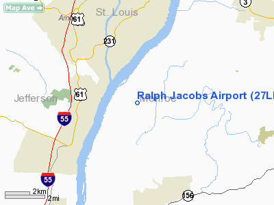
Location
& QuickFacts
|
FAA
Information Effective: |
2007-12-20 |
|
Airport
Identifier: |
27LL |
|
Airport
Status: |
Operational |
|
Longitude/Latitude: |
090-19-09.4220W/38-22-30.1930N
-90.319284/38.375054 (Estimated) |
|
Elevation: |
400 ft / 121.92 m (Estimated) |
|
Land: |
0 acres |
|
From nearest
city: |
4 nautical miles N of Valmeyer, IL |
|
Location: |
Monroe County, IL |
|
Magnetic
Variation: |
02E (1985) |
Owner
& Manager
|
Ownership: |
Privately
owned |
|
Owner: |
Ralph Jacobs |
|
Address: |
Rte 1
Valmeyer, IL 62295 |
|
Phone
number: |
618-935-2571 |
|
Manager: |
Ralph Jacobs |
|
Address: |
Rte 1
Valmeyer, IL 62295 |
|
Phone
number: |
618-935-2571 |
Airport
Operations and Facilities
|
Airport
Use: |
Private |
|
Wind indicator: |
Yes |
|
Segmented
Circle: |
No |
|
Control
Tower: |
No |
|
Landing
fee charge: |
No |
|
Sectional
chart: |
St Louis |
|
Region: |
AGL - Great Lakes |
|
Boundary
ARTCC: |
ZKC - Kansas City |
|
Tie-in
FSS: |
COU - Columbia |
|
FSS on
Airport: |
No |
|
FSS Toll
Free: |
1-800-WX-BRIEF |
|
Runway Information
Runway 10/28
|
Dimension: |
1950 x 85 ft
/ 594.4 x 25.9 m |
|
Surface: |
TURF, |
|
|
Runway 10 |
Runway 28 |
|
Traffic
Pattern: |
Left |
Left |
|
Runway 18/36
|
Dimension: |
2350 x 85 ft
/ 716.3 x 25.9 m |
|
Surface: |
TURF, |
|
|
Runway 18 |
Runway 36 |
|
Traffic
Pattern: |
Left |
Left |
|
Radio Navigation
Aids
|
ID |
Type |
Name |
Ch |
Freq |
Var |
Dist |
|
FES |
NDB |
Festus |
|
269.00 |
01E |
11.2 nm |
|
LM |
NDB |
Oblio |
|
338.00 |
00E |
26.6 nm |
|
BL |
NDB |
Belleville |
|
362.00 |
02E |
27.1 nm |
|
SAR |
NDB |
Sparta |
|
239.00 |
01E |
32.2 nm |
|
CVM |
NDB |
Civic Memorial |
|
263.00 |
02E |
33.5 nm |
|
PRI |
NDB |
Perrine |
|
367.00 |
02E |
37.0 nm |
|
UUV |
NDB |
Sullivan |
|
356.00 |
02E |
40.7 nm |
|
SKE |
TACAN |
Scott |
059X |
|
02E |
24.3 nm |
|
CSX |
VOR/DME |
Cardinal |
111Y |
116.45 |
00E |
22.8 nm |
|
TOY |
VORTAC |
Troy |
107X |
116.00 |
04E |
28.9 nm |
|
STL |
VORTAC |
St Louis |
121X |
117.40 |
01E |
30.2 nm |
|
FTZ |
VORTAC |
Foristell |
045X |
110.80 |
05E |
36.2 nm |
|
FAM |
VORTAC |
Farmington |
104X |
115.70 |
01E |
42.4 nm |
|
STL |
VOT |
St Louis Lambert |
|
111.00 |
|
22.5 nm |
|
SUS |
VOT |
Spirit Of St Louis |
|
112.20 |
|
23.3 nm |
Based Aircraft
|
Aircraft
based on field: |
20 |
|
Single Engine
Airplanes: |
15 |
|
Multi Engine Airplanes: |
5 |
Ralph Jacobs Airport
Address:
Monroe County, IL
Tel:
618-935-2571
Images
and information placed above are from
http://www.airport-data.com/airport/27LL/
We
thank them for the data!
| General
Info |
| Country |
United
States |
| State |
ILLINOIS
|
| FAA ID |
27LL |
| Latitude |
38-22-30.193N
|
| Longitude |
090-19-09.422W
|
| Elevation |
400 feet
|
| Near City |
VALMEYER
|
We don't guarantee the information is fresh and accurate. The data may
be wrong or outdated.
For more up-to-date information please refer to other sources.
|
|


