 |
|
|
|
|
|
Location
& QuickFacts
|
FAA
Information Effective: |
2007-12-20 |
|
Airport
Identifier: |
7B1 |
|
Airport
Status: |
Operational |
|
Longitude/Latitude: |
089-40-33.3590W/40-46-31.1330N
-89.675933/40.775315 (Estimated) |
|
Elevation: |
700 ft / 213.36 m (Estimated) |
|
Land: |
1 acres |
|
From nearest
city: |
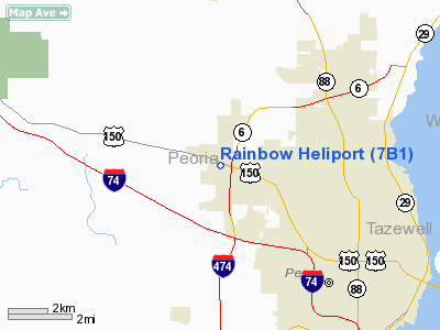
5 nautical miles NW of Peoria, IL |
|
Location: |
Peoria County, IL |
|
Magnetic
Variation: |
01E (1985) |
Owner
& Manager
|
Ownership: |
Privately
owned |
|
Owner: |
Warren Frye Farms |
|
Address: |
5400 Rte 150 West
Peoria, IL 61615 |
|
Phone
number: |
309-691-4135 |
|
Manager: |
Warren Frye |
|
Address: |
5400 Rte 150 West
Peoria, IL 61615 |
|
Phone
number: |
309-691-4135 |
Airport
Operations and Facilities
|
Airport
Use: |
Open
to public |
|
Wind indicator: |
Yes |
|
Segmented
Circle: |
No |
|
Control
Tower: |
No |
|
Landing
fee charge: |
No |
|
Sectional
chart: |
Chicago |
|
Region: |
AGL - Great Lakes |
|
Traffic
Pattern Alt: |
700 ft |
|
Boundary
ARTCC: |
ZAU - Chicago |
|
Tie-in
FSS: |
IKK - Kankakee |
|
FSS on
Airport: |
No |
|
FSS Toll
Free: |
1-800-WX-BRIEF |
|
NOTAMs
Facility: |
IKK (NOTAM-d service avaliable) |
Airport
Communications
|
CTAF: |
123.050 |
|
Unicom: |
123.050
|
Airport
Services
|
Bottled
Oxygen: |
NONE |
|
Bulk Oxygen: |
NONE |
|
Runway Information
Helipad H1
|
Dimension: |
225 x 82 ft
/ 68.6 x 25.0 m |
|
Surface: |
TURF, Good Condition |
|
|
Runway H1 |
Runway |
|
Traffic
Pattern: |
Left |
Left |
|
Markings: |
Nonstandard, Good Condition
MKD WITH 'H' IN THE GRASS. |
,
MKD WITH 'H' IN THE GRASS. |
|
Obstruction: |
31 ft tree, 476.0 ft from runway, 15:1 slope
to clear |
|
|
Radio Navigation
Aids
|
ID |
Type |
Name |
Ch |
Freq |
Var |
Dist |
|
PI |
NDB |
Tungg |
|
356.00 |
01E |
10.9 nm |
|
CTK |
NDB |
Canton |
|
236.00 |
02E |
22.2 nm |
|
EZI |
NDB |
Kewanee |
|
245.00 |
01E |
28.6 nm |
|
AAA |
NDB |
Abraham |
|
329.00 |
00E |
40.1 nm |
|
VYS |
NDB |
Valley |
|
230.00 |
00W |
42.3 nm |
|
JZY |
NDB |
Macomb |
|
251.00 |
01E |
43.2 nm |
|
GBG |
VOR/DME |
Galesburg |
035X |
109.80 |
03E |
35.8 nm |
|
BMI |
VOR/DME |
Bloomington |
019X |
108.20 |
03E |
38.3 nm |
|
PNT |
VOR/DME |
Pontiac |
033X |
109.60 |
03E |
43.0 nm |
|
PIA |
VORTAC |
Peoria |
099X |
115.20 |
04E |
7.8 nm |
|
BDF |
VORTAC |
Bradford |
094X |
114.70 |
00E |
23.4 nm |
Remarks
- APCH/DEP
FM 010-220 DEG CLKWS ONLY.
- PRVDD
INGRESS/EGRESS OPNS ARE CONDD ONLY ON THE BRGS 090, 180 & 270 DEG
FM PAD USING PAD AS CNTR OF COMPASS ROSE.
Operational Statistics
Time
Period: 2005-01-01 - 2005-12-31
|
Aircraft
Operations: |
5/Month |
|
General Aviation
Itinerant: |
16.7% |
|
Military: |
83.3% |
Rainbow Heliport
Address:
Peoria County, IL
Tel:
309-691-4135
Images
and information placed above are from
http://www.airport-data.com/airport/7B1/
We
thank them for the data!
| General
Info |
| Country |
United
States |
| State |
ILLINOIS
|
| FAA ID |
7B1 |
| Latitude |
40-46-31.133N
|
| Longitude |
089-40-33.359W
|
| Elevation |
700 feet
|
| Near City |
PEORIA
|
We don't guarantee the information is fresh and accurate. The data may
be wrong or outdated.
For more up-to-date information please refer to other sources.
|
|


