 |
|
|
|
|
|
Location
& QuickFacts
|
FAA
Information Effective: |
2007-12-20 |
|
Airport
Identifier: |
I04 |
|
Airport
Status: |
Operational |
|
Longitude/Latitude: |
090-29-34.4790W/41-27-36.1220N
-90.492911/41.460034 (Estimated) |
|
Elevation: |
560 ft / 170.69 m (Estimated) |
|
Land: |
2 acres |
|
From nearest
city: |
2 nautical miles S of Moline, IL |
|
Location: |
Rock Island County, IL |
|
Magnetic
Variation: |
01E (1985) |
Owner
& Manager
|
Ownership: |
Privately
owned |
|
Owner: |
James A Goetsch |
|
Address: |
3205 S. Shore Dr
Moline, IL 61265 |
|
Phone
number: |
309-799-3251 |
|
Manager: |
James A Goetsch |
|
Address: |
3205 S. Shore Dr
Moline, IL 61265 |
|
Phone
number: |
800-678-9747 |
Airport
Operations and Facilities
|
Airport
Use: |
Open
to public |
|
Segmented
Circle: |
Yes |
|
Control
Tower: |
No |
|
Landing
fee charge: |
No |
|
Sectional
chart: |
Chicago |
|
Region: |
AGL - Great Lakes |
|
Traffic
Pattern Alt: |
400 ft |
|
Boundary
ARTCC: |
ZAU - Chicago |
|
Tie-in
FSS: |
IKK - Kankakee |
|
FSS on
Airport: |
No |
|
FSS Toll
Free: |
1-800-WX-BRIEF |
|
NOTAMs
Facility: |
IKK (NOTAM-d service avaliable) |
Airport
Communications
Airport
Services
|
Fuel
available: |
100LL |
|
Airframe
Repair: |
MINOR |
|
Power
Plant Repair: |
MINOR |
|
Bottled
Oxygen: |
NONE |
|
Bulk Oxygen: |
NONE |
|
Runway Information
Runway E/W
|
Dimension: |
10000 x 300
ft / 3048.0 x 91.4 m |
|
Surface: |
WATER, Fair Condition |
|
|
Runway E |
Runway W |
|
Traffic
Pattern: |
Right |
Left |
|
Markings: |
None, |
None, |
|
Runway End
Identifier: |
No |
No |
|
Centerline
Lights: |
No |
No |
|
Touchdown
Lights: |
No |
No |
|
Radio Navigation
Aids
|
ID |
Type |
Name |
Ch |
Freq |
Var |
Dist |
|
CWI |
NDB |
Clinton |
|
377.00 |
01E |
23.4 nm |
|
EZI |
NDB |
Kewanee |
|
245.00 |
01E |
28.7 nm |
|
BOZ |
NDB |
Whiteside |
|
254.00 |
01E |
35.2 nm |
|
OQW |
NDB |
Maquoketa |
|
386.00 |
02E |
37.2 nm |
|
DDD |
VOR/DME |
Port City |
112X |
116.50 |
01E |
30.1 nm |
|
GBG |
VOR/DME |
Galesburg |
035X |
109.80 |
03E |
31.5 nm |
|
MZV |
VORTAC |
Moline |
091X |
114.40 |
05E |
10.6 nm |
|
CVA |
VORTAC |
Davenport |
085X |
113.80 |
04E |
14.9 nm |
|
BDF |
VORTAC |
Bradford |
094X |
114.70 |
00E |
44.7 nm |
|
BRL |
VORTAC |
Burlington |
051X |
111.40 |
05E |
48.4 nm |
|
DVN |
VOT |
Davenport Municipal |
|
111.80 |
|
10.0 nm |
Remarks
- TRAFFIC
INFORMATION AVBL FM MLI ATCT ON 119.4. INDIVIDUAL OPERATIONS MUST BE
APPROVED BY MLI ATCT ON 119.4 OR BY TELEPHONE.
- E
& W RWY THRS UNMKD BY BUOYS.
- RY
E,MARKED PLINE CROSSES RIVER 300 FT E OF HGR & DOCK AREA; HWY BRIDGE
300 FT W OF HGR & DOCK AREA.
- EXISTED
PRIOR TO 1959.
Based
Aircraft
|
Aircraft
based on field: |
1 |
|
Single Engine
Airplanes: |
1 |
Operational Statistics
Time
Period: 2006-01-01 - 2006-12-31
|
Aircraft
Operations: |
48/Week |
|
General Aviation
Local: |
96.8% |
|
General Aviation
Itinerant: |
3.2% |
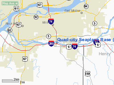
Quad-city Seaplane Base
Address:
Rock Island County, IL
Tel:
309-799-3251,
800-678-9747
Images
and information placed above are from
http://www.airport-data.com/airport/I04/
We
thank them for the data!
| General
Info |
| Country |
United
States |
| State |
ILLINOIS
|
| FAA ID |
I04 |
| Latitude |
41-27-36.122N
|
| Longitude |
090-29-34.479W
|
| Elevation |
560 feet
|
| Near City |
MOLINE
|
We don't guarantee the information is fresh and accurate. The data may
be wrong or outdated.
For more up-to-date information please refer to other sources.
|
|


