 |
|
|
|
|
|
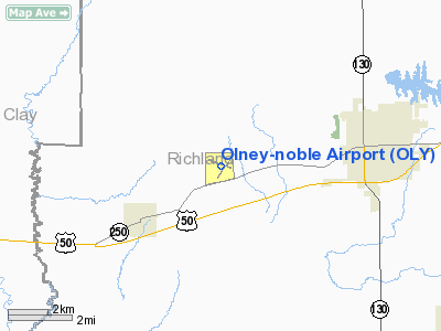
Location
& QuickFacts
|
FAA
Information Effective: |
2007-12-20 |
|
Airport
Identifier: |
OLY |
|
Airport
Status: |
Operational |
|
Longitude/Latitude: |
088-10-35.1580W/38-43-18.5780N
-88.176433/38.721827 (Estimated) |
|
Elevation: |
482 ft / 146.91 m (Surveyed) |
|
Land: |
375 acres |
|
From nearest
city: |
4 nautical miles W of Olney-noble, IL |
|
Location: |
Richland County, IL |
|
Magnetic
Variation: |
00E (1985) |
Owner & Manager
|
Ownership: |
Publicly
owned |
|
Owner: |
Olney-noble Apt Auth |
|
Address: |
2632 E. Il250
Noble, IL 62868 |
|
Phone
number: |
618-393-2967 |
|
Manager: |
Thomas D. Baker |
|
Address: |
2632 E. Il250
Noble, IL 62868 |
|
Phone
number: |
618-393-2967 |
Airport
Operations and Facilities
|
Airport
Use: |
Open
to public |
|
Wind indicator: |
Yes |
|
Segmented
Circle: |
Yes |
|
Control
Tower: |
No |
|
Lighting
Schedule: |
DUSK-DAWN
MIRL RY 11/29 PRESET ON LOW INTST - TO INCR INTST &
ACTVT VASI RYS 11 & 29; REIL RY 11; MIRL RY 03/21 &
REIL RY 03 - CTAF. |
|
Beacon
Color: |
Clear-Green (lighted land airport) |
|
Landing
fee charge: |
No |
|
Sectional
chart: |
St Louis |
|
Region: |
AGL - Great Lakes |
|
Traffic
Pattern Alt: |
800 ft |
|
Boundary
ARTCC: |
ZKC - Kansas City |
|
Tie-in
FSS: |
STL - Saint Louis |
|
FSS on
Airport: |
No |
|
FSS Toll
Free: |
1-800-WX-BRIEF |
|
NOTAMs
Facility: |
OLY (NOTAM-d service avaliable) |
|
Federal
Agreements: |
NGY |
Airport Communications
|
CTAF: |
123.000 |
|
Unicom: |
123.000
|
Airport
Services
|
Fuel
available: |
100LL |
|
Airframe
Repair: |
MAJOR |
|
Power
Plant Repair: |
MAJOR |
|
Bottled
Oxygen: |
NONE |
|
Runway Information
Runway 03/21
|
Dimension: |
3599 x 60 ft
/ 1097.0 x 18.3 m |
|
Surface: |
ASPH, Good Condition |
|
Weight Limit: |
Single wheel: 18000 lbs.
Dual wheel: 25000 lbs. |
|
Edge Lights: |
Medium |
|
|
Runway 03 |
Runway 21 |
|
Longitude: |
088-10-43.6530W |
088-10-17.0410W |
|
Latitude: |
38-42-59.6000N |
38-43-28.4270N |
|
Elevation: |
465.00 ft |
472.00 ft |
|
Alignment: |
35 |
127 |
|
Traffic
Pattern: |
Left |
Left |
|
Markings: |
Non-precision instrument, Fair Condition |
Non-precision instrument, Fair Condition |
|
Runway End
Identifier: |
Yes |
No |
|
Centerline
Lights: |
No |
No |
|
Touchdown
Lights: |
No |
No |
|
Obstruction: |
52 ft tree, 1561.0 ft from runway, 368 ft left
of centerline, 26:1 slope to clear |
44 ft trees, 1089.0 ft from runway, 49 ft left
of centerline, 20:1 slope to clear |
|
Runway 11/29
|
Dimension: |
4100 x 75 ft
/ 1249.7 x 22.9 m |
|
Surface: |
ASPH, Good Condition |
|
Weight Limit: |
Single wheel: 12000 lbs. |
|
Edge Lights: |
Medium |
|
|
Runway 11 |
Runway 29 |
|
Longitude: |
088-11-04.0980W |
088-10-14.6660W |
|
Latitude: |
38-43-28.5550N |
38-43-16.6140N |
|
Elevation: |
482.00 ft |
469.00 ft |
|
Alignment: |
107 |
127 |
|
ILS Type: |
LOC/DME |
|
|
Traffic
Pattern: |
Left |
Left |
|
Markings: |
Non-precision instrument, Good Condition |
Non-precision instrument, Good Condition |
|
Crossing
Height: |
25.00 ft |
25.00 ft |
|
VASI: |
2-box on left side |
2-box on left side |
|
Visual Glide
Angle: |
3.00° |
3.00° |
|
Runway End
Identifier: |
Yes |
No |
|
Centerline
Lights: |
No |
No |
|
Touchdown
Lights: |
No |
No |
|
Obstruction: |
12 ft road, 460.0 ft from runway, 285 ft right
of centerline, 21:1 slope to clear |
44 ft tree, 1210.0 ft from runway, 186 ft left
of centerline, 22:1 slope to clear |
|
Radio Navigation
Aids
|
ID |
Type |
Name |
Ch |
Freq |
Var |
Dist |
|
OLY |
NDB |
Olney |
|
272.00 |
00W |
0.3 nm |
|
FOA |
NDB |
Elm River |
|
353.00 |
00E |
13.4 nm |
|
AJG |
NDB |
Mount Carmel |
|
524.00 |
02W |
22.1 nm |
|
FWC |
NDB |
Wayne County |
|
257.00 |
01E |
23.3 nm |
|
OEA |
NDB |
Vincennes |
|
251.00 |
00E |
29.2 nm |
|
PLX |
NDB |
Palestine |
|
391.00 |
00W |
30.6 nm |
|
CZB |
NDB |
Casey |
|
359.00 |
00E |
36.0 nm |
|
SLO |
NDB |
Salem |
|
400.00 |
01W |
37.4 nm |
|
CUL |
NDB |
Carmi |
|
332.00 |
01W |
37.9 nm |
|
SIV |
NDB |
Sullivan |
|
326.00 |
02W |
41.5 nm |
|
MT |
NDB |
Zebre |
|
347.00 |
00E |
43.3 nm |
|
DCY |
NDB |
Washington |
|
212.00 |
03W |
49.0 nm |
|
SAM |
VOR/DME |
Samsville |
113X |
116.60 |
03E |
14.8 nm |
|
LWV |
VOR/DME |
Lawrenceville |
025X |
108.80 |
01W |
27.0 nm |
|
RSV |
VOR/DME |
Robinson |
021X |
108.40 |
02E |
30.5 nm |
|
VNN |
VOR/DME |
Mount Vernon |
085X |
113.80 |
02E |
36.7 nm |
|
MTO |
VOR/DME |
Mattoon |
031X |
109.40 |
03E |
45.7 nm |
|
BIB |
VORTAC |
Bible Grove |
027X |
109.00 |
03E |
18.6 nm |
|
ENL |
VORTAC |
Centralia |
097X |
115.00 |
04E |
49.6 nm |
Based Aircraft
|
Aircraft
based on field: |
18 |
|
Single Engine
Airplanes: |
10 |
|
Multi Engine Airplanes: |
1 |
|
Ultralights: |
7 |
Operational Statistics
Time
Period: 2004-10-01 - 2005-09-30
|
Aircraft
Operations: |
116/Week |
|
Air Taxi: |
12.5% |
|
General Aviation
Local: |
50.0% |
|
General Aviation
Itinerant: |
37.5% |
Olney-noble Airport
Address:
Richland County, IL
Tel:
618-393-2967
Images
and information placed above are from
http://www.airport-data.com/airport/OLY/
We
thank them for the data!
| General
Info |
| Country |
United
States |
| State |
ILLINOIS
|
| FAA ID |
OLY |
| Latitude |
38-43-18.578N
|
| Longitude |
088-10-35.158W
|
| Elevation |
482 feet
|
| Near City |
OLNEY-NOBLE
|
We don't guarantee the information is fresh and accurate. The data may
be wrong or outdated.
For more up-to-date information please refer to other sources.
|
|


