 |
|
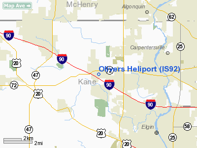
Location
& QuickFacts
|
FAA
Information Effective: |
2007-12-20 |
|
Airport
Identifier: |
IS92 |
|
Airport
Status: |
Operational |
|
Longitude/Latitude: |
088-22-09.2970W/42-06-00.0900N
-88.369249/42.100025 (Estimated) |
|
Elevation: |
895 ft / 272.80 m (Estimated) |
|
Land: |
2 acres |
|
From nearest
city: |
0 nautical miles SE of Gilberts, IL |
|
Location: |
Kane County, IL |
|
Magnetic
Variation: |
01E (1985) |
Owner & Manager
|
Ownership: |
Privately
owned |
|
Owner: |
Olivers Helicopters Inc |
|
Address: |
120 Center Dr
Gilberts, IL 60136 |
|
Phone
number: |
847-428-3818 |
|
Manager: |
Darrel Oliver |
|
Address: |
120 Center Dr
Gilberts, IL 60136 |
|
Phone
number: |
847-428-3818 |
Airport
Operations and Facilities
|
Airport
Use: |
Private |
|
Wind indicator: |
Yes |
|
Segmented
Circle: |
No |
|
Control
Tower: |
No |
|
Sectional
chart: |
Chicago |
|
Region: |
AGL - Great Lakes |
|
Boundary
ARTCC: |
ZAU - Chicago |
|
Tie-in
FSS: |
IKK - Kankakee |
|
FSS Toll
Free: |
1-800-WX-BRIEF |
|
Runway Information
Helipad H1
|
Dimension: |
20 x 20 ft /
6.1 x 6.1 m |
|
Surface: |
CONC, |
|
|
Runway H1 |
Runway |
|
Traffic
Pattern: |
Left |
Left |
|
Radio Navigation
Aids
|
ID |
Type |
Name |
Ch |
Freq |
Var |
Dist |
|
ME |
NDB |
Deana |
|
350.00 |
00E |
17.2 nm |
|
DKB |
NDB |
Dekalb |
|
209.00 |
02W |
18.1 nm |
|
HK |
NDB |
Ermin |
|
332.00 |
01W |
33.1 nm |
|
MX |
NDB |
Kedzi |
|
248.00 |
01W |
37.3 nm |
|
LVV |
NDB |
Lake Lawn |
|
404.00 |
00W |
37.3 nm |
|
RA |
NDB |
Paser |
|
206.00 |
00E |
40.8 nm |
|
JVL |
NDB |
Janesville |
|
375.00 |
03E |
43.0 nm |
|
OIX |
NDB |
Ottawa |
|
266.00 |
01E |
49.4 nm |
|
DPA |
VOR/DME |
Dupage |
021X |
108.40 |
02E |
12.6 nm |
|
OBK |
VOR/DME |
Northbrook |
077X |
113.00 |
02W |
20.0 nm |
|
ORD |
VOR/DME |
Chicago O'hare |
086X |
113.90 |
02E |
21.8 nm |
|
BUU |
VOR/DME |
Burbun |
092X |
114.50 |
01W |
35.5 nm |
|
ENW |
VOR/DME |
Kenosha |
029X |
109.20 |
02W |
35.7 nm |
|
RFD |
VOR/DME |
Rockford |
045X |
110.80 |
01E |
37.7 nm |
|
JVL |
VOR/DME |
Janesville |
090X |
114.30 |
03E |
42.7 nm |
|
HRK |
VOR/DME |
Horlick |
124X |
117.70 |
02W |
46.8 nm |
|
JOT |
VORTAC |
Joliet |
070X |
112.30 |
02E |
33.4 nm |
|
ORD |
VOT |
Chicago O'hare Intl |
|
112.00 |
|
21.8 nm |
|
MDW |
VOT |
Chicago Midway |
|
111.00 |
|
33.4 nm |
Remarks
- PRVDD
APCH/DEP OPERATIONS ARE CONDUCTED FROM 180-270 DEGREES; AREA IS MARKED;
WIND INDICATOR MAINTAINED; USERS BE ADVISED OF PLINES NORTH & EAST.
Based Aircraft
|
Aircraft
based on field: |
4 |
|
Helicopters: |
4 |
Olivers Heliport
Address:
Kane County, IL
Tel:
847-428-3818
Images
and information placed above are from
http://www.airport-data.com/airport/IS92/
We
thank them for the data!
| General
Info |
| Country |
United
States |
| State |
ILLINOIS
|
| FAA ID |
IS92 |
| Latitude |
42-06-00.090N
|
| Longitude |
088-22-09.297W
|
| Elevation |
895 feet
|
| Near City |
GILBERTS
|
We don't guarantee the information is fresh and accurate. The data may
be wrong or outdated.
For more up-to-date information please refer to other sources.
|
|


