|
|
|
 |
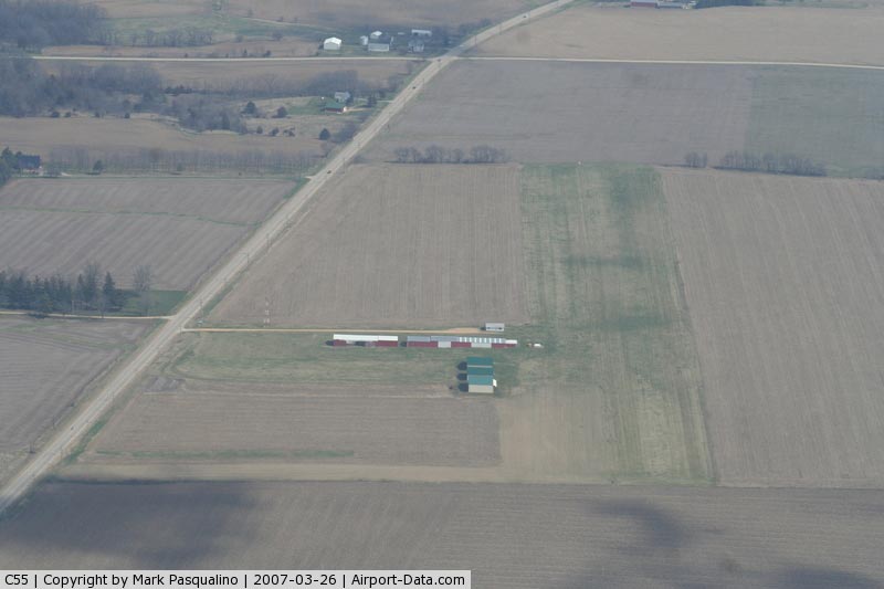
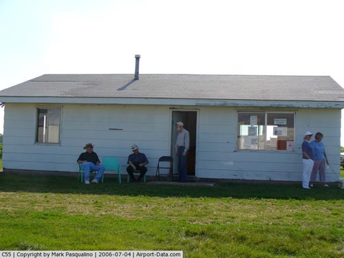
(Click on the photo to enlarge) |
|
 |
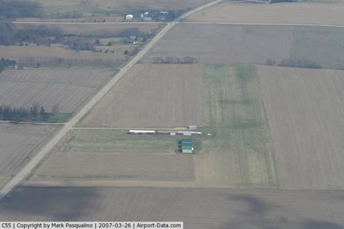
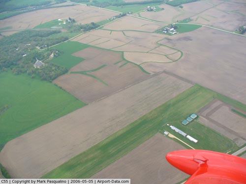
(Click on the photo to enlarge) |
|
 |
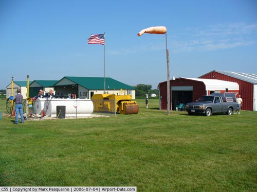
(Click on the photo to enlarge) |
|
 |
(Click on the photo to enlarge) |
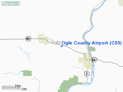
Location
& QuickFacts
|
FAA
Information Effective: |
2007-12-20 |
|
Airport
Identifier: |
C55 |
|
Airport
Status: |
Operational |
|
Longitude/Latitude: |
089-23-34.3870W/42-02-14.1030N
-89.392885/42.037251 (Estimated) |
|
Elevation: |
929 ft / 283.16 m (Surveyed) |
|
Land: |
42 acres |
|
From nearest
city: |
2 nautical miles SE of Mount Morris, IL |
|
Location: |
Ogle County, IL |
|
Magnetic
Variation: |
00E (1985) |
Owner
& Manager
|
Ownership: |
Privately
owned |
|
Owner: |
Ogle County Pilots Inc |
|
Address: |
Po Box 61
Mt Morris, IL 61054 |
|
Phone
number: |
815-298-0457 |
|
Manager: |
Doug Schiller |
|
Address: |
Po Box 61
Mt Morris, IL 61054 |
|
Phone
number: |
815-234-5840 |
Airport Operations
and Facilities
|
Airport
Use: |
Open
to public |
|
Wind indicator: |
Yes |
|
Segmented
Circle: |
No |
|
Control
Tower: |
No |
|
Lighting
Schedule: |
RDO-CTL
ACTVT NSTD LIRL RY 09/27 & ROTG BCN - CTAF. |
|
Beacon
Color: |
Clear-Green (lighted land airport) |
|
Landing
fee charge: |
No |
|
Sectional
chart: |
Chicago |
|
Region: |
AGL - Great Lakes |
|
Traffic
Pattern Alt: |
800 ft |
|
Boundary
ARTCC: |
ZAU - Chicago |
|
Tie-in
FSS: |
IKK - Kankakee |
|
FSS on
Airport: |
No |
|
FSS Toll
Free: |
1-800-WX-BRIEF |
|
NOTAMs
Facility: |
IKK (NOTAM-d service avaliable) |
Airport Communications
|
Runway Information
Runway 09/27
|
Dimension: |
2640 x 200 ft
/ 804.7 x 61.0 m |
|
Surface: |
TURF, Good Condition |
|
Edge Lights: |
Non-standard lighting system
RWY 09/27 NSTD LIRL DUE TO SPACING; INTENSITY & NON-FRANGIBLE
- ORANGE CONES ADJACENT TO LIGHTS. |
|
|
Runway 09 |
Runway 27 |
|
Longitude: |
089-23-53.3800W |
089-23-18.3800W |
|
Latitude: |
42-02-14.0800N |
42-02-14.1000N |
|
Elevation: |
920.00 ft |
920.00 ft |
|
Traffic
Pattern: |
Left |
Left |
|
Obstruction: |
51 ft trees, 2250.0 ft from runway, 100 ft
left of centerline, 44:1 slope to clear |
, 50:1 slope to clear |
|
Radio Navigation
Aids
|
ID |
Type |
Name |
Ch |
Freq |
Var |
Dist |
|
FEP |
NDB |
Freeport |
|
335.00 |
00E |
15.2 nm |
|
BOZ |
NDB |
Whiteside |
|
254.00 |
01E |
26.3 nm |
|
DKB |
NDB |
Dekalb |
|
209.00 |
02W |
31.3 nm |
|
JVL |
NDB |
Janesville |
|
375.00 |
03E |
38.1 nm |
|
VYS |
NDB |
Valley |
|
230.00 |
00W |
42.5 nm |
|
CWI |
NDB |
Clinton |
|
377.00 |
01E |
43.6 nm |
|
OIX |
NDB |
Ottawa |
|
266.00 |
01E |
47.2 nm |
|
PLL |
VOR/DME |
Polo |
049X |
111.20 |
03E |
7.3 nm |
|
RFD |
VOR/DME |
Rockford |
045X |
110.80 |
01E |
14.2 nm |
|
JVL |
VOR/DME |
Janesville |
090X |
114.30 |
03E |
33.8 nm |
|
DPA |
VOR/DME |
Dupage |
021X |
108.40 |
02E |
47.4 nm |
Remarks
- PRVD
ALL OBS PENTG RWY APP SLOPE SFCS ARE RMVD, THRS CLRLY MKD TO PRVD MIN
OF 20:1 APP CLRNC OVR ALL OBS & SUF RMNG USBL RWY LENGTH AVBL TO
PRMT SAFE LNDG/TKOF BY TYPE ACFT USING RWYS.
Based Aircraft
|
Aircraft
based on field: |
20 |
|
Single Engine
Airplanes: |
12 |
|
Multi Engine Airplanes: |
1 |
|
Ultralights: |
7 |
Operational Statistics
Time
Period: 2006-01-01 - 2006-12-31
|
Aircraft
Operations: |
125/Week |
|
General Aviation
Local: |
92.3% |
|
General Aviation
Itinerant: |
7.7% |
Ogle County Airport
Address:
Ogle County, IL
Tel:
815-298-0457,
815-234-5840
Images
and information placed above are from
http://www.airport-data.com/airport/C55/
We
thank them for the data!
We don't guarantee the information is fresh and accurate. The data may
be wrong or outdated.
For more up-to-date information please refer to other sources.
|
|