 |
|
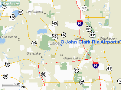
Location
& QuickFacts
|
FAA
Information Effective: |
2007-12-20 |
|
Airport
Identifier: |
7IL2 |
|
Airport
Status: |
Operational |
|
Longitude/Latitude: |
087-59-30.2800W/42-22-06.0770N
-87.991744/42.368355 (Estimated) |
|
Elevation: |
790 ft / 240.79 m (Estimated) |
|
Land: |
0 acres |
|
From nearest
city: |
3 nautical miles NE of Grays Lake, IL |
|
Location: |
Lake County, IL |
|
Magnetic
Variation: |
01W (1985) |
Owner & Manager
|
Ownership: |
Privately
owned |
|
Owner: |
John Clark |
|
Address: |
18036 Washington Street
Gurnee, IL 60031 |
|
Phone
number: |
708-223-0784 |
|
Address: |
|
Airport Operations
and Facilities
|
Airport Use: |
Private |
|
Wind
indicator: |
Yes |
|
Segmented
Circle: |
No |
|
Control
Tower: |
No |
|
Landing
fee charge: |
No |
|
Sectional
chart: |
Chicago |
|
Region: |
AGL - Great Lakes |
|
Boundary
ARTCC: |
ZAU - Chicago |
|
Tie-in
FSS: |
IKK - Kankakee |
|
FSS on
Airport: |
No |
|
FSS Toll
Free: |
1-800-WX-BRIEF |
Airport Services
|
Airframe
Repair: |
NONE |
|
Power
Plant Repair: |
NONE |
|
Runway Information
Runway N/S
|
Dimension: |
2640 x 120 ft
/ 804.7 x 36.6 m |
|
Surface: |
TURF, |
|
|
Runway N |
Runway S |
|
Traffic
Pattern: |
Left |
Left |
|
Obstruction: |
30 ft pline |
|
|
Radio Navigation
Aids
|
ID |
Type |
Name |
Ch |
Freq |
Var |
Dist |
|
RA |
NDB |
Paser |
|
206.00 |
00E |
19.3 nm |
|
ME |
NDB |
Deana |
|
350.00 |
00E |
24.1 nm |
|
GM |
NDB |
Teels |
|
242.00 |
02W |
32.6 nm |
|
LVV |
NDB |
Lake Lawn |
|
404.00 |
00W |
33.2 nm |
|
HK |
NDB |
Ermin |
|
332.00 |
01W |
39.6 nm |
|
MX |
NDB |
Kedzi |
|
248.00 |
01W |
40.0 nm |
|
DKB |
NDB |
Dekalb |
|
209.00 |
02W |
41.2 nm |
|
BL |
NDB |
Yanks |
|
260.00 |
02W |
41.9 nm |
|
UES |
NDB |
Waukesha |
|
359.00 |
01W |
42.1 nm |
|
JVL |
NDB |
Janesville |
|
375.00 |
03E |
48.8 nm |
|
OBK |
VOR/DME |
Northbrook |
077X |
113.00 |
02W |
9.0 nm |
|
ENW |
VOR/DME |
Kenosha |
029X |
109.20 |
02W |
14.1 nm |
|
ORD |
VOR/DME |
Chicago O'hare |
086X |
113.90 |
02E |
23.2 nm |
|
BUU |
VOR/DME |
Burbun |
092X |
114.50 |
01W |
23.7 nm |
|
HRK |
VOR/DME |
Horlick |
124X |
117.70 |
02W |
24.9 nm |
|
DPA |
VOR/DME |
Dupage |
021X |
108.40 |
02E |
32.9 nm |
|
LJT |
VOR/DME |
Timmerman |
072X |
112.50 |
02W |
44.6 nm |
|
BAE |
VORTAC |
Badger |
111X |
116.40 |
02E |
46.8 nm |
|
ORD |
VOT |
Chicago O'hare Intl |
|
112.00 |
|
23.5 nm |
|
MKE |
VOT |
Milwaukee |
|
109.00 |
|
35.1 nm |
|
MDW |
VOT |
Chicago Midway |
|
111.00 |
|
36.6 nm |
Based Aircraft
|
Aircraft
based on field: |
1 |
|
Single Engine
Airplanes: |
1 |
O John Clark Rla Airport
Address:
Lake County, IL
Tel:
708-223-0784
Images
and information placed above are from
http://www.airport-data.com/airport/7IL2/
We
thank them for the data!
| General
Info |
| Country |
United
States |
| State |
ILLINOIS
|
| FAA ID |
7IL2 |
| Latitude |
42-22-06.077N
|
| Longitude |
087-59-30.280W
|
| Elevation |
790 feet
|
| Near City |
GRAYS
LAKE |
We don't guarantee the information is fresh and accurate. The data may
be wrong or outdated.
For more up-to-date information please refer to other sources.
|
|


