 |
|
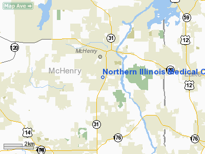
Northern Illinois Medical Center Heliport |
|
|
Location
& QuickFacts
|
FAA
Information Effective: |
2007-12-20 |
|
Airport
Identifier: |
5IS8 |
|
Airport
Status: |
Operational |
|
Longitude/Latitude: |
088-16-44.3110W/42-19-10.0780N
-88.278975/42.319466 (Estimated) |
|
Elevation: |
815 ft / 248.41 m (Estimated) |
|
Land: |
100 acres |
|
From nearest
city: |
2 nautical miles S of Mc Henry, IL |
|
Location: |
Mc Henry County, IL |
|
Magnetic
Variation: |
01W (1985) |
Owner
& Manager
|
Ownership: |
Privately
owned |
|
Owner: |
Northern Il Medical Cntr |
|
Address: |
4201 Medical Cntr Dr
Mc Henry, IL 60050 |
|
Phone
number: |
815-344-5000 |
|
Manager: |
William G. Riggs |
|
Address: |
4201 Medical Cntr Dr
Mc Henry, IL 60050 |
|
Phone
number: |
815-344-5000
EXT 760. |
Airport Operations
and Facilities
|
Airport
Use: |
Private
MEDICAL USE. |
|
Wind indicator: |
Yes |
|
Segmented
Circle: |
No |
|
Control
Tower: |
No |
|
Lighting
Schedule: |
DUSK-DAWN
HELIPAD LGTD WITH PERIMETER LGTS. |
|
Beacon
Color: |
Clear-Green-Yellow (heliport) |
|
Sectional
chart: |
Chicago |
|
Region: |
AGL - Great Lakes |
|
Boundary
ARTCC: |
ZAU - Chicago |
|
Tie-in
FSS: |
IKK - Kankakee |
|
FSS on
Airport: |
No |
|
FSS Toll
Free: |
1-800-WX-BRIEF |
Airport Services
|
Fuel
available: |
A
FUEL FOR PVT USE OF BASED HELICOPTERS. |
|
Runway Information
Helipad H1
|
Dimension: |
65 x 65 ft /
19.8 x 19.8 m |
|
Surface: |
CONC,
CONC PAD WITHIN 100 X 100'SOD APRON. |
|
|
Runway H1 |
Runway |
|
Traffic
Pattern: |
Left |
Left |
|
Helipad H2
|
Dimension: |
48 x 48 ft /
14.6 x 14.6 m |
|
Surface: |
CONC, Good Condition
CONC PAD WITHIN 100 X 100'SOD APRON. |
|
|
Runway H2 |
Runway |
|
Traffic
Pattern: |
Left |
Left |
|
Radio Navigation
Aids
|
ID |
Type |
Name |
Ch |
Freq |
Var |
Dist |
|
ME |
NDB |
Deana |
|
350.00 |
00E |
23.9 nm |
|
LVV |
NDB |
Lake Lawn |
|
404.00 |
00W |
26.7 nm |
|
RA |
NDB |
Paser |
|
206.00 |
00E |
27.6 nm |
|
DKB |
NDB |
Dekalb |
|
209.00 |
02W |
30.0 nm |
|
GM |
NDB |
Teels |
|
242.00 |
02W |
37.0 nm |
|
JVL |
NDB |
Janesville |
|
375.00 |
03E |
38.2 nm |
|
HK |
NDB |
Ermin |
|
332.00 |
01W |
41.2 nm |
|
MX |
NDB |
Kedzi |
|
248.00 |
01W |
43.6 nm |
|
UES |
NDB |
Waukesha |
|
359.00 |
01W |
43.6 nm |
|
BL |
NDB |
Yanks |
|
260.00 |
02W |
47.9 nm |
|
OBK |
VOR/DME |
Northbrook |
077X |
113.00 |
02W |
15.7 nm |
|
BUU |
VOR/DME |
Burbun |
092X |
114.50 |
01W |
22.3 nm |
|
ENW |
VOR/DME |
Kenosha |
029X |
109.20 |
02W |
22.8 nm |
|
DPA |
VOR/DME |
Dupage |
021X |
108.40 |
02E |
26.0 nm |
|
ORD |
VOR/DME |
Chicago O'hare |
086X |
113.90 |
02E |
26.0 nm |
|
HRK |
VOR/DME |
Horlick |
124X |
117.70 |
02W |
33.6 nm |
|
JVL |
VOR/DME |
Janesville |
090X |
114.30 |
03E |
39.4 nm |
|
RFD |
VOR/DME |
Rockford |
045X |
110.80 |
01E |
41.3 nm |
|
LJT |
VOR/DME |
Timmerman |
072X |
112.50 |
02W |
48.7 nm |
|
JOT |
VORTAC |
Joliet |
070X |
112.30 |
02E |
46.5 nm |
|
BAE |
VORTAC |
Badger |
111X |
116.40 |
02E |
47.9 nm |
|
ORD |
VOT |
Chicago O'hare Intl |
|
112.00 |
|
26.2 nm |
|
MDW |
VOT |
Chicago Midway |
|
111.00 |
|
39.8 nm |
|
MKE |
VOT |
Milwaukee |
|
109.00 |
|
41.4 nm |
Remarks
- LMTD
USE TO HELI TRNSPG MEDICAL PATIENTS.
- PRVDD
OPNS ARE CONDD IN AREA 110-300 DEG; AREA APROPLY MKD; WIND INDCR IS
MAINTD.
Based Aircraft
|
Aircraft
based on field: |
2 |
|
Multi Engine Airplanes: |
1 |
|
Helicopters: |
1 |
Northern Illinois Medical Center Heliport
Address:
Mc Henry County, IL
Tel:
815-344-5000
Images
and information placed above are from
http://www.airport-data.com/airport/5IS8/
We
thank them for the data!
| General
Info |
| Country |
United
States |
| State |
ILLINOIS
|
| FAA ID |
5IS8 |
| Latitude |
42-19-10.078N
|
| Longitude |
088-16-44.311W
|
| Elevation |
815 feet
|
| Near City |
MC HENRY
|
We don't guarantee the information is fresh and accurate. The data may
be wrong or outdated.
For more up-to-date information please refer to other sources.
|
|


