 |
|
Location
& QuickFacts
|
FAA
Information Effective: |
2007-12-20 |
|
Airport
Identifier: |
19LL |
|
Airport
Status: |
Operational |
|
Longitude/Latitude: |
087-55-10.1690W/41-15-25.1150N
-87.919491/41.256976 (Estimated) |
|
Elevation: |
650 ft / 198.12 m (Estimated) |
|
Land: |
0 acres |
|
From nearest
city: |
4 nautical miles NW of Manteno, IL |
|
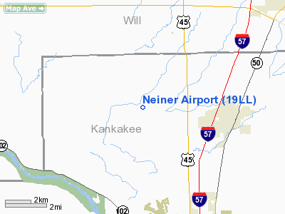
Location: |
Kankakee County, IL |
|
Magnetic
Variation: |
01W (1985) |
Owner & Manager
|
Ownership: |
Privately
owned |
|
Owner: |
Pat Neiner |
|
Address: |
Rr 1
Manteno, IL 60950 |
|
Phone
number: |
815-468-8882 |
|
Manager: |
Pat Neiner |
|
Address: |
Rr 1
Manteno, IL 60950 |
|
Phone
number: |
815-468-8882 |
Airport
Operations and Facilities
|
Airport
Use: |
Private |
|
Wind indicator: |
Yes |
|
Segmented
Circle: |
No |
|
Control
Tower: |
No |
|
Landing
fee charge: |
No |
|
Sectional
chart: |
Chicago |
|
Region: |
AGL - Great Lakes |
|
Boundary
ARTCC: |
ZAU - Chicago |
|
Tie-in
FSS: |
IKK - Kankakee |
|
FSS on
Airport: |
No |
|
FSS Toll
Free: |
1-800-WX-BRIEF |
|
Runway Information
Runway 18/36
|
Dimension: |
1940 x 70 ft
/ 591.3 x 21.3 m |
|
Surface: |
TURF, Good Condition |
|
|
Runway 18 |
Runway 36 |
|
Traffic
Pattern: |
Left |
Right |
|
Radio Navigation
Aids
|
ID |
Type |
Name |
Ch |
Freq |
Var |
Dist |
|
HK |
NDB |
Ermin |
|
332.00 |
01W |
28.0 nm |
|
MX |
NDB |
Kedzi |
|
248.00 |
01W |
30.9 nm |
|
RZL |
NDB |
Rensselaer |
|
362.00 |
02W |
38.2 nm |
|
OIX |
NDB |
Ottawa |
|
266.00 |
01E |
42.7 nm |
|
ME |
NDB |
Deana |
|
350.00 |
00E |
43.0 nm |
|
VP |
NDB |
Sedly |
|
212.00 |
02W |
48.4 nm |
|
IKK |
VOR/DME |
Kankakee |
053X |
111.60 |
00E |
11.4 nm |
|
RBS |
VOR/DME |
Roberts |
115X |
116.80 |
02E |
42.1 nm |
|
DPA |
VOR/DME |
Dupage |
021X |
108.40 |
02E |
42.7 nm |
|
ORD |
VOR/DME |
Chicago O'hare |
086X |
113.90 |
02E |
43.9 nm |
|
PNT |
VOR/DME |
Pontiac |
033X |
109.60 |
03E |
45.3 nm |
|
EON |
VORTAC |
Peotone |
079X |
113.20 |
02E |
5.9 nm |
|
CGT |
VORTAC |
Chicago Heights |
089X |
114.20 |
02E |
21.9 nm |
|
JOT |
VORTAC |
Joliet |
070X |
112.30 |
02E |
25.0 nm |
|
MDW |
VOT |
Chicago Midway |
|
111.00 |
|
32.7 nm |
|
ORD |
VOT |
Chicago O'hare Intl |
|
112.00 |
|
43.6 nm |
Remarks
- PRVDD
TFC PATS CONDUCTED E RWY; RGT HAND FOR RWY 36 & LEFT HAND FOR RWY
18; TFC PATS AT MORAN ARPT CONDUCTED W OF RWY 18/36 & N OF RWY 09/27.
Neiner Airport
Address:
Kankakee County, IL
Tel:
815-468-8882
Images
and information placed above are from
http://www.airport-data.com/airport/19LL/
We
thank them for the data!
| General
Info |
| Country |
United
States |
| State |
ILLINOIS
|
| FAA ID |
19LL |
| Latitude |
41-15-25.115N
|
| Longitude |
087-55-10.169W
|
| Elevation |
650 feet
|
| Near City |
MANTENO
|
We don't guarantee the information is fresh and accurate. The data may
be wrong or outdated.
For more up-to-date information please refer to other sources.
|
|


